
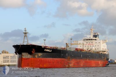
KANALA
Oil Products Tanker
Current Trip
| Time Travelled | 19 days |
|---|---|
| Remaining Time | 1 day |
| Distance Travelled | 3962.10 nm |
| Remaining Distance | 469.89 nm |
| AVG Speed | 9.9 Knots |
| MAX Speed | 13.8 Knots |
| AVG Wind | 12.7 knots |
| MAX Wind | 25 knots |
| MIN Temp | 6.8°C / 44.24°F |
| MAX Temp | 30°C / 86°F |
| Dybgang | 12.6 m |
| Position Modtaget | 40 m siden |
Current Position
| Longitude | --- |
|---|---|
| Latitude | --- |
| Status | Under way using engine |
| Fart | 12.9 Knots |
| Kurs | 77.5° |
| Område | Alboran Sea |
| Station | T-AIS |
| Position Modtaget | 40 m siden |
Information
The current position of KANALA is in Alboran Sea with coordinates 36.09231° / -4.05387° as reported on 2025-03-25 08:16 by AIS to our vessel tracker app. The vessel's current speed is 12.9 Knots and is heading at the port of BARCELONA. The estimated time of arrival as calculated by MyShipTracking vessel tracking app is 2025-03-26 22:25 LT
The vessel KANALA (IMO: 9425552, MMSI: 248951000) is a Oil Products Tanker that was built in 2010 ( 15 år gamle ). It's sailing under the flag of [MT] Malta.
In this page you can find informations about the vessels current position, last detected port calls, and current voyage information. If the vessels is not in coverage by AIS you will find the latest position.
The current position of KANALA is detected by our AIS receivers and we are not responsible for the reliability of the data. The last position was recorded while the vessel was in Coverage by the Ais receivers of our vessel tracking app.
The current draught of KANALA as reported by AIS is 12.6 meters
Weather
| Temperature | 14.6°C / 58.28°F |
|---|---|
| Wind Speed | 14 knots |
| Direction | 275° W |
| Pressure | 1020.3 hPa |
| Humidity | 74.6 % |
| Cloud Coverage | 5 % |
Featured Company
Last Trips
| Origin | Departure | Destination | Arrival | Distance | |
|---|---|---|---|---|---|
| 2025-02-17 03:39 | 2025-03-02 09:50 | 3351.36 nm | |||
| 2025-01-30 22:15 | 2025-02-14 07:47 | 3657.73 nm | |||
| 2025-01-11 20:55 | 2025-01-25 01:43 | 3575.95 nm | |||
| 2025-01-09 03:26 | 2025-01-09 18:45 | 53.82 nm | |||
| 2024-12-30 22:43 | 2025-01-06 19:48 | 1315.46 nm |
Events
| Tid | Hændelsen | Detaljer | Position / Dest | Info |
|---|---|---|---|---|
| 2025-03-25 08:19 | Status er ændret | Default Under way using engine |
36.09480 / -4.04030
ESBCN
|
Fart: 12.9 kn Kurs: 77.5° |
| 2025-03-25 08:08 | Status er ændret | Under way using engine Default |
36.08685 / -4.08812
ESBCN
|
Fart: 13.8 kn Kurs: 84° |
| 2025-03-25 07:50 | Indenfor Dækning |
36.08762 / -4.08261
Alboran Sea
ESBCN
|
Fart: 13.4 kn Kurs: 81° |
|
| 2025-03-25 06:27 | Status er ændret | Default Under way using engine |
36.05764 / -4.52946
ESBCN
|
Fart: 11.8 kn Kurs: 82.1° |
| 2025-03-25 06:23 | Udenfor Dækning |
36.05593 / -4.54432
Alboran Sea
ESBCN
|
Fart: 11.8 kn Kurs: 82.1° |
|
| 2025-03-25 03:02 | Ændre havområde | Spanish part of the Alboran Sea Gibraltarian part of the Alboran Sea |
36.02049 / -5.24696
Alboran Sea
ESBCN
|
Fart: 12 kn Kurs: 96.9° |
| 2025-03-25 02:44 | Ændre havområde | Gibraltarian part of the Alboran Sea Gibraltarian part of the Strait of Gibraltar |
36.03084 / -5.32117
Alboran Sea
ESBCN
|
Fart: 12.7 kn Kurs: 139.2° |
| 2025-03-25 01:56 | Ændre havområde | Gibraltarian part of the Strait of Gibraltar Spanish part of the Strait of Gibraltar |
36.14530 / -5.39104
Strait of Gibraltar
ESBCN
|
Fart: 6.6 kn Kurs: 180.3° |
| 2025-03-25 01:46 | START Sejllads | 0.7 nm, South of CAMPAMENTO |
36.15939 / -5.38277
ESBCN
|
Fart: 3.1 kn Kurs: 220° |
| 2025-03-25 01:39 | Status er ændret | Under way using engine At anchor |
36.15886 / -5.37947
ESBCN
|
Fart: 0.5 kn Kurs: 314° |