
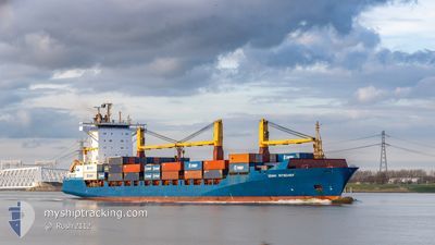
JONNI RITSCHER
Container Ship
Current Trip
| Time Travelled | 1 day |
|---|---|
| Remaining Time | 15 h, 47 mins |
| Distance Travelled | 801.83 nm |
| Remaining Distance | 343.19 nm |
| AVG Speed | 21.9 Knots |
| MAX Speed | 21.9 Knots |
| AVG Wind | 9.3 knots |
| MAX Wind | 16 knots |
| MIN Temp | 6.5°C / 43.7°F |
| MAX Temp | 13.7°C / 56.66°F |
| Draught | 9.7 m |
| Position Received | 27 m ago |
Current Position
| Longitude | -0.81275° |
|---|---|
| Latitude | 56.73342° |
| Status | Under way using engine |
| Speed | 21 Knots |
| Course | 156.1° |
| Area | North Sea |
| Station | T-AIS |
| Position Received | 27 m ago |
Info
Information
The current position of JONNI RITSCHER is in North Sea with coordinates 56.73342° / -0.81275° as reported on 2024-09-21 16:37 by AIS to our vessel tracker app. The vessel's current speed is 21 Knots and is heading at the port of ROTTERDAM. The estimated time of arrival as calculated by MyShipTracking vessel tracking app is 2024-09-22 08:52 LT
The vessel JONNI RITSCHER (IMO: 9333383, MMSI: 636091136) is a Container Ship that was built in 2006 ( 18 years old ). It's sailing under the flag of [LR] Liberia.
In this page you can find informations about the vessels current position, last detected port calls, and current voyage information. If the vessels is not in coverage by AIS you will find the latest position.
The current position of JONNI RITSCHER is detected by our AIS receivers and we are not responsible for the reliability of the data. The last position was recorded while the vessel was in Coverage by the Ais receivers of our vessel tracking app.
The current draught of JONNI RITSCHER as reported by AIS is 9.7 meters
Weather
| Temperature | 13.5°C / 56.3°F |
|---|---|
| Wind Speed | 12 knots |
| Direction | 56° NE |
| Pressure | 1024 hPa |
| Humidity | 88.4 % |
| Cloud Coverage | 5 % |
Featured Company
Last Port Calls
| Port | Arrival | Departure | Time In Port |
|---|---|---|---|
| 2024-09-18 19:27 | 2024-09-19 22:21 | 1 d | |
| 2024-09-18 07:59 | 2024-09-18 15:33 | 7 h | |
| 2024-09-17 07:59 | 2024-09-17 20:41 | 12 h | |
| 2024-09-15 12:48 | 2024-09-17 06:15 | 1 d | |
| 2024-09-12 22:45 | 2024-09-13 08:03 | 9 h | |
| 2024-09-10 12:46 | 2024-09-11 13:38 | 1 d | |
| 2024-09-10 12:42 | |||
| 2024-09-09 14:04 | 2024-09-10 12:02 | 21 h | |
| 2024-09-08 16:23 | 2024-09-09 13:47 | 21 h | |
| 2024-09-04 19:42 | 2024-09-05 20:47 | 1 d |
Most Visited Ports (Last year)
| Port | Arrivals | |
|---|---|---|
| 47 | ||
| 40 | ||
| 31 | ||
| 15 | ||
| 12 | ||
| 9 |
Last Trips
| Origin | Departure | Destination | Arrival | Distance | |
|---|---|---|---|---|---|
| 2024-09-18 15:33 | 2024-09-18 19:27 | 15.17 nm | |||
| 2024-09-17 20:41 | 2024-09-18 07:59 | 4.16 nm | |||
| 2024-09-17 06:15 | 2024-09-17 07:59 | 14.81 nm | |||
| 2024-09-13 09:03 | 2024-09-15 12:48 | 965.47 nm | |||
| 2024-09-11 15:38 | 2024-09-12 23:45 | 283.82 nm | |||
| 2024-09-10 14:02 | 2024-09-10 14:46 | 2.95 nm | |||
| 2024-09-10 14:02 | 2024-09-10 14:42 | 2.95 nm | |||
| 2024-09-09 15:47 | 2024-09-09 16:04 | 0.99 nm | |||
| 2024-09-05 20:47 | 2024-09-08 18:23 | 1186.12 nm | |||
| 2024-09-04 17:56 | 2024-09-04 19:42 | 14.39 nm |
Events
| Time | Event | Details | Position / Dest | Info |
|---|---|---|---|---|
| 2024-09-21 13:01 | Status Changed | Under way using engine Default |
57.91053 / -1.79850
NLRTM
|
Speed: 21.2 kn Course: 149° |
| 2024-09-21 12:59 | Status Changed | Default Under way using engine |
57.91762 / -1.80591
NLRTM
|
Speed: 21.1 kn Course: 150.2° |
| 2024-09-21 12:29 | Status Changed | Under way using engine Default |
58.05290 / -2.01299
NLRTM
|
Speed: 20.7 kn Course: 140° |
| 2024-09-21 12:03 | Status Changed | Default Under way using engine |
58.16891 / -2.19067
NLRTM
|
Speed: 20.6 kn Course: 138.8° |
| 2024-09-21 11:56 | Status Changed | Under way using engine Default |
58.20008 / -2.23934
NLRTM
|
Speed: 20.9 kn Course: 139° |
| 2024-09-21 11:55 | Status Changed | Default Under way using engine |
58.20492 / -2.24716
NLRTM
|
Speed: 20.8 kn Course: 140.9° |
| 2024-09-21 11:13 | Status Changed | Under way using engine Default |
58.39326 / -2.54386
NLRTM
|
Speed: 21.3 kn Course: 141° |
| 2024-09-21 11:11 | Status Changed | Default Under way using engine |
58.40126 / -2.55686
NLRTM
|
Speed: 21.3 kn Course: 139.5° |
| 2024-09-21 11:09 | Status Changed | Under way using engine Default |
58.40993 / -2.57052
NLRTM
|
Speed: 21.3 kn Course: 139° |
| 2024-09-21 11:07 | Status Changed | Default Under way using engine |
58.41917 / -2.58581
NLRTM
|
Speed: 21.2 kn Course: 140.1° |