
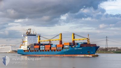
JONNI RITSCHER
Container Ship
Current Trip
| Trip Time | 2 days |
|---|---|
| Trip Distance | 946.72 nm |
| AVG Speed | 18.3 Knop |
| MAX Speed | 21.2 Knop |
| Djupgående | 10.2 m |
| AVG Wind | 5.2 knots |
| MAX Wind | 28.9 knots |
| MIN Temp | 4.5°C / 40.1°F |
| MAX Temp | 7.5°C / 45.5°F |
| Position mottagen | 2 d sen |
Current Position
| Longitud | -4.49331° |
|---|---|
| Latitude | 58.95403° |
| Status | Under way using engine |
| Fart | 19 Knop |
| Kurs | 293.4° |
| Område | North Atlantic Ocean |
| Station | T-AIS |
| Position mottagen | 2 d sen |
Info
Information
The current position of JONNI RITSCHER is in North Atlantic Ocean with coordinates 58.95403° / -4.49331° as reported on 2024-04-27 01:30 by AIS to our vessel tracker app. The vessel's current speed is 19 Knop and is currently inside the port of REYKJAVIK.
The vessel JONNI RITSCHER (IMO: 9333383, MMSI: 636091136) is a Container Ship that was built in 2006 ( 18 År gammal ). It's sailing under the flag of [LR] Liberia.
In this page you can find informations about the vessels current position, last detected port calls, and current voyage information. If the vessels is not in coverage by AIS you will find the latest position.
The current position of JONNI RITSCHER is detected by our AIS receivers and we are not responsible for the reliability of the data. The last position was recorded while the vessel was in Coverage by the Ais receivers of our vessel tracking app.
The current draught of JONNI RITSCHER as reported by AIS is 10.2 meters
Weather
| Temperature | 4.4°C / 39.92°F |
|---|---|
| Wind Speed | 7 knots |
| Direction | 49° NE |
| Pressure | 1015.5 hPa |
| Humidity | 73.7 % |
| Cloud Coverage | 16 % |
Featured Company
Last Port Calls
| Port | Arrival | Departure | Time In Port |
|---|---|---|---|
| 2024-04-28 11:55 | |||
| 2024-04-25 19:04 | 2024-04-26 08:44 | 13 h | |
| 2024-04-23 12:54 | 2024-04-24 18:48 | 1 d | |
| 2024-04-21 16:43 | 2024-04-23 12:14 | 1 d | |
| 2024-04-17 23:30 | 2024-04-18 21:35 | 22 h | |
| 2024-04-17 21:41 | |||
| 2024-04-16 13:09 | |||
| 2024-04-11 13:24 | 2024-04-12 02:54 | 13 h | |
| 2024-04-07 16:21 | 2024-04-10 17:10 | 3 d | |
| 2024-04-07 16:18 |
Most Visited Ports (Last year)
| Port | Arrivals | |
|---|---|---|
| 45 | ||
| 38 | ||
| 31 | ||
| 26 | ||
| 17 | ||
| 5 |
Last Trips
| Origin | Departure | Destination | Arrival | Distance | |
|---|---|---|---|---|---|
| 2024-04-26 09:44 | 2024-04-28 11:55 | 946.72 nm | |||
| 2024-04-24 20:48 | 2024-04-25 20:04 | 296.08 nm | |||
| 2024-04-23 14:14 | 2024-04-23 14:54 | 2.87 nm | |||
| 2024-04-18 21:35 | 2024-04-21 18:43 | 1130.33 nm | |||
| 2024-04-17 21:41 | 2024-04-17 23:30 | 1.16 nm | |||
| 2024-04-10 19:10 | 2024-04-11 14:24 | 287.43 nm | |||
| 2024-04-04 20:12 | 2024-04-07 18:21 | 1177.06 nm | |||
| 2024-04-04 20:12 | 2024-04-07 18:18 | 1177.02 nm | |||
| 2024-03-29 05:48 | 2024-04-01 06:38 | 976.46 nm | |||
| 2024-03-27 19:28 | 2024-03-28 12:56 | 280.60 nm |
Events
| Tid | Event | Detaljer | Position / Dest | Information |
|---|---|---|---|---|
| 2024-04-28 11:55 | ANLÄNDER HAMN |
|
64.14969 / -21.84369
[IS] REYKJAVIK
|
Fart: 18.4 kn Kurs: 82° |
| 2024-04-27 01:38 | Status ändrad | Default Under way using engine |
58.96720 / -4.56314
ISREY
|
Fart: 19 kn Kurs: 293.4° |
| 2024-04-27 01:30 | UTANFÖR täckningsområde |
58.95403 / -4.49331
North Atlantic Ocean
ISREY
|
Fart: 19 kn Kurs: 293.4° |
|
| 2024-04-26 23:34 | Byter havsområde | United Kingdom part of the North Atlantic Ocean United Kingdom part of the North Sea |
58.76767 / -3.41768
North Atlantic Ocean
ISREY
|
Fart: 16.6 kn Kurs: 284.5° |
| 2024-04-26 21:46 | Status ändrad | Under way using engine Default |
58.51976 / -2.73718
ISREY
|
Fart: 18.3 kn Kurs: 321° |
| 2024-04-26 21:31 | I täckningsområde |
58.52368 / -2.74340
North Sea
ISREY
|
Fart: 18.2 kn Kurs: 319.9° |
|
| 2024-04-26 19:46 | Status ändrad | Default Under way using engine |
58.04006 / -1.95696
ISREY
|
Fart: 19.5 kn Kurs: 322.4° |
| 2024-04-26 19:38 | UTANFÖR täckningsområde |
58.00463 / -1.90157
North Sea
ISREY
|
Fart: 19.5 kn Kurs: 322.4° |
|
| 2024-04-26 16:08 | Status ändrad | Under way using engine Default |
56.90554 / -1.44103
ISREY
|
Fart: 18.5 kn Kurs: 356° |
| 2024-04-26 15:53 | I täckningsområde |
56.90554 / -1.44103
North Sea
ISREY
|
Fart: 18.5 kn Kurs: 356° |