
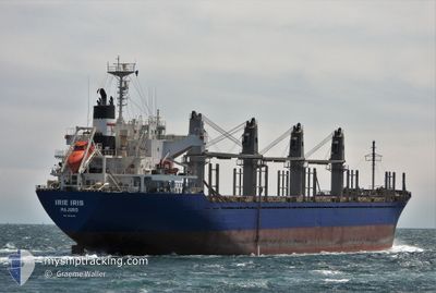
IRIE IRIS
Bulk Carrier
Current Trip
| Trip Time | 7 days |
|---|---|
| Trip Distance | 239.60 nm |
| AVG Speed | 8.8 Knots |
| MAX Speed | 13.9 Knots |
| Draught | 10.3 m |
| AVG Wind | 9.3 knots |
| MAX Wind | 17.9 knots |
| MIN Temp | 11.5°C / 52.7°F |
| MAX Temp | 16.5°C / 61.7°F |
| Position Received | 2024-03-30 23:47 |
Current Position
| Longitude | 174.34942° |
|---|---|
| Latitude | -34.83058° |
| Status | Under way using engine |
| Speed | 12.3 Knots |
| Course | 312.1° |
| Area | South Pacific Ocean |
| Station | T-AIS |
| Position Received | 2024-03-30 23:47 |
Info
Information
The current position of IRIE IRIS is in South Pacific Ocean with coordinates -34.83058° / 174.34942° as reported on 2024-03-30 23:47 by AIS to our vessel tracker app. The vessel's current speed is 12.3 Knots and is currently inside the port of DONGJIAKOU.
The vessel IRIE IRIS (IMO: 9633290, MMSI: 538009756) is a Bulk Carrier that was built in 2012 ( 12 years old ). It's sailing under the flag of [MH] Marshall Is.
In this page you can find informations about the vessels current position, last detected port calls, and current voyage information. If the vessels is not in coverage by AIS you will find the latest position.
The current position of IRIE IRIS is detected by our AIS receivers and we are not responsible for the reliability of the data. The last position was recorded while the vessel was in Coverage by the Ais receivers of our vessel tracking app.
The current draught of IRIE IRIS as reported by AIS is 10.3 meters
Weather
| Temperature | 13.7°C / 56.66°F |
|---|---|
| Wind Speed | 6 knots |
| Direction | 141° SE |
| Pressure | 1015.9 hPa |
| Humidity | 78 % |
| Cloud Coverage | 100 % |
Featured Company
Last Port Calls
| Port | Arrival | Departure | Time In Port |
|---|---|---|---|
| 2024-05-01 07:53 | |||
| 2024-04-23 11:36 | |||
| 2024-03-28 03:28 | 2024-03-30 06:25 | 2 d | |
| 2024-03-21 00:52 | 2024-03-24 21:24 | 3 d |
Most Visited Ports (Last year)
| Port | Arrivals | |
|---|---|---|
| 2 | ||
| 1 | ||
| 1 | ||
| 1 | ||
| 1 | ||
| 1 |
Last Trips
| Origin | Departure | Destination | Arrival | Distance | |
|---|---|---|---|---|---|
| 2024-04-23 19:36 | 2024-05-01 15:53 | 239.60 nm | |||
| 2024-03-25 10:24 | 2024-03-28 16:28 | 512.59 nm | |||
| 2024-02-27 17:17 | 2024-03-21 13:52 | 6102.86 nm |
Events
| Time | Event | Details | Position / Dest | Info |
|---|---|---|---|---|
| 2024-05-01 08:23 | STOP Moving |
35.61118 / 119.79958
[CN] DONGJIAKOU
|
Speed: Course: 359° |
|
| 2024-05-01 07:53 | PORT ARRIVAL |
|
35.58848 / 119.80274
[CN] DONGJIAKOU
|
Speed: 10.4 kn Course: 358° |
| 2024-05-01 05:08 | START Moving | 20.57 nm, South East of DONGJIAKOU |
35.36386 / 120.11696
CN LSN
|
Speed: 3.5 kn Course: 281° |
| 2024-05-01 03:08 | STOP Moving | 20.61 nm, South East of DONGJIAKOU |
35.36018 / 120.11411
CN LSN
|
Speed: 0.3 kn Course: 79° |
| 2024-04-30 21:32 | START Moving | 3.75 nm, North of LANSHAN |
35.15610 / 119.40515
CN LSN
|
Speed: 5.5 kn Course: 168° |
| 2024-04-28 10:35 | STOP Moving | 4.02 nm, North of LANSHAN |
35.16087 / 119.40381
CN LSN
|
Speed: 0.1 kn Course: 89° |
| 2024-04-28 08:36 | START Moving | 11.08 nm, East of LANSHAN |
35.08191 / 119.61874
CN LSN
|
Speed: 3.3 kn Course: 353° |
| 2024-04-25 05:25 | STOP Moving | 10.98 nm, East of LANSHAN |
35.08447 / 119.61702
CN LSN
|
Speed: 0.3 kn Course: 156° |
| 2024-04-24 23:48 | START Moving |
35.00709 / 120.72535
CN LSN
|
Speed: 3.9 kn Course: 354° |
|
| 2024-04-24 23:24 | STOP Moving |
35.00338 / 120.71513
CN LSN
|
Speed: Course: 111° |