
INEOS INSIGHT
Tanker
Current Trip
| Time Travelled | 5 days |
|---|---|
| Remaining Time | --- |
| Distance Travelled | 2154.47 nm |
| Remaining Distance | --- |
| AVG Speed | 15.5 Knots |
| MAX Speed | 20.3 Knots |
| AVG Wind | 21.6 knots |
| MAX Wind | 34 knots |
| MIN Temp | -0.8°C / 30.56°F |
| MAX Temp | 18.2°C / 64.76°F |
| Draught | 7.7 m |
| Position Received | 4 h, 14 m ago |
Current Position
| Longitude | --- |
|---|---|
| Latitude | --- |
| Status | Under way using engine |
| Speed | 15.1 Knots |
| Course | 234.2° |
| Area | North Atlantic Ocean |
| Station | T-AIS |
| Position Received | 4 h, 14 m ago |
Info
Information
The current position of INEOS INSIGHT is in North Atlantic Ocean with coordinates 35.86034° / -24.95866° as reported on 2025-02-16 07:45 by AIS to our vessel tracker app. The vessel's current speed is 15.1 Knots and is heading at the port of MARCUS HOOK. The estimated time of arrival as calculated by MyShipTracking vessel tracking app is 2025-02-22 12:00 LT
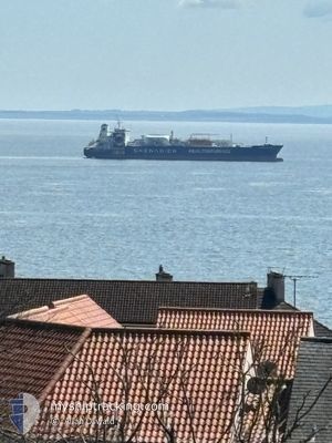
The vessel INEOS INSIGHT (IMO: 9685425, MMSI: 219671000) is a Tanker It's sailing under the flag of [DK] Denmark.
In this page you can find informations about the vessels current position, last detected port calls, and current voyage information. If the vessels is not in coverage by AIS you will find the latest position.
The current position of INEOS INSIGHT is detected by our AIS receivers and we are not responsible for the reliability of the data. The last position was recorded while the vessel was in Coverage by the Ais receivers of our vessel tracking app.
The current draught of INEOS INSIGHT as reported by AIS is 7.7 meters
Weather
| Temperature | 18°C / 64.4°F |
|---|---|
| Wind Speed | 20 knots |
| Direction | 229° SW |
| Pressure | 1012.8 hPa |
| Humidity | 85.5 % |
| Cloud Coverage | 100 % |
Featured Company
Most Visited Ports (Last year)
| Port | Arrivals | |
|---|---|---|
| 14 | ||
| 8 | ||
| 3 | ||
| 1 | ||
| 1 |
Last Trips
| Origin | Departure | Destination | Arrival | Distance | |
|---|---|---|---|---|---|
| 2025-01-23 23:34 | 2025-02-09 05:56 | 5863.01 nm | |||
| 2024-12-30 20:58 | 2025-01-20 17:30 | 6284.04 nm | |||
| 2024-12-18 04:39 | 2024-12-29 17:56 | 4109.93 nm | |||
| 2024-12-04 13:39 | 2024-12-17 06:18 | 4087.48 nm | |||
| 2024-11-21 01:04 | 2024-12-03 04:18 | 4054.97 nm |
Events
| Time | Event | Details | Position / Dest | Info |
|---|---|---|---|---|
| 2025-02-16 07:50 | Status Changed | Default Under way using engine |
35.84807 / -24.97972
NORAF>USMAH
|
Speed: 15.1 kn Course: 234.2° |
| 2025-02-16 07:45 | OUT of Coverage |
35.86034 / -24.95866
North Atlantic Ocean
NORAF>USMAH
|
Speed: 15.1 kn Course: 234.2° |
|
| 2025-02-16 07:36 | Status Changed | Under way using engine Default |
35.88258 / -24.92095
NORAF>USMAH
|
Speed: 15.2 kn Course: 235° |
| 2025-02-16 07:32 | Status Changed | Default Under way using engine |
35.89394 / -24.90104
NORAF>USMAH
|
Speed: 15.4 kn Course: 236° |
| 2025-02-16 03:13 | Status Changed | Under way using engine Default |
36.52076 / -23.83122
NORAF>USMAH
|
Speed: 14.9 kn Course: 234° |
| 2025-02-16 03:11 | Status Changed | Default Under way using engine |
36.52624 / -23.82150
NORAF>USMAH
|
Speed: 14.7 kn Course: 232.8° |
| 2025-02-16 03:04 | Change Sea Area | Portuguese (Azores) part of the North Atlantic Ocean United Kingdom part of the Celtic Sea |
36.54281 / -23.79286
North Atlantic Ocean
NORAF>USMAH
|
Speed: 14.7 kn Course: 232.8° |
| 2025-02-16 03:03 | Status Changed | Under way using engine Default |
36.54577 / -23.78795
NORAF>USMAH
|
Speed: 14.4 kn Course: 231° |
| 2025-02-16 02:57 | IN Coverage |
36.54281 / -23.79286
North Atlantic Ocean
NORAF>USMAH
|
Speed: 14.7 kn Course: 232.8° |
|
| 2025-02-12 21:27 | OUT of Coverage |
49.26113 / -5.74571
Celtic Sea
NORAF>USMAH
|
Speed: 18.2 kn Course: 247.2° |