

INEOS INSIGHT
Tanker

Current Trip
| Time Travelled | 1 day |
|---|---|
| Remaining Time | --- |
| Distance Travelled | 531.39 nm |
| Remaining Distance | --- |
| AVG Speed | 13.1 Noeuds |
| MAX Speed | 19.7 Noeuds |
| AVG Wind | 13.6 knots |
| MAX Wind | 20.2 knots |
| MIN Temp | 0.6°C / 33.08°F |
| MAX Temp | 11.1°C / 51.98°F |
| Tirant d eau | 9.4 m |
| Position reçue | 1 d depuis |
Current Position
| Longitude | --- |
|---|---|
| Latitude | --- |
| Etat | Under way using engine |
| Vitesse | 16.1 Noeuds |
| Parcours | 105.2° |
| Zone | North Atlantic Ocean |
| Station | T-AIS |
| Position reçue | 1 d depuis |
Information
The current position of INEOS INSIGHT is in North Atlantic Ocean with coordinates 38.72271° / -74.42031° as reported on 2025-03-27 13:12 by AIS to our vessel tracker app. The vessel's current speed is 16.1 Noeuds and is heading at the port of GRANGEMOUTH. The estimated time of arrival as calculated by MyShipTracking vessel tracking app is 2025-04-05 23:00 LT
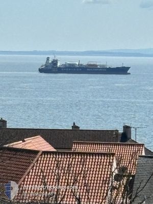
The vessel INEOS INSIGHT (IMO: 9685425, MMSI: 219671000) is a Tanker It's sailing under the flag of [DK] Denmark.
In this page you can find informations about the vessels current position, last detected port calls, and current voyage information. If the vessels is not in coverage by AIS you will find the latest position.
The current position of INEOS INSIGHT is detected by our AIS receivers and we are not responsible for the reliability of the data. The last position was recorded while the vessel was in Coverage by the Ais receivers of our vessel tracking app.
The current draught of INEOS INSIGHT as reported by AIS is 9.4 meters
Weather
| Temperature | 11°C / 51.8°F |
|---|---|
| Wind Speed | 20 knots |
| Direction | 267° W |
| Pressure | 1026.5 hPa |
| Humidity | 52.5 % |
| Cloud Coverage | 12 % |


Featured Company
Last Port Calls
| Port | Arrival | Departure | Time In Port |
|---|---|---|---|
| 2025-03-25 17:46 | 2025-03-27 00:55 | 1 d | |
| 2025-03-08 08:57 | 2025-03-10 21:44 | 2 d | |
| 2025-02-24 05:22 | 2025-02-25 03:12 | 21 h | |
| 2025-02-09 05:56 | 2025-02-10 15:27 | 1 d | |
| 2025-01-20 17:30 | 2025-01-23 23:34 | 3 d |
Most Visited Ports (Last year)
| Port | Arrivals | |
|---|---|---|
| 12 | ||
| 9 | ||
| 3 | ||
| 2 | ||
| 1 |
Last Trips
| Origin | Departure | Destination | Arrival | Distance | |
|---|---|---|---|---|---|
| 2025-03-10 21:44 | 2025-03-25 17:46 | 4519.09 nm | |||
| 2025-02-25 03:12 | 2025-03-08 08:57 | 3946.04 nm | |||
| 2025-02-10 15:27 | 2025-02-24 05:22 | 4915.70 nm | |||
| 2025-01-23 23:34 | 2025-02-09 05:56 | 5863.01 nm | |||
| 2024-12-30 20:58 | 2025-01-20 17:30 | 6284.04 nm |
Events
| Heure | Evenement | Détails | Position/ Destination | Info |
|---|---|---|---|---|
| 2025-03-27 13:17 | Etat Changé | Default Under way using engine |
38.71594 / -74.38979
US MAH>GB GRG
|
Vitesse: 16.1 kn Parcours: 105.2° |
| 2025-03-27 13:12 | Hors de la zone couverte |
38.72271 / -74.42031
North Atlantic Ocean
US MAH>GB GRG
|
Vitesse: 16.1 kn Parcours: 105.2° |
|
| 2025-03-27 13:12 | Etat Changé | Under way using engine Default |
38.72283 / -74.42087
US MAH>GB GRG
|
Vitesse: 16.2 kn Parcours: 108° |
| 2025-03-27 13:07 | Etat Changé | Default Under way using engine |
38.72866 / -74.44734
US MAH>GB GRG
|
Vitesse: 16.1 kn Parcours: 105.2° |
| 2025-03-27 12:41 | Etat Changé | Under way using engine Default |
38.75373 / -74.58931
US MAH>GB GRG
|
Vitesse: 14.8 kn Parcours: 99° |
| 2025-03-27 12:40 | Etat Changé | Default Under way using engine |
38.75457 / -74.59571
US MAH>GB GRG
|
Vitesse: 9.9 kn Parcours: 91° |
| 2025-03-27 11:25 | Etat Changé | Under way using engine Default |
38.76308 / -74.86528
US MAH>GB GRG
|
Vitesse: 9.8 kn Parcours: 93° |
| 2025-03-27 11:24 | Etat Changé | Default Under way using engine |
38.76311 / -74.87000
US MAH>GB GRG
|
Vitesse: 9.8 kn Parcours: 93.5° |
| 2025-03-27 08:01 | Changement d'ETA | 2025/04/05 22:00 2025/04/05 12:00 |
39.22856 / -75.30034
US MAH>GB GRG
|
Vitesse: 15 kn Parcours: 152° |
| 2025-03-27 04:55 | Tirant d'eau modifié | 9.4 7.4 |
39.80235 / -75.42391
[US] MARCUS HOOK
|
Vitesse: 6.4 kn Parcours: 237° |