
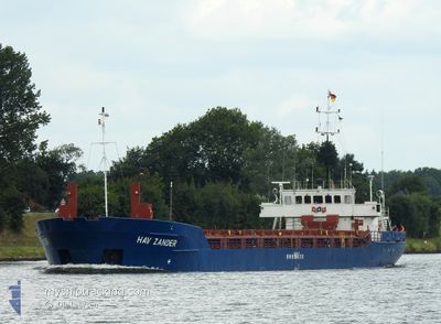
HAV ZANDER
General Cargo
Current Trip
| Time Travelled | 19 h, 6 mins |
|---|---|
| Remaining Time | 6 h, 44 mins |
| Distance Travelled | 176.51 nm |
| Remaining Distance | 58.50 nm |
| AVG Speed | 9.6 Knots |
| MAX Speed | 12.2 Knots |
| AVG Wind | 8.9 knots |
| MAX Wind | 13.3 knots |
| MIN Temp | 4.9°C / 40.82°F |
| MAX Temp | 8.3°C / 46.94°F |
| Draught | 3.4 m |
| Position Received | Now |
Current Position
| Longitude | --- |
|---|---|
| Latitude | --- |
| Status | Under way using engine |
| Speed | 8.2 Knots |
| Course | 188.1° |
| Area | North Sea |
| Station | T-AIS |
| Position Received | Now |
Info
Information
The current position of HAV ZANDER is in North Sea with coordinates 51.85348° / 1.74146° as reported on 2024-12-24 06:51 by AIS to our vessel tracker app. The vessel's current speed is 8.2 Knots and is heading at the port of DUNKERQUE. The estimated time of arrival as calculated by MyShipTracking vessel tracking app is 2024-12-24 13:36 LT
The vessel HAV ZANDER (IMO: 9001849, MMSI: 311014900) is a General Cargo that was built in 1990 ( 34 years old ). It's sailing under the flag of [BS] Bahamas.
In this page you can find informations about the vessels current position, last detected port calls, and current voyage information. If the vessels is not in coverage by AIS you will find the latest position.
The current position of HAV ZANDER is detected by our AIS receivers and we are not responsible for the reliability of the data. The last position was recorded while the vessel was in Coverage by the Ais receivers of our vessel tracking app.
The current draught of HAV ZANDER as reported by AIS is 3.4 meters
Weather
| Temperature | 8.7°C / 47.66°F |
|---|---|
| Wind Speed | 12 knots |
| Direction | 242° WSW |
| Pressure | 1023 hPa |
| Humidity | 92.8 % |
| Cloud Coverage | 100 % |
Featured Company
Last Port Calls
| Port | Arrival | Departure | Time In Port |
|---|---|---|---|
| 2024-12-17 20:25 | 2024-12-23 11:46 | 5 d | |
| 2024-12-05 13:18 | 2024-12-09 22:03 | 4 d | |
| 2024-11-28 15:30 | 2024-11-28 17:46 | 2 h | |
| 2024-11-23 16:16 | 2024-11-25 09:13 | 1 d | |
| 2024-11-18 16:21 | 2024-11-18 17:39 | 1 h | |
| 2024-11-13 22:38 | 2024-11-16 17:00 | 2 d | |
| 2024-11-13 19:33 | 2024-11-13 21:29 | 1 h | |
| 2024-11-10 10:34 | 2024-11-13 16:47 | 3 d | |
| 2024-11-07 10:53 | 2024-11-08 13:29 | 1 d | |
| 2024-11-03 23:38 | 2024-11-07 06:18 | 3 d |
Last Trips
| Origin | Departure | Destination | Arrival | Distance | |
|---|---|---|---|---|---|
| 2024-12-09 23:03 | 2024-12-17 20:25 | 931.19 nm | |||
| 2024-11-28 18:46 | 2024-12-05 14:18 | 451.36 nm | |||
| 2024-11-25 10:13 | 2024-11-28 16:30 | 497.89 nm | |||
| 2024-11-18 18:39 | 2024-11-23 17:16 | 795.95 nm | |||
| 2024-11-16 18:00 | 2024-11-18 17:21 | 9.57 nm | |||
| 2024-11-13 22:29 | 2024-11-13 23:38 | 7.88 nm | |||
| 2024-11-13 17:47 | 2024-11-13 20:33 | 23.36 nm | |||
| 2024-11-08 14:29 | 2024-11-10 11:34 | 364.60 nm | |||
| 2024-11-07 07:18 | 2024-11-07 11:53 | 30.22 nm | |||
| 2024-11-02 19:29 | 2024-11-04 00:38 | 265.39 nm |
Events
| Time | Event | Details | Position / Dest | Info |
|---|---|---|---|---|
| 2024-12-24 04:30 | Status Changed | Under way using engine Default |
52.19505 / 1.81698
FRDKK
|
Speed: 9.6 kn Course: 187° |
| 2024-12-24 04:13 | IN Coverage |
52.18977 / 1.81586
North Sea
FRDKK
|
Speed: 9.6 kn Course: 186.8° |
|
| 2024-12-24 03:33 | Status Changed | Default Under way using engine |
52.34798 / 1.84794
FRDKK
|
Speed: 10.1 kn Course: 187.6° |
| 2024-12-24 03:25 | OUT of Coverage |
52.36962 / 1.85257
North Sea
FRDKK
|
Speed: 10.1 kn Course: 187.6° |
|
| 2024-12-24 01:31 | Status Changed | Under way using engine Default |
52.69414 / 1.90838
FRDKK
|
Speed: 10.2 kn Course: 160° |
| 2024-12-24 01:21 | IN Coverage |
52.69193 / 1.90969
North Sea
FRDKK
|
Speed: 10.4 kn Course: 161.4° |
|
| 2024-12-23 17:58 | Status Changed | Default Under way using engine |
53.39645 / .48034
FRDKK
|
Speed: 8.2 kn Course: 137° |
| 2024-12-23 17:42 | OUT of Coverage |
53.42497 / .43731
North Sea
FRDKK
|
Speed: 8.2 kn Course: 137° |
|
| 2024-12-23 11:46 | PORT DEPARTURE |
|
53.69539 / -.86443
FRDKK
|
Speed: 4.3 kn Course: 148° |
| 2024-12-23 11:44 | START Moving |
53.69730 / -.86725
[GB] GOOLE
|
Speed: 3.1 kn Course: 128° |