
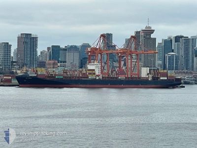
GSL TRIPOLI
Container Ship
Current Trip
| Time Travelled | 6 h, 18 mins |
|---|---|
| Remaining Time | --- |
| Distance Travelled | 78.46 nm |
| Remaining Distance | --- |
| AVG Speed | 11.7 Knots |
| MAX Speed | 16.2 Knots |
| AVG Wind | 10.5 knots |
| MAX Wind | 17 knots |
| MIN Temp | 12.3°C / 54.14°F |
| MAX Temp | 20.8°C / 69.44°F |
| Draught | 9.3 m |
| Position Received | 2 h, 44 m ago |
Current Position
| Longitude | --- |
|---|---|
| Latitude | --- |
| Status | Under way using engine |
| Speed | 14.1 Knots |
| Course | 88.8° |
| Area | North Atlantic Ocean |
| Station | T-AIS |
| Position Received | 2 h, 44 m ago |
Information
The current position of GSL TRIPOLI is in North Atlantic Ocean with coordinates 32.61050° / -79.08580° as reported on 2025-02-04 04:59 by AIS to our vessel tracker app. The vessel's current speed is 14.1 Knots and is heading at the port of TANGER MED. The estimated time of arrival as calculated by MyShipTracking vessel tracking app is 2025-02-15 02:30 LT
The vessel GSL TRIPOLI (IMO: 9437048, MMSI: 636020986) is a Container Ship that was built in 2009 ( 16 years old ). It's sailing under the flag of [LR] Liberia.
In this page you can find informations about the vessels current position, last detected port calls, and current voyage information. If the vessels is not in coverage by AIS you will find the latest position.
The current position of GSL TRIPOLI is detected by our AIS receivers and we are not responsible for the reliability of the data. The last position was recorded while the vessel was in Coverage by the Ais receivers of our vessel tracking app.
The current draught of GSL TRIPOLI as reported by AIS is 9.3 meters
Weather
| Temperature | 20.7°C / 69.26°F |
|---|---|
| Wind Speed | 17 knots |
| Direction | 244° WSW |
| Pressure | 1019.2 hPa |
| Humidity | 77.6 % |
| Cloud Coverage | --- |
Featured Company
Last Port Calls
| Port | Arrival | Departure | Time In Port |
|---|---|---|---|
| 2025-02-03 01:33 | 2025-02-04 01:26 | 23 h | |
| 2025-02-01 07:44 | 2025-02-01 08:35 | 50 m | |
| 2025-01-31 09:11 | 2025-01-31 10:33 | 1 h | |
| 2025-01-25 17:27 | 2025-01-26 19:08 | 1 d | |
| 2024-12-30 03:10 | 2024-12-30 23:42 | 20 h | |
| 2024-12-28 09:51 | 2024-12-28 18:57 | 9 h | |
| 2024-12-25 19:17 | 2024-12-26 20:16 | 1 d | |
| 2024-12-16 16:56 | 2024-12-17 22:00 | 1 d |
Most Visited Ports (Last year)
| Port | Arrivals | |
|---|---|---|
| 7 | ||
| 5 | ||
| 3 | ||
| 3 | ||
| 3 | ||
| 3 |
Last Trips
| Origin | Departure | Destination | Arrival | Distance | |
|---|---|---|---|---|---|
| 2025-02-01 03:35 | 2025-02-02 20:33 | 634.10 nm | |||
| 2025-01-31 05:33 | 2025-02-01 02:44 | 2.53 nm | |||
| 2025-01-26 13:08 | 2025-01-31 04:11 | 2056.66 nm | |||
| 2024-12-31 08:42 | 2025-01-25 11:27 | 10643.94 nm | |||
| 2024-12-29 03:57 | 2024-12-30 12:10 | 152.32 nm | |||
| 2024-12-27 04:16 | 2024-12-28 18:51 | 449.61 nm | |||
| 2024-12-18 06:00 | 2024-12-26 03:17 | 883.98 nm | |||
| 2024-11-28 21:44 | 2024-12-17 00:56 | 5904.92 nm |
Events
| Time | Event | Details | Position / Dest | Info |
|---|---|---|---|---|
| 2025-02-04 05:07 | Status Changed | Default Under way using engine |
32.61110 / -79.04572
USCHS>MAPTM
|
Speed: 14.1 kn Course: 88.8° |
| 2025-02-04 04:59 | OUT of Coverage |
32.61050 / -79.08580
North Atlantic Ocean
USCHS>MAPTM
|
Speed: 14.1 kn Course: 88.8° |
|
| 2025-02-04 04:56 | Status Changed | Under way using engine Default |
32.61042 / -79.09800
USCHS>MAPTM
|
Speed: 14.1 kn Course: 88° |
| 2025-02-04 04:51 | Status Changed | Default Under way using engine |
32.60898 / -79.12025
USCHS>MAPTM
|
Speed: 14.1 kn Course: 84.8° |
| 2025-02-04 04:50 | Status Changed | Under way using engine Default |
32.60853 / -79.12488
USCHS>MAPTM
|
Speed: 14.1 kn Course: 88° |
| 2025-02-04 04:39 | Status Changed | Default Under way using engine |
32.60697 / -79.17575
USCHS>MAPTM
|
Speed: 14.1 kn Course: 88.5° |
| 2025-02-04 01:45 | Status Changed | Under way using engine Default |
32.71315 / -79.79136
USCHS>MAPTM
|
Speed: 15.3 kn Course: 119° |
| 2025-02-04 01:43 | Status Changed | Default Under way using engine |
32.71570 / -79.79673
USCHS>MAPTM
|
Speed: 13.9 kn Course: 118.9° |
| 2025-02-04 01:32 | Status Changed | Under way using engine Default |
32.73846 / -79.84386
USCHS>MAPTM
|
Speed: 11.6 kn Course: 122° |
| 2025-02-04 01:31 | Status Changed | Default Under way using engine |
32.73875 / -79.84441
USCHS>MAPTM
|
Speed: 10.6 kn Course: 138° |