
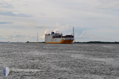
GRANDE AFRICA
Vehicles Carrier
Current Trip
| Time Travelled | 5 days |
|---|---|
| Remaining Time | 1 h, 35 mins |
| Distance Travelled | 1372.34 nm |
| Remaining Distance | 23.83 nm |
| AVG Speed | 10.7 Knots |
| MAX Speed | 16.4 Knots |
| AVG Wind | 13.3 knots |
| MAX Wind | 21.3 knots |
| MIN Temp | 11.3°C / 52.34°F |
| MAX Temp | 18.8°C / 65.84°F |
| Draught | 8.3 m |
| Position Received | 1 m ago |
Current Position
| Longitude | 3.86425° |
|---|---|
| Latitude | 51.34937° |
| Status | Under way using engine |
| Speed | 12.8 Knots |
| Course | 73.1° |
| Area | North Sea |
| Station | T-AIS |
| Position Received | 1 m ago |
Info
Information
The current position of GRANDE AFRICA is in North Sea with coordinates 51.34937° / 3.86425° as reported on 2024-05-19 03:27 by AIS to our vessel tracker app. The vessel's current speed is 12.8 Knots and is heading at the port of ANTWERP. The estimated time of arrival as calculated by MyShipTracking vessel tracking app is 2024-05-19 07:03 LT
The vessel GRANDE AFRICA (IMO: 9130949, MMSI: 215751000) is a Vehicles Carrier that was built in 1998 ( 26 years old ). It's sailing under the flag of [MT] Malta.
In this page you can find informations about the vessels current position, last detected port calls, and current voyage information. If the vessels is not in coverage by AIS you will find the latest position.
The current position of GRANDE AFRICA is detected by our AIS receivers and we are not responsible for the reliability of the data. The last position was recorded while the vessel was in Coverage by the Ais receivers of our vessel tracking app.
The current draught of GRANDE AFRICA as reported by AIS is 8.3 meters
Weather
| Temperature | 11.3°C / 52.34°F |
|---|---|
| Wind Speed | 6 knots |
| Direction | 296° WNW |
| Pressure | 1010.6 hPa |
| Humidity | 97.2 % |
| Cloud Coverage | --- |
Featured Company
Last Port Calls
| Port | Arrival | Departure | Time In Port |
|---|---|---|---|
| 2024-05-12 18:39 | 2024-05-13 19:40 | 1 d | |
| 2024-04-29 09:28 | 2024-05-02 14:36 | 3 d | |
| 2024-04-26 08:44 | 2024-04-28 08:04 | 1 d | |
| 2024-04-25 09:08 | 2024-04-25 17:20 | 8 h | |
| 2024-04-23 08:46 | 2024-04-24 18:22 | 1 d | |
| 2024-04-20 14:00 | 2024-04-21 18:32 | 1 d | |
| 2024-04-14 04:52 | 2024-04-16 16:09 | 2 d | |
| 2024-04-04 18:41 | 2024-04-05 20:39 | 1 d | |
| 2024-04-02 01:59 | 2024-04-03 01:25 | 23 h | |
| 2024-03-26 06:08 | 2024-03-31 22:51 | 5 d |
Last Trips
| Origin | Departure | Destination | Arrival | Distance | |
|---|---|---|---|---|---|
| 2024-05-02 14:36 | 2024-05-12 18:39 | 3478.89 nm | |||
| 2024-04-28 08:04 | 2024-04-29 09:28 | 244.94 nm | |||
| 2024-04-25 17:20 | 2024-04-26 08:44 | 65.69 nm | |||
| 2024-04-24 18:22 | 2024-04-25 09:08 | 136.60 nm | |||
| 2024-04-21 18:32 | 2024-04-23 08:46 | 567.31 nm | |||
| 2024-04-16 16:09 | 2024-04-20 14:00 | 1494.14 nm | |||
| 2024-04-05 20:39 | 2024-04-14 04:52 | 2422.38 nm | |||
| 2024-04-03 01:25 | 2024-04-04 18:41 | 523.36 nm | |||
| 2024-03-31 22:51 | 2024-04-02 01:59 | 395.85 nm | |||
| 2024-03-22 00:25 | 2024-03-26 06:08 | 1390.79 nm |
Events
| Time | Event | Details | Position / Dest | Info |
|---|---|---|---|---|
| 2024-05-19 01:26 | Change Sea Area | Dutch part of the North Sea Belgian part of the North Sea |
51.40435 / 3.34348
North Sea
MAPTM>BE ANR
|
Speed: 14.6 kn Course: 86.5° |
| 2024-05-18 23:13 | START Moving | 17.65 nm, North West of OOSTENDE |
51.40920 / 2.57559
MAPTM>BE ANR
|
Speed: 3.1 kn Course: 176° |
| 2024-05-18 23:11 | Status Changed | Under way using engine At anchor |
51.41009 / 2.57704
MAPTM>BE ANR
|
Speed: 0.4 kn Course: 266° |
| 2024-05-18 23:11 | ETA Changed | 2024/05/18 23:45 2024/05/18 17:50 |
51.40994 / 2.57788
MAPTM>BE ANR
|
Speed: 0.4 kn Course: 266° |
| 2024-05-18 22:18 | Status Changed | At anchor Default |
51.41023 / 2.57961
MAPTM>BE ANR
|
Speed: Course: 250° |
| 2024-05-18 22:14 | Status Changed | Default At anchor |
51.41025 / 2.57974
MAPTM>BE ANR
|
Speed: Course: 250° |
| 2024-05-18 19:36 | STOP Moving | 17.53 nm, North West of OOSTENDE |
51.40799 / 2.57805
MAPTM>BE ANR
|
Speed: 0.3 kn Course: 319° |
| 2024-05-18 19:14 | Status Changed | At anchor Under way using engine |
51.40934 / 2.57687
MAPTM>BE ANR
|
Speed: 1.4 kn Course: 328° |
| 2024-05-18 19:05 | Draught Changed | 8.3 8.1 |
51.39738 / 2.56836
MAPTM>BE ANR
|
Speed: 7.1 kn Course: 33.6° |
| 2024-05-18 17:19 | Change Sea Area | Belgian part of the North Sea French part of the North Sea |
51.32332 / 2.36518
North Sea
MAPTM>BE ANR
|
Speed: 7.6 kn Course: 55.8° |