
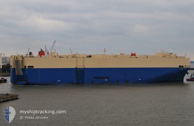
GRAND COSMO
Vehicles Carrier
Current Trip
SG PEBGB
| Time Travelled | 24 days |
|---|---|
| Remaining Time | --- |
| Distance Travelled | 8096.03 nm |
| Remaining Distance | --- |
| AVG Speed | 13.1 Knots |
| MAX Speed | 19 Knots |
| AVG Wind | 16 knots |
| MAX Wind | 33.5 knots |
| MIN Temp | 11.8°C / 53.24°F |
| MAX Temp | 28.2°C / 82.76°F |
| Draught | 7.7 m |
| Position Received | 6 d ago |
Current Position
| Longitude | --- |
|---|---|
| Latitude | --- |
| Status | Under way using engine |
| Speed | 9.9 Knots |
| Course | 115.4° |
| Area | South Atlantic Ocean |
| Station | T-AIS |
| Position Received | 6 d ago |
Info
Information
The current position of GRAND COSMO is in South Atlantic Ocean with coordinates -34.52922° / 18.46722° as reported on 2025-02-19 12:16 by AIS to our vessel tracker app. The vessel's current speed is 9.9 Knots
The vessel GRAND COSMO (IMO: 9303182, MMSI: 371648000) is a Vehicles Carrier that was built in 2006 ( 19 years old ). It's sailing under the flag of [PA] Panama.
In this page you can find informations about the vessels current position, last detected port calls, and current voyage information. If the vessels is not in coverage by AIS you will find the latest position.
The current position of GRAND COSMO is detected by our AIS receivers and we are not responsible for the reliability of the data. The last position was recorded while the vessel was in Coverage by the Ais receivers of our vessel tracking app.
The current draught of GRAND COSMO as reported by AIS is 7.7 meters
Weather
| Temperature | 27.2°C / 80.96°F |
|---|---|
| Wind Speed | 11 knots |
| Direction | 61° ENE |
| Pressure | 1011.1 hPa |
| Humidity | 78.2 % |
| Cloud Coverage | 31 % |
Featured Company
Last Port Calls
| Port | Arrival | Departure | Time In Port |
|---|---|---|---|
| 2025-01-31 06:02 | 2025-02-01 12:04 | 1 d | |
| 2025-01-18 10:47 | 2025-01-19 02:48 | 16 h | |
| 2025-01-13 04:11 | 2025-01-13 18:42 | 14 h | |
| 2024-12-02 02:52 |
Most Visited Ports (Last year)
| Port | Arrivals | |
|---|---|---|
| 3 | ||
| 2 | ||
| 2 | ||
| 2 | ||
| 2 | ||
| 2 |
Events
| Time | Event | Details | Position / Dest | Info |
|---|---|---|---|---|
| 2025-02-19 12:21 | Status Changed | Default Under way using engine |
-34.53484 / 18.48137
SG PEBGB
|
Speed: 9.9 kn Course: 115.4° |
| 2025-02-19 12:16 | OUT of Coverage |
-34.52922 / 18.46722
South Atlantic Ocean
SG PEBGB
|
Speed: 9.9 kn Course: 115.4° |
|
| 2025-02-19 11:45 | Draught Changed | 7.7 7 |
-34.48576 / 18.36551
SG PEBGB
|
Speed: 11.3 kn Course: 122.3° |
| 2025-02-19 11:45 | ETA Changed | 2025/03/07 09:00 |
-34.48576 / 18.36551
SG PEBGB
|
Speed: 11.3 kn Course: 122.3° |
| 2025-02-19 10:03 | Draught Changed | 7 7.7 |
-34.32314 / 18.03285
SG PEBGB
|
Speed: 11.3 kn Course: 124.9° |
| 2025-02-19 09:57 | Draught Changed | 7.7 7 |
-34.31330 / 18.01335
SG PEBGB
|
Speed: 11.4 kn Course: 125° |
| 2025-02-19 09:57 | ETA Changed | 2025/03/07 09:00 |
-34.31330 / 18.01335
SG PEBGB
|
Speed: 11.4 kn Course: 125° |
| 2025-02-19 09:03 | Draught Changed | 7 7.7 |
-34.23219 / 17.84345
SG PEBGB
|
Speed: 10 kn Course: 121° |
| 2025-02-19 08:25 | Detected in Sea | South African part of the South Atlantic Ocean |
-34.17806 / 17.73077
South Atlantic Ocean
SG PEBGB
|
Speed: 10.1 kn Course: 118° |
| 2025-02-19 08:24 | Status Changed | Under way using engine Default |
-34.17678 / 17.72822
SG PEBGB
|
Speed: 10.8 kn Course: 120° |