
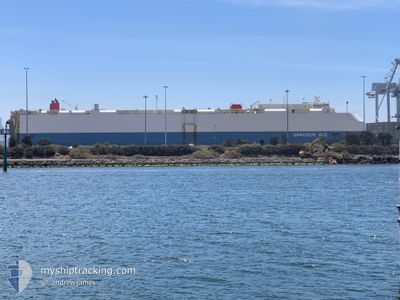
GRACIOUS ACE
Vehicles Carrier
Current Trip
| Time Travelled | 8 days |
|---|---|
| Remaining Time | --- |
| Distance Travelled | 2517.97 nm |
| Remaining Distance | --- |
| AVG Speed | 14.7 Knots |
| MAX Speed | 19.6 Knots |
| AVG Wind | 15.3 knots |
| MAX Wind | 33.7 knots |
| MIN Temp | 10.2°C / 50.36°F |
| MAX Temp | 20.5°C / 68.9°F |
| Draught | 8.6 m |
| Position Received | 1 d ago |
Current Position
| Longitude | --- |
|---|---|
| Latitude | --- |
| Status | Under way using engine |
| Speed | 17.8 Knots |
| Course | 209.1° |
| Area | North Atlantic Ocean |
| Station | T-AIS |
| Position Received | 1 d ago |
Info
Information
The current position of GRACIOUS ACE is in North Atlantic Ocean with coordinates 27.19339° / -15.49858° as reported on 2025-12-16 21:46 by AIS to our vessel tracker app. The vessel's current speed is 17.8 Knots and is heading at the port of WALVIS BAY. The estimated time of arrival as calculated by MyShipTracking vessel tracking app is 2025-12-27 08:00 LT
The vessel GRACIOUS ACE (IMO: 9604914, MMSI: 636015657) is a Vehicles Carrier that was built in 2012 ( 13 years old ). It's sailing under the flag of [LR] Liberia.
In this page you can find informations about the vessels current position, last detected port calls, and current voyage information. If the vessels is not in coverage by AIS you will find the latest position.
The current position of GRACIOUS ACE is detected by our AIS receivers and we are not responsible for the reliability of the data. The last position was recorded while the vessel was in Coverage by the Ais receivers of our vessel tracking app.
The current draught of GRACIOUS ACE as reported by AIS is 8.6 meters
Weather
| Temperature | 20.5°C / 68.9°F |
|---|---|
| Wind Speed | 24 knots |
| Direction | 34° NE |
| Pressure | 1019.7 hPa |
| Humidity | 72.2 % |
| Cloud Coverage | --- |
Featured Company
Last Port Calls
| Port | Arrival | Departure | Time In Port |
|---|---|---|---|
| 2025-12-08 04:44 | 2025-12-09 01:43 | 20 h | |
| 2025-12-05 04:11 | 2025-12-08 00:22 | 2 d | |
| 2025-12-03 02:30 | 2025-12-03 15:25 | 12 h | |
| 2025-11-28 05:01 | 2025-11-28 19:41 | 14 h | |
| 2025-10-23 19:36 | 2025-10-24 19:08 | 23 h | |
| 2025-10-22 06:08 | 2025-10-23 16:40 | 1 d | |
| 2025-10-20 06:04 | 2025-10-20 13:33 | 7 h | |
| 2025-10-18 06:00 | 2025-10-18 14:36 | 8 h | |
| 2025-10-09 20:03 | 2025-10-10 03:27 | 7 h | |
| 2025-10-02 12:47 | 2025-10-03 15:09 | 1 d |
Last Trips
| Origin | Departure | Destination | Arrival | Distance | |
|---|---|---|---|---|---|
| 2025-12-08 00:22 | 2025-12-08 04:44 | 57.76 nm | |||
| 2025-12-03 15:25 | 2025-12-05 04:11 | 581.77 nm | |||
| 2025-11-28 19:41 | 2025-12-03 02:30 | 1629.48 nm | |||
| 2025-10-24 19:08 | 2025-11-28 05:01 | 14028.57 nm | |||
| 2025-10-23 16:40 | 2025-10-23 19:36 | 44.22 nm | |||
| 2025-10-20 13:33 | 2025-10-22 06:08 | 89.00 nm | |||
| 2025-10-18 14:36 | 2025-10-20 06:04 | 454.40 nm | |||
| 2025-10-10 03:27 | 2025-10-18 06:00 | 1723.99 nm | |||
| 2025-10-03 15:09 | 2025-10-09 20:03 | 1909.12 nm | |||
| 2025-09-29 04:43 | 2025-10-02 12:47 | 1444.16 nm |
Events
| Time | Event | Details | Position / Dest | Info |
|---|---|---|---|---|
| 2025-12-16 21:52 | Status Changed | Default Under way using engine |
27.16837 / -15.51459
NA WVB
|
Speed: 17.8 kn Course: 209.1° |
| 2025-12-16 21:46 | Status Changed | Under way using engine Default |
27.19339 / -15.49858
NA WVB
|
Speed: 17.8 kn Course: 210° |
| 2025-12-16 21:46 | OUT of Coverage |
27.19339 / -15.49858
North Atlantic Ocean
NA WVB
|
Speed: 17.8 kn Course: 209.1° |
|
| 2025-12-16 21:28 | Status Changed | Default Under way using engine |
27.27216 / -15.44947
NA WVB
|
Speed: 18 kn Course: 209.1° |
| 2025-12-16 20:40 | ETA Changed | 2025/12/27 06:00 2025/12/27 12:00 |
27.48469 / -15.32249
NA WVB
|
Speed: 18.2 kn Course: 207° |
| 2025-12-16 20:21 | Status Changed | Under way using engine Default |
27.57339 / -15.27570
NA WVB
|
Speed: 18.3 kn Course: 204° |
| 2025-12-16 20:08 | Status Changed | Default Under way using engine |
27.63463 / -15.24499
NA WVB
|
Speed: 18.1 kn Course: 204.3° |
| 2025-12-16 19:59 | Status Changed | Under way using engine Default |
27.67571 / -15.22461
NA WVB
|
Speed: 18.1 kn Course: 204° |
| 2025-12-16 19:44 | Status Changed | Default Under way using engine |
27.74320 / -15.18441
NA WVB
|
Speed: 18.2 kn Course: 209.3° |
| 2025-12-16 18:04 | Status Changed | Under way using engine Default |
28.21039 / -14.96858
NA WVB
|
Speed: 18.3 kn Course: 206° |