
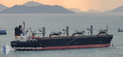
GLORIOUS HIBISCUS
Wood Chips Carrier
Current Trip
CN NTG
| Time Travelled | 1 day |
|---|---|
| Remaining Time | --- |
| Distance Travelled | 306.08 nm |
| Remaining Distance | --- |
| AVG Speed | 11.2 Knots |
| MAX Speed | 14.7 Knots |
| AVG Wind | 13.4 knots |
| MAX Wind | 22 knots |
| MIN Temp | 25.9°C / 78.62°F |
| MAX Temp | 31.3°C / 88.34°F |
| Draught | 10.8 m |
| Position Received | 7 d ago |
Current Position
| Longitude | 121.05219° |
|---|---|
| Latitude | 25.43966° |
| Status | Under way using engine |
| Speed | 12.2 Knots |
| Course | 42.5° |
| Area | Eastern China Sea |
| Station | T-AIS |
| Position Received | 7 d ago |
Info
Information
The current position of GLORIOUS HIBISCUS is in Eastern China Sea with coordinates 25.43966° / 121.05219° as reported on 2024-06-28 18:17 by AIS to our vessel tracker app. The vessel's current speed is 12.2 Knots
The vessel GLORIOUS HIBISCUS (IMO: 9515216, MMSI: 373048000) is a Wood Chips Carrier that was built in 2012 ( 12 years old ). It's sailing under the flag of [PA] Panama.
In this page you can find informations about the vessels current position, last detected port calls, and current voyage information. If the vessels is not in coverage by AIS you will find the latest position.
The current position of GLORIOUS HIBISCUS is detected by our AIS receivers and we are not responsible for the reliability of the data. The last position was recorded while the vessel was in Coverage by the Ais receivers of our vessel tracking app.
The current draught of GLORIOUS HIBISCUS as reported by AIS is 10.8 meters
Weather
| Temperature | 28.4°C / 83.12°F |
|---|---|
| Wind Speed | 17 knots |
| Direction | 194° SSW |
| Pressure | 1009.4 hPa |
| Humidity | 88.9 % |
| Cloud Coverage | --- |
Featured Company
Last Port Calls
| Port | Arrival | Departure | Time In Port |
|---|---|---|---|
| 2024-07-01 03:29 | 2024-07-04 22:04 | 3 d | |
| 2024-06-18 23:48 | 2024-06-22 10:53 | 3 d | |
| 2024-06-08 02:11 | |||
| 2024-06-02 21:55 | 2024-06-04 10:28 | 1 d | |
| 2024-05-18 21:56 | 2024-05-23 19:16 | 4 d | |
| 2024-05-05 05:20 | 2024-05-09 00:20 | 3 d |
Last Trips
| Origin | Departure | Destination | Arrival | Distance | |
|---|---|---|---|---|---|
| 2024-06-22 17:53 | 2024-07-01 11:29 | 2324.01 nm | |||
| 2024-06-08 11:11 | 2024-06-19 06:48 | 2493.34 nm | |||
| 2024-05-24 02:16 | 2024-06-03 06:55 | 2824.82 nm | |||
| 2024-05-09 09:20 | 2024-05-19 04:56 | 2771.17 nm | |||
| 2024-04-05 13:08 | 2024-05-05 14:20 | 5903.61 nm |
Events
| Time | Event | Details | Position / Dest | Info |
|---|---|---|---|---|
| 2024-07-04 22:04 | PORT DEPARTURE |
|
31.80029 / 120.95436
CN NTG
|
Speed: 5.8 kn Course: 147° |
| 2024-07-04 21:56 | START Moving |
31.81687 / 120.94032
[CN] NANTONG
|
Speed: 5.8 kn Course: 147° |
|
| 2024-07-01 03:53 | STOP Moving |
31.82281 / 120.94047
[CN] NANTONG
|
Speed: 0.2 kn Course: 342° |
|
| 2024-07-01 03:29 | PORT ARRIVAL |
|
31.81181 / 120.94402
[CN] NANTONG
|
Speed: 4.6 kn Course: 325° |
| 2024-07-01 00:28 | START Moving | 6.93 nm, South East of TAICANG |
31.59795 / 121.30705
CN NTG
|
Speed: 3.1 kn Course: 291° |
| 2024-06-30 15:05 | STOP Moving | 7.24 nm, South East of TAICANG |
31.59734 / 121.31398
CN NTG
|
Speed: 0.2 kn Course: 296° |
| 2024-06-28 18:20 | Status Changed | Default Under way using engine |
25.44710 / 121.06004
CN NTG
|
Speed: 12.2 kn Course: 42.5° |
| 2024-06-28 18:17 | OUT of Coverage |
25.43966 / 121.05219
Eastern China Sea
CN NTG
|
Speed: 12.2 kn Course: 42.5° |
|
| 2024-06-28 18:17 | Draught Changed | 10.8 7.2 |
25.43797 / 121.05052
CN NTG
|
Speed: 12.2 kn Course: 40.3° |
| 2024-06-28 18:15 | Detected in Sea | Taiwanese part of the Eastern China Sea |
25.43310 / 121.04601
Eastern China Sea
|
Speed: 12.2 kn Course: 40.2° |