
GLOBAL HIGHWAY
Cargo
Current Trip
| Time Travelled | 5 days |
|---|---|
| Remaining Time | 6 h, 18 mins |
| Distance Travelled | 1078.15 nm |
| Remaining Distance | 173.12 nm |
| AVG Speed | 11.4 Knots |
| MAX Speed | 16.3 Knots |
| AVG Wind | 15.2 knots |
| MAX Wind | 31 knots |
| MIN Temp | 12.9°C / 55.22°F |
| MAX Temp | 21.3°C / 70.34°F |
| Draught | 8.6 m |
| Position Received | 1 m ago |
Current Position
| Longitude | --- |
|---|---|
| Latitude | --- |
| Status | Under way using engine |
| Speed | 1.2 Knots |
| Course | 323° |
| Area | Bass Strait |
| Station | T-AIS |
| Position Received | 1 m ago |
Info
Information
The current position of GLOBAL HIGHWAY is in Bass Strait with coordinates -40.31505° / 145.89517° as reported on 2024-12-25 14:29 by AIS to our vessel tracker app. The vessel's current speed is 1.2 Knots and is heading at the port of MELBOURNE. The estimated time of arrival as calculated by MyShipTracking vessel tracking app is 2024-12-25 20:49 LT
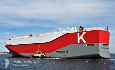
The vessel GLOBAL HIGHWAY (IMO: 9726695, MMSI: 374494000) is a Cargo It's sailing under the flag of [PA] Panama.
In this page you can find informations about the vessels current position, last detected port calls, and current voyage information. If the vessels is not in coverage by AIS you will find the latest position.
The current position of GLOBAL HIGHWAY is detected by our AIS receivers and we are not responsible for the reliability of the data. The last position was recorded while the vessel was in Coverage by the Ais receivers of our vessel tracking app.
The current draught of GLOBAL HIGHWAY as reported by AIS is 8.6 meters
Weather
| Temperature | 16.3°C / 61.34°F |
|---|---|
| Wind Speed | 16 knots |
| Direction | 34° NE |
| Pressure | 1010.6 hPa |
| Humidity | 89 % |
| Cloud Coverage | 100 % |
Featured Company
Last Port Calls
| Port | Arrival | Departure | Time In Port |
|---|---|---|---|
| 2024-12-16 11:14 | 2024-12-19 22:40 | 3 d | |
| 2024-12-11 08:07 | 2024-12-12 14:24 | 1 d | |
| 2024-12-05 20:24 | 2024-12-06 16:20 | 19 h | |
| 2024-11-23 21:30 | 2024-11-24 08:26 | 10 h | |
| 2024-11-22 21:52 | 2024-11-23 08:20 | 10 h | |
| 2024-11-20 21:14 | 2024-11-22 09:20 | 1 d | |
| 2024-11-17 22:15 | 2024-11-19 07:02 | 1 d | |
| 2024-11-16 01:44 | 2024-11-16 10:46 | 9 h | |
| 2024-11-15 00:25 | 2024-11-15 09:08 | 8 h | |
| 2024-11-11 13:06 | 2024-11-12 17:00 | 1 d |
Last Trips
| Origin | Departure | Destination | Arrival | Distance | |
|---|---|---|---|---|---|
| 2024-12-13 00:24 | 2024-12-16 22:14 | 700.67 nm | |||
| 2024-12-07 02:20 | 2024-12-11 18:07 | 807.39 nm | |||
| 2024-11-24 17:26 | 2024-12-06 06:24 | 3555.71 nm | |||
| 2024-11-23 17:20 | 2024-11-24 06:30 | 121.88 nm | |||
| 2024-11-22 18:20 | 2024-11-23 06:52 | 109.46 nm | |||
| 2024-11-19 16:02 | 2024-11-21 06:14 | 234.21 nm | |||
| 2024-11-16 19:46 | 2024-11-18 07:15 | 262.15 nm | |||
| 2024-11-15 18:08 | 2024-11-16 10:44 | 236.73 nm | |||
| 2024-11-13 01:00 | 2024-11-15 09:25 | 958.21 nm | |||
| 2024-11-10 15:47 | 2024-11-11 21:06 | 248.19 nm |
Events
| Time | Event | Details | Position / Dest | Info |
|---|---|---|---|---|
| 2024-12-25 07:58 | STOP Moving |
-40.25921 / 145.95391
AUMEL
|
Speed: 0.3 kn Course: 10° |
|
| 2024-12-25 07:02 | Status Changed | Under way using engine Default |
-40.26008 / 145.94102
AUMEL
|
Speed: 0.7 kn Course: 9° |
| 2024-12-25 07:00 | Status Changed | Default Under way using engine |
-40.26013 / 145.94038
AUMEL
|
Speed: 0.7 kn Course: 7° |
| 2024-12-25 06:50 | Status Changed | Under way using engine Default |
-40.26020 / 145.93766
AUMEL
|
Speed: 0.8 kn Course: 6° |
| 2024-12-25 06:44 | Status Changed | Default Under way using engine |
-40.26026 / 145.93570
AUMEL
|
Speed: 0.8 kn Course: 7° |
| 2024-12-25 06:33 | Status Changed | Under way using engine Default |
-40.26036 / 145.93240
AUMEL
|
Speed: 0.8 kn Course: 6° |
| 2024-12-25 06:00 | Status Changed | Default Under way using engine |
-40.26034 / 145.92107
AUMEL
|
Speed: 0.9 kn Course: 6° |
| 2024-12-25 05:53 | Status Changed | Under way using engine Default |
-40.26039 / 145.91822
AUMEL
|
Speed: 0.9 kn Course: 6° |
| 2024-12-25 05:52 | Status Changed | Default Under way using engine |
-40.26039 / 145.91817
AUMEL
|
Speed: 0.8 kn Course: 7° |
| 2024-12-25 05:41 | Status Changed | Under way using engine Default |
-40.26038 / 145.91402
AUMEL
|
Speed: 1 kn Course: 8° |