
GAS 87
Other Type
Current Trip
BORN
| Time Travelled | 8 days |
|---|---|
| Remaining Time | --- |
| Distance Travelled | 323.34 nm |
| Remaining Distance | --- |
| AVG Speed | 7.8 Knots |
| MAX Speed | 10.5 Knots |
| AVG Wind | 7.1 knots |
| MAX Wind | 15 knots |
| MIN Temp | 1.5°C / 34.7°F |
| MAX Temp | 11.6°C / 52.88°F |
| Draught | 1.8 m |
| Position Received | 48 m ago |
Current Position
| Longitude | --- |
|---|---|
| Latitude | --- |
| Status | Moored |
| Speed | 0.1 Knots |
| Course | 24° |
| Area | North Sea |
| Station | T-AIS |
| Position Received | 48 m ago |
Info
Information
The current position of GAS 87 is in North Sea with coordinates 51.18117° / 5.92243° as reported on 2026-04-03 04:37 by AIS to our vessel tracker app. The vessel's current speed is 0.1 Knots
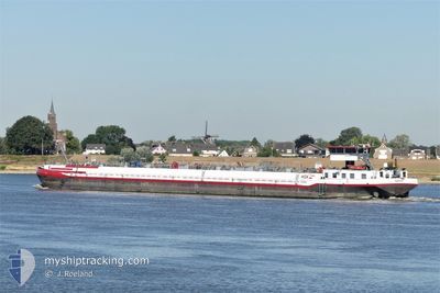
The vessel GAS 87 (MMSI: 211510550) is a Other Type It's sailing under the flag of [DE] Germany.
In this page you can find informations about the vessels current position, last detected port calls, and current voyage information. If the vessels is not in coverage by AIS you will find the latest position.
The current position of GAS 87 is detected by our AIS receivers and we are not responsible for the reliability of the data. The last position was recorded while the vessel was in Coverage by the Ais receivers of our vessel tracking app.
The current draught of GAS 87 as reported by AIS is 1.8 meters
Weather
| Temperature | 3.3°C / 37.94°F |
|---|---|
| Wind Speed | 4 knots |
| Direction | 209° SSW |
| Pressure | 1018.5 hPa |
| Humidity | 77.7 % |
| Cloud Coverage | 79 % |
Featured Company
Last Port Calls
| Port | Arrival | Departure | Time In Port |
|---|---|---|---|
| 2026-03-23 16:49 | 2026-03-25 12:20 | 1 d | |
| 2026-03-19 09:55 | 2026-03-19 13:47 | 3 h | |
| 2026-03-16 11:39 | 2026-03-19 04:27 | 2 d | |
| 2026-03-16 01:34 | 2026-03-16 09:29 | 7 h | |
| 2026-03-09 20:12 | 2026-03-10 04:33 | 8 h | |
| 2026-03-07 13:11 | 2026-03-08 08:07 | 18 h | |
| 2026-02-09 17:13 | 2026-02-10 08:58 | 15 h | |
| 2026-02-03 04:52 |
Last Trips
| Origin | Departure | Destination | Arrival | Distance | |
|---|---|---|---|---|---|
| 2026-03-19 13:47 | 2026-03-23 16:49 | 133.11 nm | |||
| 2026-03-19 04:27 | 2026-03-19 09:55 | 35.91 nm | |||
| 2026-03-16 09:29 | 2026-03-16 11:39 | 17.58 nm | |||
| 2026-03-10 04:33 | 2026-03-16 01:34 | 270.45 nm | |||
| 2026-03-08 08:07 | 2026-03-09 20:12 | 123.40 nm | |||
| 2026-02-10 08:58 | 2026-03-07 13:11 | 295.52 nm | |||
| 2026-02-03 04:52 | 2026-02-09 17:13 | 270.30 nm |
Events
| Time | Event | Details | Position / Dest | Info |
|---|---|---|---|---|
| 2026-04-03 04:37 | IN Coverage |
51.18117 / 5.92243
North Sea
|
Speed: 0.1 kn Course: 34.1° |
|
| 2026-04-02 13:40 | OUT of Coverage |
51.04803 / 5.80398
North Sea
|
Speed: 7.5 kn Course: 10.1° |
|
| 2026-04-02 13:37 | Status Changed | Under way using engine Moored |
51.04281 / 5.80233
BORN
|
Speed: 0.1 kn Course: 18° |
| 2026-04-02 13:37 | START Moving | --- |
51.04281 / 5.80233
BORN
|
Speed: 7.5 kn Course: 12.5° |
| 2026-04-02 13:13 | STOP Moving | --- |
51.03497 / 5.79884
BORN
|
Speed: 0.3 kn Course: 18° |
| 2026-04-02 13:12 | Status Changed | Moored Under way using engine |
51.03490 / 5.79880
BORN
|
Speed: 0.7 kn Course: 18° |
| 2026-04-02 12:43 | IN Coverage |
50.99320 / 5.77016
North Sea
|
Speed: 7.2 kn Course: 21.9° |
|
| 2026-04-02 11:07 | OUT of Coverage |
50.98395 / 5.76419
North Sea
|
Speed: 0.1 kn Course: 28° |
|
| 2026-04-02 00:28 | IN Coverage |
50.98393 / 5.76419
North Sea
|
Speed: Course: 4.9° |
|
| 2026-04-01 23:25 | OUT of Coverage |
50.98394 / 5.76419
North Sea
|
Speed: 0.1 kn Course: 21.1° |