
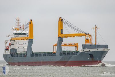
FWN SOLIDE
General Cargo
Current Trip
| Time Travelled | 2 days |
|---|---|
| Remaining Time | --- |
| Distance Travelled | 71.14 nm |
| Remaining Distance | --- |
| AVG Speed | 11.6 Knots |
| MAX Speed | 13.3 Knots |
| AVG Wind | 5.6 knots |
| MAX Wind | 11 knots |
| MIN Temp | 12.2°C / 53.96°F |
| MAX Temp | 14.6°C / 58.28°F |
| Draught | 7.6 m |
| Position Received | 10 d ago |
Current Position
| Longitude | --- |
|---|---|
| Latitude | --- |
| Status | Moored |
| Speed | |
| Course | 168° |
| Area | Mediterranean Sea - Western Basin |
| Station | T-AIS |
| Position Received | 10 d ago |
Info
Information
The current position of FWN SOLIDE is in Mediterranean Sea - Western Basin with coordinates 35.71049° / -0.63886° as reported on 2024-12-19 15:17 by AIS to our vessel tracker app. The vessel's current speed is 0 Knots
The vessel FWN SOLIDE (IMO: 9321093, MMSI: 244850854) is a General Cargo that was built in 2006 ( 18 years old ). It's sailing under the flag of [NL] Netherlands.
In this page you can find informations about the vessels current position, last detected port calls, and current voyage information. If the vessels is not in coverage by AIS you will find the latest position.
The current position of FWN SOLIDE is detected by our AIS receivers and we are not responsible for the reliability of the data. The last position was recorded while the vessel was in Coverage by the Ais receivers of our vessel tracking app.
The current draught of FWN SOLIDE as reported by AIS is 7.6 meters
Weather
| Temperature | 13.2°C / 55.76°F |
|---|---|
| Wind Speed | 3 knots |
| Direction | 119° ESE |
| Pressure | 1029.7 hPa |
| Humidity | 66.8 % |
| Cloud Coverage | 2 % |
Featured Company
Last Port Calls
| Port | Arrival | Departure | Time In Port |
|---|---|---|---|
| 2024-12-25 17:39 | 2024-12-27 15:32 | 1 d | |
| 2024-12-22 14:08 | 2024-12-23 09:17 | 19 h | |
| 2024-12-19 05:42 | 2024-12-19 18:06 | 12 h | |
| 2024-12-04 08:29 | 2024-12-11 08:26 | 6 d | |
| 2024-12-01 12:53 | 2024-12-02 17:18 | 1 d | |
| 2024-11-21 21:53 | 2024-11-23 21:24 | 1 d | |
| 2024-11-12 01:28 | 2024-11-13 12:28 | 1 d | |
| 2024-11-06 10:58 | 2024-11-07 16:14 | 1 d | |
| 2024-11-02 06:26 | 2024-11-04 17:58 | 2 d | |
| 2024-10-17 20:34 | 2024-10-22 19:17 | 4 d |
Last Trips
| Origin | Departure | Destination | Arrival | Distance | |
|---|---|---|---|---|---|
| 2024-12-23 10:17 | 2024-12-25 18:39 | 442.91 nm | |||
| 2024-12-19 19:06 | 2024-12-22 15:08 | 115.32 nm | |||
| 2024-12-11 09:26 | 2024-12-19 06:42 | 1723.50 nm | |||
| 2024-12-02 18:18 | 2024-12-04 09:29 | 386.52 nm | |||
| 2024-11-23 21:24 | 2024-12-01 13:53 | 1293.87 nm | |||
| 2024-11-13 14:28 | 2024-11-21 21:53 | 2061.16 nm | |||
| 2024-11-07 17:14 | 2024-11-12 03:28 | 902.66 nm | |||
| 2024-11-04 17:58 | 2024-11-06 11:58 | 520.24 nm | |||
| 2024-10-22 21:17 | 2024-11-02 06:26 | 2908.45 nm | |||
| 2024-10-14 22:32 | 2024-10-17 22:34 | 880.25 nm |
Events
| Time | Event | Details | Position / Dest | Info |
|---|---|---|---|---|
| 2024-12-27 22:10 | STOP Moving | 1.83 nm, North of SKIKDA |
36.91952 / 6.91232
DZORN
|
Speed: 0.1 kn Course: 85° |
| 2024-12-27 15:39 | START Moving | 1.03 nm, East of ANNABA |
36.90407 / 7.79994
DZORN
|
Speed: 11.3 kn Course: 78° |
| 2024-12-27 15:32 | PORT DEPARTURE |
|
36.90407 / 7.79994
DZORN
|
Speed: Course: 221° |
| 2024-12-25 17:39 | PORT ARRIVAL |
|
36.90185 / 7.77057
[DZ] ANNABA
|
Speed: 5 kn Course: 203° |
| 2024-12-25 01:31 | STOP Moving | 2.58 nm, North East of ANNABA |
36.93560 / 7.81597
DZORN
|
Speed: 0.3 kn Course: 359° |
| 2024-12-23 09:17 | PORT DEPARTURE |
|
35.85770 / -.26542
DZORN
|
Speed: 4.4 kn Course: 131° |
| 2024-12-23 09:04 | START Moving |
35.84899 / -.29473
[DZ] ARZEW
|
Speed: 4.4 kn Course: 131° |
|
| 2024-12-22 14:29 | STOP Moving |
35.85876 / -.30176
[DZ] ARZEW
|
Speed: Course: 3° |
|
| 2024-12-22 14:08 | PORT ARRIVAL |
|
35.85862 / -.30225
[DZ] ARZEW
|
Speed: 2.9 kn Course: 331° |
| 2024-12-22 07:51 | START Moving | 3.05 nm, North West of MOSTAGANEM |
35.97658 / .03885
DZORN
|
Speed: 11.5 kn Course: 234° |