
GEM
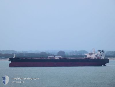
Crude Oil Tanker
Current Trip
ROCND
| Time Travelled | 31 days |
|---|---|
| Remaining Time | --- |
| Distance Travelled | 4041.95 nm |
| Remaining Distance | --- |
| AVG Speed | 11.7 Knots |
| MAX Speed | 11.7 Knots |
| AVG Wind | 13.3 knots |
| MAX Wind | 26 knots |
| MIN Temp | 6.3°C / 43.34°F |
| MAX Temp | 21°C / 69.8°F |
| Draught | 9.1 m |
| Position Received | 2 h, 4 m ago |
Current Position
| Longitude | 28.98937° |
|---|---|
| Latitude | 44.00060° |
| Status | At anchor |
| Speed | |
| Course | 98° |
| Area | Black Sea |
| Station | T-AIS |
| Position Received | 2 h, 4 m ago |
Info
Information
The current position of GEM is in Black Sea with coordinates 44.00060° / 28.98937° as reported on 2024-05-21 21:49 by AIS to our vessel tracker app. The vessel's current speed is 0 Knots
The vessel GEM (IMO: 9406001, MMSI: 538003884) is a Crude Oil Tanker that was built in 2010 ( 14 years old ). It's sailing under the flag of [MH] Marshall Is.
In this page you can find informations about the vessels current position, last detected port calls, and current voyage information. If the vessels is not in coverage by AIS you will find the latest position.
The current position of GEM is detected by our AIS receivers and we are not responsible for the reliability of the data. The last position was recorded while the vessel was in Coverage by the Ais receivers of our vessel tracking app.
The current draught of GEM as reported by AIS is 9.1 meters
Weather
| Temperature | 16.3°C / 61.34°F |
|---|---|
| Wind Speed | 9 knots |
| Direction | 130° SE |
| Pressure | 1016 hPa |
| Humidity | 74.7 % |
| Cloud Coverage | 5 % |
Featured Company
Most Visited Ports (Last year)
| Port | Arrivals | |
|---|---|---|
| 4 | ||
| 3 | ||
| 3 | ||
| 1 | ||
| 1 | ||
| 1 |
Events
| Time | Event | Details | Position / Dest | Info |
|---|---|---|---|---|
| 2024-05-21 21:55 | Status Changed | Default At anchor |
44.00061 / 28.98932
ROCND
|
Speed: Course: 98° |
| 2024-05-21 21:49 | OUT of Coverage |
44.00060 / 28.98937
Black Sea
|
Speed: Course: 77.5° |
|
| 2024-05-21 21:43 | Status Changed | At anchor Default |
44.00054 / 28.98931
ROCND
|
Speed: Course: 96° |
| 2024-05-21 21:40 | Status Changed | Default At anchor |
44.00052 / 28.98933
ROCND
|
Speed: Course: 96° |
| 2024-05-21 21:32 | Status Changed | At anchor Default |
44.00053 / 28.98931
ROCND
|
Speed: Course: 97° |
| 2024-05-21 21:24 | IN Coverage |
44.00053 / 28.98931
Black Sea
|
Speed: Course: 254.9° |
|
| 2024-05-21 17:29 | START Moving | 15.6 nm, South East of CONSTANTA |
44.00089 / 28.98973
ROCND
|
Speed: 3.4 kn Course: 98° |
| 2024-05-21 06:06 | Status Changed | Default At anchor |
43.99863 / 28.99076
ROCND
|
Speed: Course: 43° |
| 2024-05-21 05:57 | Status Changed | At anchor Default |
43.99854 / 28.99070
ROCND
|
Speed: Course: 43° |
| 2024-05-21 05:57 | OUT of Coverage |
43.99854 / 28.99070
Black Sea
|
Speed: Course: 34.1° |