
GEM
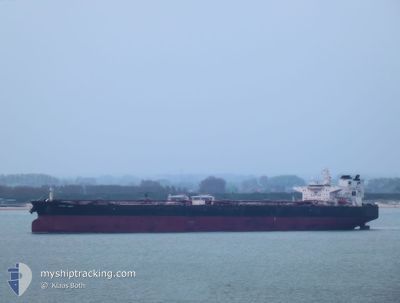
Crude Oil Tanker
Current Trip
| Time Travelled | 10 days |
|---|---|
| Remaining Time | --- |
| Distance Travelled | 2755.81 nm |
| Remaining Distance | --- |
| AVG Speed | 11.7 Knop |
| MAX Speed | 15.3 Knop |
| AVG Wind | 17.6 knots |
| MAX Wind | 26 knots |
| MIN Temp | 6.3°C / 43.34°F |
| MAX Temp | 18.5°C / 65.3°F |
| Djupgående | 9.1 m |
| Position mottagen | 9 h, 35 m sen |
Current Position
| Longitud | 17.73630° |
|---|---|
| Latitude | 36.35439° |
| Status | Under way using engine |
| Fart | 12.9 Knop |
| Kurs | 91.7° |
| Område | Mediterranean Sea - Eastern Basin |
| Station | T-AIS |
| Position mottagen | 9 h, 35 m sen |
Info
Information
The current position of GEM is in Mediterranean Sea - Eastern Basin with coordinates 36.35439° / 17.73630° as reported on 2024-04-30 14:58 by AIS to our vessel tracker app. The vessel's current speed is 12.9 Knop and is heading at the port of CANAKKALE. The estimated time of arrival as calculated by MyShipTracking vessel tracking app is 2024-05-02 06:30 LT
The vessel GEM (IMO: 9406001, MMSI: 538003884) is a Crude Oil Tanker that was built in 2010 ( 14 År gammal ). It's sailing under the flag of [MH] Marshall Is.
In this page you can find informations about the vessels current position, last detected port calls, and current voyage information. If the vessels is not in coverage by AIS you will find the latest position.
The current position of GEM is detected by our AIS receivers and we are not responsible for the reliability of the data. The last position was recorded while the vessel was in Coverage by the Ais receivers of our vessel tracking app.
The current draught of GEM as reported by AIS is 9.1 meters
Weather
| Temperature | 17.9°C / 64.22°F |
|---|---|
| Wind Speed | 7 knots |
| Direction | 109° ESE |
| Pressure | 1014.8 hPa |
| Humidity | 77.8 % |
| Cloud Coverage | 84 % |
Featured Company
Most Visited Ports (Last year)
| Port | Arrivals | |
|---|---|---|
| 4 | ||
| 3 | ||
| 3 | ||
| 1 | ||
| 1 | ||
| 1 |
Events
| Tid | Event | Detaljer | Position / Dest | Information |
|---|---|---|---|---|
| 2024-04-30 15:05 | Status ändrad | Default Under way using engine |
36.35166 / 17.76833
TRCKZ
|
Fart: 12.9 kn Kurs: 91.7° |
| 2024-04-30 14:58 | UTANFÖR täckningsområde |
36.35439 / 17.73630
Mediterranean Sea - Eastern Basin
TRCKZ
|
Fart: 12.9 kn Kurs: 91.7° |
|
| 2024-04-30 14:30 | Status ändrad | Under way using engine Default |
36.35721 / 17.61069
TRCKZ
|
Fart: 13 kn Kurs: 91° |
| 2024-04-30 14:26 | I täckningsområde |
36.35721 / 17.61069
Mediterranean Sea - Eastern Basin
TRCKZ
|
Fart: 13 kn Kurs: 90.6° |
|
| 2024-04-30 10:26 | Status ändrad | Default Under way using engine |
36.37167 / 16.46833
TRCKZ
|
Fart: 13.9 kn Kurs: 97° |
| 2024-04-30 10:22 | UTANFÖR täckningsområde |
36.37402 / 16.44909
Mediterranean Sea - Eastern Basin
TRCKZ
|
Fart: 13.9 kn Kurs: 97° |
|
| 2024-04-30 09:56 | Status ändrad | Under way using engine Default |
36.38455 / 16.32703
TRCKZ
|
Fart: 14 kn Kurs: 94° |
| 2024-04-30 09:24 | Status ändrad | Default Under way using engine |
36.39235 / 16.17243
TRCKZ
|
Fart: 14.4 kn Kurs: 83.7° |
| 2024-04-30 09:06 | Status ändrad | Under way using engine Default |
36.38605 / 16.08032
TRCKZ
|
Fart: 14 kn Kurs: 80° |
| 2024-04-30 08:44 | Status ändrad | Default Under way using engine |
36.37500 / 15.97667
TRCKZ
|
Fart: 13.6 kn Kurs: 90.5° |