

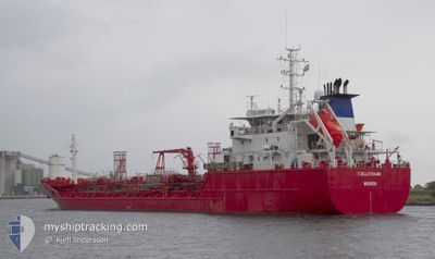
FJELLSTRAUM
Oil/Chemical Tanker

Current Trip
| Time Travelled | 7 days |
|---|---|
| Remaining Time | 1 day |
| Distance Travelled | 990.70 nm |
| Remaining Distance | 314.19 nm |
| AVG Speed | 9.8 Knots |
| MAX Speed | 9.8 Knots |
| AVG Wind | 16.9 knots |
| MAX Wind | 32 knots |
| MIN Temp | -11.8°C / 10.76°F |
| MAX Temp | 7.4°C / 45.32°F |
| Draught | 5.3 m |
| Position Received | 1 m ago |
Current Position
| Longitude | --- |
|---|---|
| Latitude | --- |
| Status | Under way using engine |
| Speed | 12.1 Knots |
| Course | 221.9° |
| Area | North Sea |
| Station | T-AIS |
| Position Received | 1 m ago |
Information
The current position of FJELLSTRAUM is in North Sea with coordinates 56.45737° / 7.47553° as reported on 2025-02-21 06:49 by AIS to our vessel tracker app. The vessel's current speed is 12.1 Knots and is heading at the port of ROTTERDAM. The estimated time of arrival as calculated by MyShipTracking vessel tracking app is 2025-02-22 09:38 LT
The vessel FJELLSTRAUM (IMO: 9140815, MMSI: 257601000) is a Oil/Chemical Tanker that was built in 1997 ( 28 years old ). It's sailing under the flag of [NO] Norway.
In this page you can find informations about the vessels current position, last detected port calls, and current voyage information. If the vessels is not in coverage by AIS you will find the latest position.
The current position of FJELLSTRAUM is detected by our AIS receivers and we are not responsible for the reliability of the data. The last position was recorded while the vessel was in Coverage by the Ais receivers of our vessel tracking app.
The current draught of FJELLSTRAUM as reported by AIS is 5.3 meters
Weather
| Temperature | 6°C / 42.8°F |
|---|---|
| Wind Speed | 14 knots |
| Direction | 201° SSW |
| Pressure | 1015.3 hPa |
| Humidity | 96.5 % |
| Cloud Coverage | 100 % |


Featured Company
Last Port Calls
| Port | Arrival | Departure | Time In Port |
|---|---|---|---|
| 2025-02-12 23:04 | 2025-02-13 15:17 | 16 h | |
| 2025-02-08 00:20 | 2025-02-08 01:09 | 49 m | |
| 2025-02-06 14:33 | 2025-02-07 18:37 | 1 d | |
| 2025-02-06 08:49 | 2025-02-06 09:09 | 19 m | |
| 2025-02-03 15:06 | 2025-02-04 11:22 | 20 h | |
| 2025-01-30 14:44 | 2025-02-01 19:55 | 2 d | |
| 2025-01-26 21:05 | 2025-01-27 07:24 | 10 h | |
| 2025-01-25 08:33 | 2025-01-25 18:23 | 9 h | |
| 2025-01-24 18:34 | 2025-01-25 04:32 | 9 h | |
| 2025-01-24 05:43 | 2025-01-24 11:44 | 6 h |
Most Visited Ports (Last year)
| Port | Arrivals | |
|---|---|---|
| 12 | ||
| 8 | ||
| 6 | ||
| 6 | ||
| 5 | ||
| 5 |
Last Trips
| Origin | Departure | Destination | Arrival | Distance | |
|---|---|---|---|---|---|
| 2025-02-08 02:09 | 2025-02-13 00:04 | 1352.55 nm | |||
| 2025-02-07 19:37 | 2025-02-08 01:20 | 65.70 nm | |||
| 2025-02-06 10:09 | 2025-02-06 15:33 | 65.11 nm | |||
| 2025-02-04 12:22 | 2025-02-06 09:49 | 618.20 nm | |||
| 2025-02-01 20:55 | 2025-02-03 16:06 | 564.41 nm | |||
| 2025-01-27 08:24 | 2025-01-30 15:44 | 829.21 nm | |||
| 2025-01-25 19:23 | 2025-01-26 22:05 | 226.09 nm | |||
| 2025-01-25 05:32 | 2025-01-25 09:33 | 38.81 nm | |||
| 2025-01-24 12:44 | 2025-01-24 19:34 | 101.25 nm | |||
| 2025-01-22 12:38 | 2025-01-24 06:43 | 526.24 nm |
Events
| Time | Event | Details | Position / Dest | Info |
|---|---|---|---|---|
| 2025-02-21 01:56 | Detected in Sea | Danish part of the North Sea |
57.20728 / 8.45307
North Sea
NLRTM
|
Speed: 11.7 kn Course: 238° |
| 2025-02-20 17:55 | Change Sea Area | Danish part of the Skaggerak Danish part of the Kattegat |
57.77740 / 10.80069
Skaggerak
NLRTM
|
Speed: 11.1 kn Course: 340.7° |
| 2025-02-20 16:48 | ETA Changed | 2025/02/22 08:00 2025/02/17 08:00 |
57.57101 / 10.65267
NLRTM
|
Speed: 11.3 kn Course: 21.7° |
| 2025-02-20 16:41 | Destination Changed | NLRTM DKSKA FO |
57.56845 / 10.63973
NLRTM
|
Speed: 1.3 kn Course: 145° |
| 2025-02-20 14:45 | Status Changed | Under way using engine At anchor |
57.62255 / 10.58017
DKSKA FO
|
Speed: 1.3 kn Course: 164° |
| 2025-02-20 14:40 | START Moving | 5.3 nm, South of SKAGEN |
57.62567 / 10.57790
DKSKA FO
|
Speed: 3.1 kn Course: 148° |
| 2025-02-19 12:46 | Status Changed | At anchor Default |
57.62266 / 10.58221
DKSKA FO
|
Speed: 0.1 kn Course: 210° |
| 2025-02-19 12:43 | Status Changed | Default At anchor |
57.62268 / 10.58239
DKSKA FO
|
Speed: 0.1 kn Course: 210° |
| 2025-02-17 08:17 | Status Changed | At anchor Under way using engine |
57.62189 / 10.58188
DKSKA FO
|
Speed: 0.6 kn Course: 246° |
| 2025-02-17 08:14 | STOP Moving | 5.53 nm, South of SKAGEN |
57.62171 / 10.58151
DKSKA FO
|
Speed: 0.3 kn Course: 252° |