

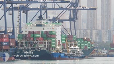
EVER BEING
Cargo D

Current Trip
| Time Travelled | 1 day |
|---|---|
| Remaining Time | 3 days |
| Distance Travelled | 387.78 nm |
| Remaining Distance | 1810.06 nm |
| AVG Speed | 12.5 Knots |
| MAX Speed | 20.3 Knots |
| AVG Wind | 7.7 knots |
| MAX Wind | 11.9 knots |
| MIN Temp | 23.9°C / 75.02°F |
| MAX Temp | 32.2°C / 89.96°F |
| Draught | 9.4 m |
| Position Received | 8 h, 2 m ago |
Current Position
| Longitude | --- |
|---|---|
| Latitude | --- |
| Status | Under way using engine |
| Speed | 19.9 Knots |
| Course | 89.7° |
| Area | Java Sea |
| Station | T-AIS |
| Position Received | 8 h, 2 m ago |
Information
The current position of EVER BEING is in Java Sea with coordinates -6.74325° / 112.89695° as reported on 2025-02-20 08:52 by AIS to our vessel tracker app. The vessel's current speed is 19.9 Knots and is heading at the port of KAOHSIUNG. The estimated time of arrival as calculated by MyShipTracking vessel tracking app is 2025-02-24 11:44 LT
The vessel EVER BEING (IMO: 9784142, MMSI: 416037000) is a Cargo D It's sailing under the flag of [TW] Taiwan.
In this page you can find informations about the vessels current position, last detected port calls, and current voyage information. If the vessels is not in coverage by AIS you will find the latest position.
The current position of EVER BEING is detected by our AIS receivers and we are not responsible for the reliability of the data. The last position was recorded while the vessel was in Coverage by the Ais receivers of our vessel tracking app.
The current draught of EVER BEING as reported by AIS is 9.4 meters
Weather
| Temperature | 28.2°C / 82.76°F |
|---|---|
| Wind Speed | 8 knots |
| Direction | 276° W |
| Pressure | 1010.5 hPa |
| Humidity | 77.4 % |
| Cloud Coverage | 100 % |


Featured Company
Last Port Calls
| Port | Arrival | Departure | Time In Port |
|---|---|---|---|
| 2025-02-17 17:12 | 2025-02-18 18:20 | 1 d | |
| 2025-02-12 23:08 | 2025-02-13 15:40 | 16 h | |
| 2025-02-06 17:41 | 2025-02-07 17:01 | 23 h | |
| 2025-01-28 02:16 | 2025-01-29 20:23 | 1 d | |
| 2025-01-23 13:23 | 2025-01-24 03:42 | 14 h | |
| 2025-01-21 18:01 | 2025-01-22 11:18 | 17 h | |
| 2025-01-19 01:20 | 2025-01-19 22:00 | 20 h | |
| 2025-01-11 06:25 | 2025-01-12 08:01 | 1 d | |
| 2025-01-08 11:36 | 2025-01-09 15:37 | 1 d | |
| 2025-01-01 13:24 | 2025-01-02 08:49 | 19 h |
Last Trips
| Origin | Departure | Destination | Arrival | Distance | |
|---|---|---|---|---|---|
| 2025-02-13 22:40 | 2025-02-18 00:12 | 252.85 nm | |||
| 2025-02-08 01:01 | 2025-02-13 06:08 | 1814.12 nm | |||
| 2025-01-30 04:23 | 2025-02-07 01:41 | 439.97 nm | |||
| 2025-01-24 11:42 | 2025-01-28 10:16 | 1617.06 nm | |||
| 2025-01-22 19:18 | 2025-01-23 21:23 | 72.79 nm | |||
| 2025-01-20 05:00 | 2025-01-22 02:01 | 586.10 nm | |||
| 2025-01-12 16:01 | 2025-01-19 08:20 | 2420.16 nm | |||
| 2025-01-09 23:37 | 2025-01-11 14:25 | 402.00 nm | |||
| 2025-01-02 15:49 | 2025-01-08 19:36 | 2166.88 nm | |||
| 2024-12-31 19:49 | 2025-01-01 20:24 | 248.54 nm |
Events
| Time | Event | Details | Position / Dest | Info |
|---|---|---|---|---|
| 2025-02-20 09:22 | Status Changed | Default Under way using engine |
-6.73641 / 113.06129
IDSUB > TWKHH
|
Speed: 19.9 kn Course: 89.7° |
| 2025-02-20 08:52 | OUT of Coverage |
-6.74325 / 112.89695
Java Sea
IDSUB > TWKHH
|
Speed: 19.9 kn Course: 89.7° |
|
| 2025-02-20 08:49 | Status Changed | Under way using engine Default |
-6.74348 / 112.87695
IDSUB > TWKHH
|
Speed: 19.5 kn Course: 99° |
| 2025-02-20 08:29 | Status Changed | Default Under way using engine |
-6.73306 / 112.76959
IDSUB > TWKHH
|
Speed: 14.6 kn Course: 356.5° |
| 2025-02-20 08:02 | ETA Changed | 2025/02/24 22:00 2025/02/25 07:00 |
-6.83159 / 112.73981
IDSUB > TWKHH
|
Speed: 12.5 kn Course: 351.4° |
| 2025-02-20 06:03 | START Moving | 1.85 nm, West of SURABAYA |
-7.19461 / 112.70201
IDSUB > TWKHH
|
Speed: 4 kn Course: 310° |
| 2025-02-20 05:50 | Status Changed | Under way using engine Moored |
-7.19602 / 112.70343
IDSUB > TWKHH
|
Speed: Course: 281° |
| 2025-02-20 05:39 | Status Changed | Moored Default |
-7.19600 / 112.70347
IDSUB > TWKHH
|
Speed: Course: 281° |
| 2025-02-20 05:36 | Status Changed | Default Moored |
-7.19600 / 112.70341
IDSUB > TWKHH
|
Speed: Course: 281° |
| 2025-02-20 05:25 | Draught Changed | 9.4 8.5 |
-7.19599 / 112.70350
IDSUB > TWKHH
|
Speed: Course: 281° |