
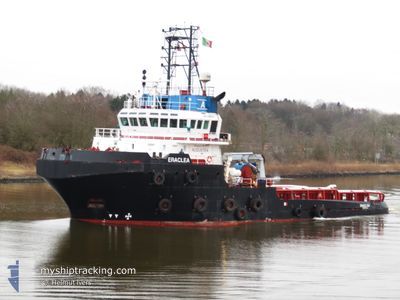
ERACLEA
Tug
Current Trip
| Time Travelled | --- |
|---|---|
| Remaining Time | 1 day |
| Distance Travelled | 2894.02 nm |
| Remaining Distance | 158.46 nm |
| AVG Speed | 8.1 Knots |
| MAX Speed | 11.8 Knots |
| AVG Wind | 8.4 knots |
| MAX Wind | 17 knots |
| MIN Temp | 23.2°C / 73.76°F |
| MAX Temp | 33.3°C / 91.94°F |
| Draught | 5.4 m |
| Position Received | 1 h, 21 m ago |
Current Position
| Longitude | --- |
|---|---|
| Latitude | --- |
| Status | Restricted manoeuverability |
| Speed | 4 Knots |
| Course | 54° |
| Area | English Channel |
| Station | T-AIS |
| Position Received | 1 h, 21 m ago |
Information
The current position of ERACLEA is in English Channel with coordinates 50.48483° / 1.00263° as reported on 2025-04-01 07:02 by AIS to our vessel tracker app. The vessel's current speed is 4 Knots and is heading at the port of ROTTERDAM. The estimated time of arrival as calculated by MyShipTracking vessel tracking app is 2025-04-02 17:31 LT
The vessel ERACLEA (IMO: 9499656, MMSI: 247278500) is a Tug that was built in 2010 ( 15 years old ). It's sailing under the flag of [IT] Italy.
In this page you can find informations about the vessels current position, last detected port calls, and current voyage information. If the vessels is not in coverage by AIS you will find the latest position.
The current position of ERACLEA is detected by our AIS receivers and we are not responsible for the reliability of the data. The last position was recorded while the vessel was in Coverage by the Ais receivers of our vessel tracking app.
The current draught of ERACLEA as reported by AIS is 5.4 meters
Weather
| Temperature | 7.4°C / 45.32°F |
|---|---|
| Wind Speed | 16 knots |
| Direction | 83° E |
| Pressure | 1025.8 hPa |
| Humidity | 78.8 % |
| Cloud Coverage | 6 % |
Featured Company
Last Port Calls
Most Visited Ports (Last year)
| Port | Arrivals | |
|---|---|---|
| 2 | ||
| 2 | ||
| 1 | ||
| 1 | ||
| 1 | ||
| 1 |
Last Trips
| Origin | Departure | Destination | Arrival | Distance |
|---|
Events
| Time | Event | Details | Position / Dest | Info |
|---|---|---|---|---|
| 2025-04-01 07:10 | Status Changed | Default Restricted manoeuverability |
50.48985 / 1.01291
NLRTM
|
Speed: 4 kn Course: 54° |
| 2025-04-01 07:02 | OUT of Coverage |
50.48483 / 1.00263
English Channel
NLRTM
|
Speed: 4 kn Course: 51° |
|
| 2025-04-01 06:56 | Change Sea Area | French part of the English Channel United Kingdom part of the English Channel |
50.48089 / .99325
English Channel
NLRTM
|
Speed: 4 kn Course: 64.6° |
| 2025-04-01 06:56 | Status Changed | Restricted manoeuverability Default |
50.48089 / .99325
NLRTM
|
Speed: 3.9 kn Course: 64° |
| 2025-04-01 06:42 | IN Coverage |
50.48089 / .99325
English Channel
NLRTM
|
Speed: 4 kn Course: 64.6° |
|
| 2025-04-01 01:02 | Status Changed | Default Restricted manoeuverability |
50.35136 / .32453
NLRTM
|
Speed: 5.3 kn Course: 71.2° |
| 2025-04-01 00:55 | Status Changed | Restricted manoeuverability Default |
50.34857 / .30998
NLRTM
|
Speed: 5.4 kn Course: 71° |
| 2025-04-01 00:55 | OUT of Coverage |
50.34857 / .30998
English Channel
NLRTM
|
Speed: 5.3 kn Course: 71.2° |
|
| 2025-04-01 00:54 | Status Changed | Default Restricted manoeuverability |
50.34776 / .30630
NLRTM
|
Speed: 5.3 kn Course: 73.7° |
| 2025-04-01 00:34 | Status Changed | Restricted manoeuverability Default |
50.33980 / .26188
NLRTM
|
Speed: 5.7 kn Course: 54° |