

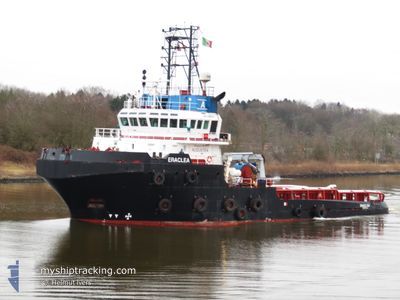
ERACLEA
Tug

Current Trip
| Time Travelled | --- |
|---|---|
| Remaining Time | 1 day |
| Distance Travelled | 2894.02 nm |
| Remaining Distance | 615.66 nm |
| AVG Speed | 8.1 Noeuds |
| MAX Speed | 11.8 Noeuds |
| AVG Wind | 8.4 knots |
| MAX Wind | 17 knots |
| MIN Temp | 23.2°C / 73.76°F |
| MAX Temp | 33.3°C / 91.94°F |
| Tirant d eau | 6 m |
| Position reçue | 7 d depuis |
Current Position
| Longitude | --- |
|---|---|
| Latitude | --- |
| Etat | Restricted manoeuverability |
| Vitesse | 5.6 Noeuds |
| Parcours | 354.7° |
| Zone | North Atlantic Ocean |
| Station | T-AIS |
| Position reçue | 7 d depuis |
Information
The current position of ERACLEA is in North Atlantic Ocean with coordinates 28.90070° / -15.39908° as reported on 2025-03-21 02:21 by AIS to our vessel tracker app. The vessel's current speed is 5.6 Noeuds and is heading at the port of LAS PALMAS. The estimated time of arrival as calculated by MyShipTracking vessel tracking app is 2025-03-29 14:18 LT
The vessel ERACLEA (IMO: 9499656, MMSI: 247278500) is a Tug that was built in 2010 ( 15 Age ). It's sailing under the flag of [IT] Italy.
In this page you can find informations about the vessels current position, last detected port calls, and current voyage information. If the vessels is not in coverage by AIS you will find the latest position.
The current position of ERACLEA is detected by our AIS receivers and we are not responsible for the reliability of the data. The last position was recorded while the vessel was in Coverage by the Ais receivers of our vessel tracking app.
The current draught of ERACLEA as reported by AIS is 6 meters
Weather
| Temperature | 12.5°C / 54.5°F |
|---|---|
| Wind Speed | 13 knots |
| Direction | 14° NNE |
| Pressure | 1021.8 hPa |
| Humidity | 87.2 % |
| Cloud Coverage | 13 % |


Featured Company
Last Port Calls
Most Visited Ports (Last year)
| Port | Arrivals | |
|---|---|---|
| 2 | ||
| 2 | ||
| 1 | ||
| 1 | ||
| 1 | ||
| 1 |
Last Trips
| Origin | Departure | Destination | Arrival | Distance |
|---|
Events
| Heure | Evenement | Détails | Position/ Destination | Info |
|---|---|---|---|---|
| 2025-03-21 02:27 | Etat Changé | Default Restricted manoeuverability |
28.90980 / -15.40037
LAS PALMAS
|
Vitesse: 5.6 kn Parcours: 354.7° |
| 2025-03-21 02:21 | Hors de la zone couverte |
28.90070 / -15.39908
North Atlantic Ocean
|
Vitesse: 5.6 kn Parcours: 354.7° |
|
| 2025-03-21 02:11 | Etat Changé | Restricted manoeuverability Default |
28.88622 / -15.39716
LAS PALMAS
|
Vitesse: 5.5 kn Parcours: 353° |
| 2025-03-21 02:04 | Etat Changé | Default Restricted manoeuverability |
28.87427 / -15.39572
LAS PALMAS
|
Vitesse: 5.4 kn Parcours: 353.4° |
| 2025-03-19 13:32 | Etat Changé | Restricted manoeuverability Default |
28.17226 / -15.30193
LAS PALMAS
|
Vitesse: 4.3 kn Parcours: 186° |
| 2025-03-19 13:32 | Etat Changé | Default Restricted manoeuverability |
28.17305 / -15.30185
LAS PALMAS
|
Vitesse: 3.8 kn Parcours: 178° |
| 2025-03-19 07:06 | Changement de destination | LAS PALMAS ROTTERDAM |
27.72648 / -15.29535
LAS PALMAS
|
Vitesse: 5.5 kn Parcours: 29.2° |
| 2025-03-19 07:06 | Changement d'ETA | 2025/03/19 10:00 2025/03/31 10:00 |
27.72648 / -15.29535
LAS PALMAS
|
Vitesse: 5.5 kn Parcours: 29.2° |
| 2025-03-19 06:48 | Changement de zone | Spanish (Canary Islands) part of the North Atlantic Ocean Western Saharan part of the North Atlantic Ocean |
27.70262 / -15.31162
North Atlantic Ocean
ROTTERDAM
|
Vitesse: 5.7 kn Parcours: 31.9° |
| 2025-03-19 06:48 | Etat Changé | Restricted manoeuverability Default |
27.70262 / -15.31162
ROTTERDAM
|
Vitesse: 5.7 kn Parcours: 31° |