
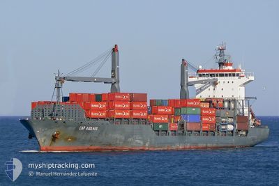
EM HYDRA
Container Ship
Current Trip
| Time Travelled | 3 days |
|---|---|
| Remaining Time | --- |
| Distance Travelled | 283.14 nm |
| Remaining Distance | --- |
| AVG Speed | 8.7 Knots |
| MAX Speed | 17.6 Knots |
| AVG Wind | 7.6 knots |
| MAX Wind | 13.3 knots |
| MIN Temp | 13.1°C / 55.58°F |
| MAX Temp | 21.1°C / 69.98°F |
| Draught | 9 m |
| Position Received | 1 h, 0 m ago |
Current Position
| Longitude | --- |
|---|---|
| Latitude | --- |
| Status | At anchor |
| Speed | 0.7 Knots |
| Course | 241° |
| Area | North Atlantic Ocean |
| Station | T-AIS |
| Position Received | 1 h, 0 m ago |
Info
Information
The current position of EM HYDRA is in North Atlantic Ocean with coordinates 30.43269° / -9.67482° as reported on 2025-12-13 00:01 by AIS to our vessel tracker app. The vessel's current speed is 0.7 Knots
The vessel EM HYDRA (IMO: 9338967, MMSI: 636014956) is a Container Ship that was built in 2005 ( 20 years old ). It's sailing under the flag of [LR] Liberia.
In this page you can find informations about the vessels current position, last detected port calls, and current voyage information. If the vessels is not in coverage by AIS you will find the latest position.
The current position of EM HYDRA is detected by our AIS receivers and we are not responsible for the reliability of the data. The last position was recorded while the vessel was in Coverage by the Ais receivers of our vessel tracking app.
The current draught of EM HYDRA as reported by AIS is 9 meters
Weather
| Temperature | 14.7°C / 58.46°F |
|---|---|
| Wind Speed | 4 knots |
| Direction | 256° WSW |
| Pressure | 1011.1 hPa |
| Humidity | 67.5 % |
| Cloud Coverage | 99 % |
Featured Company
Last Port Calls
| Port | Arrival | Departure | Time In Port |
|---|---|---|---|
| 2025-12-08 01:07 | 2025-12-09 10:22 | 1 d | |
| 2025-12-06 05:04 | 2025-12-06 23:51 | 18 h | |
| 2025-12-01 13:40 | 2025-12-02 06:45 | 17 h | |
| 2025-11-28 20:01 | 2025-11-29 04:15 | 8 h | |
| 2025-11-28 11:07 | 2025-11-28 17:37 | 6 h | |
| 2025-11-26 21:50 | 2025-11-27 11:09 | 13 h | |
| 2025-11-26 03:47 | 2025-11-26 19:22 | 15 h | |
| 2025-11-23 20:18 | 2025-11-24 14:13 | 17 h | |
| 2025-11-22 02:04 | 2025-11-22 15:13 | 13 h | |
| 2025-11-20 10:31 | 2025-11-20 21:31 | 10 h |
Most Visited Ports (Last year)
| Port | Arrivals | |
|---|---|---|
| 11 | ||
| 10 | ||
| 9 | ||
| 8 | ||
| 8 | ||
| 8 |
Last Trips
| Origin | Departure | Destination | Arrival | Distance | |
|---|---|---|---|---|---|
| 2025-12-06 23:51 | 2025-12-08 01:07 | 193.16 nm | |||
| 2025-12-02 06:45 | 2025-12-06 05:04 | 1285.17 nm | |||
| 2025-11-29 04:15 | 2025-12-01 13:40 | 281.31 nm | |||
| 2025-11-28 17:37 | 2025-11-28 20:01 | 21.99 nm | |||
| 2025-11-27 11:09 | 2025-11-28 11:07 | 124.94 nm | |||
| 2025-11-26 19:22 | 2025-11-26 21:50 | 31.78 nm | |||
| 2025-11-24 14:13 | 2025-11-26 03:47 | 367.67 nm | |||
| 2025-11-22 15:13 | 2025-11-23 20:18 | 306.16 nm | |||
| 2025-11-20 21:31 | 2025-11-22 02:04 | 173.62 nm | |||
| 2025-11-15 16:13 | 2025-11-20 10:31 | 1550.53 nm |
Events
| Time | Event | Details | Position / Dest | Info |
|---|---|---|---|---|
| 2025-12-13 00:02 | Status Changed | Default At anchor |
30.43167 / -9.67333
MAAGA
|
Speed: 0.7 kn Course: 241° |
| 2025-12-13 00:01 | Status Changed | At anchor Default |
30.43269 / -9.67482
MAAGA
|
Speed: Course: -1° |
| 2025-12-13 00:01 | IN Coverage |
30.43269 / -9.67482
North Atlantic Ocean
|
Speed: 0.7 kn Course: 191.4° |
|
| 2025-12-12 22:29 | Status Changed | Default At anchor |
30.43333 / -9.67666
MAAGA
|
Speed: 1.3 kn Course: 245° |
| 2025-12-12 22:22 | Status Changed | At anchor Default |
30.43350 / -9.67689
MAAGA
|
Speed: Course: -1° |
| 2025-12-12 22:22 | OUT of Coverage |
30.43350 / -9.67689
North Atlantic Ocean
|
Speed: 1.3 kn Course: 189.8° |
|
| 2025-12-12 22:05 | IN Coverage |
30.43350 / -9.67689
North Atlantic Ocean
|
Speed: 1.3 kn Course: 189.8° |
|
| 2025-12-12 21:25 | Status Changed | Default At anchor |
30.43394 / -9.68051
MAAGA
|
Speed: 0.1 kn Course: 130° |
| 2025-12-12 21:12 | Status Changed | At anchor Default |
30.43394 / -9.68097
MAAGA
|
Speed: 0.1 kn Course: 118° |
| 2025-12-12 21:12 | OUT of Coverage |
30.43394 / -9.68097
North Atlantic Ocean
|
Speed: 0.1 kn Course: 350.3° |