
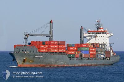
EM HYDRA
Container Ship
Current Trip
| Trip Time | 3 days |
|---|---|
| Trip Distance | 340.05 nm |
| AVG Speed | 10.5 Knopen |
| MAX Speed | 16 Knopen |
| Diepgang | 10.6 M |
| AVG Wind | 11.2 knots |
| MAX Wind | 16.9 knots |
| MIN Temp | 20.6°C / 69.08°F |
| MAX Temp | 34.1°C / 93.38°F |
| Positie ontvangen | 5 d geleden |
Current Position
| Lengtegraad | -16.56165° |
|---|---|
| Breedtegraat | 13.44556° |
| Status | At anchor |
| Snelheid | |
| Koers | 344° |
| Gebied | North Atlantic Ocean |
| Station | T-AIS |
| Positie ontvangen | 5 d geleden |
Info
Information
The current position of EM HYDRA is in North Atlantic Ocean with coordinates 13.44556° / -16.56165° as reported on 2024-04-20 06:52 by AIS to our vessel tracker app. The vessel's current speed is 0 Knopen and is currently inside the port of BANJUL.
The vessel EM HYDRA (IMO: 9338967, MMSI: 636014956) is a Container Ship that was built in 2005 ( 19 Jaar oud ). It's sailing under the flag of [LR] Liberia.
In this page you can find informations about the vessels current position, last detected port calls, and current voyage information. If the vessels is not in coverage by AIS you will find the latest position.
The current position of EM HYDRA is detected by our AIS receivers and we are not responsible for the reliability of the data. The last position was recorded while the vessel was in Coverage by the Ais receivers of our vessel tracking app.
The current draught of EM HYDRA as reported by AIS is 10.6 meters
Weather
| Temperature | 22.5°C / 72.5°F |
|---|---|
| Wind Speed | 9 knots |
| Direction | 332° NNW |
| Pressure | 1009.4 hPa |
| Humidity | 66.5 % |
| Cloud Coverage | 99 % |
Featured Company
Last Port Calls
| Port | Arrival | Departure | Time In Port |
|---|---|---|---|
| 2024-04-21 21:13 | |||
| 2024-04-16 06:59 | 2024-04-17 22:02 | 1 d | |
| 2024-04-04 06:35 | 2024-04-05 12:15 | 1 d | |
| 2024-03-30 19:03 | 2024-03-31 15:23 | 20 h | |
| 2024-03-19 14:39 | 2024-03-19 19:45 | 5 h | |
| 2024-03-12 13:53 | |||
| 2024-03-10 17:29 | 2024-03-11 11:16 | 17 h | |
| 2024-02-27 23:30 | 2024-02-28 18:32 | 19 h | |
| 2024-02-13 07:31 | 2024-02-15 08:23 | 2 d | |
| 2024-02-03 22:07 |
Most Visited Ports (Last year)
| Port | Arrivals | |
|---|---|---|
| 7 | ||
| 6 | ||
| 4 | ||
| 4 | ||
| 4 | ||
| 2 |
Last Trips
| Origin | Departure | Destination | Arrival | Distance | |
|---|---|---|---|---|---|
| 2024-04-17 22:02 | 2024-04-21 21:13 | 340.05 nm | |||
| 2024-04-05 12:15 | 2024-04-16 06:59 | 1401.67 nm | |||
| 2024-03-31 17:23 | 2024-04-04 06:35 | 205.78 nm | |||
| 2024-03-19 19:45 | 2024-03-30 20:03 | 1396.86 nm | |||
| 2024-03-11 11:16 | 2024-03-12 13:53 | 17.36 nm | |||
| 2024-02-28 19:32 | 2024-03-10 17:29 | 1724.23 nm | |||
| 2024-02-15 09:23 | 2024-02-28 00:30 | 3620.02 nm | |||
| 2024-02-03 23:07 | 2024-02-13 08:31 | 106.87 nm |
Events
| Tijd | Evenement | Details | Positie / Bestemming | Info |
|---|---|---|---|---|
| 2024-04-21 21:26 | Stop beweging |
13.44167 / -16.57167
[GM] BANJUL
|
Snelheid: Koers: -1° |
|
| 2024-04-21 21:13 | Aankomsthaven |
|
13.44284 / -16.57147
[GM] BANJUL
|
Snelheid: 2 kn Koers: -1° |
| 2024-04-21 20:57 | Start beweging | 0.47 nm, East of BANJUL |
13.44432 / -16.56352
MRNKC
|
Snelheid: 3.7 kn Koers: 251° |
| 2024-04-20 06:59 | Status Changed | Default At anchor |
13.44500 / -16.56167
MRNKC
|
Snelheid: Koers: 344° |
| 2024-04-20 06:52 | Status Changed | At anchor Default |
13.44556 / -16.56165
MRNKC
|
Snelheid: Koers: -1° |
| 2024-04-20 06:52 | Buitenbereik |
13.44556 / -16.56165
North Atlantic Ocean
|
Snelheid: Koers: 239.6° |
|
| 2024-04-20 06:44 | Binnenbereik |
13.44556 / -16.56165
North Atlantic Ocean
|
Snelheid: Koers: 239.6° |
|
| 2024-04-20 05:22 | Status Changed | Default At anchor |
13.44574 / -16.56107
MRNKC
|
Snelheid: Koers: 325° |
| 2024-04-20 05:16 | Status Changed | At anchor Default |
13.44573 / -16.56106
MRNKC
|
Snelheid: Koers: 328° |
| 2024-04-20 05:16 | Buitenbereik |
13.44573 / -16.56106
North Atlantic Ocean
|
Snelheid: Koers: 239.6° |