
EKMEN TRANS
General Cargo
Current Trip
| Time Travelled | 11 days |
|---|---|
| Remaining Time | --- |
| Distance Travelled | 2716.97 nm |
| Remaining Distance | --- |
| AVG Speed | 10 Knots |
| MAX Speed | 11.8 Knots |
| AVG Wind | 11.2 knots |
| MAX Wind | 22.8 knots |
| MIN Temp | 20°C / 68°F |
| MAX Temp | 27.9°C / 82.22°F |
| Draught | 5.3 m |
| Position Received | 5 h, 25 m ago |
Current Position
| Longitude | --- |
|---|---|
| Latitude | --- |
| Status | Under way using engine |
| Speed | 10.3 Knots |
| Course | 25.6° |
| Area | North Atlantic Ocean |
| Station | T-AIS |
| Position Received | 5 h, 25 m ago |
Info
Information
The current position of EKMEN TRANS is in North Atlantic Ocean with coordinates 30.22772° / -11.53533° as reported on 2024-10-01 00:30 by AIS to our vessel tracker app. The vessel's current speed is 10.3 Knots and is heading at the port of ISTANBUL. The estimated time of arrival as calculated by MyShipTracking vessel tracking app is 2024-10-11 18:00 LT
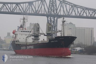
The vessel EKMEN TRANS (IMO: 9204348, MMSI: 314616000) is a General Cargo that was built in 1999 ( 25 years old ). It's sailing under the flag of [BB] Barbados.
In this page you can find informations about the vessels current position, last detected port calls, and current voyage information. If the vessels is not in coverage by AIS you will find the latest position.
The current position of EKMEN TRANS is detected by our AIS receivers and we are not responsible for the reliability of the data. The last position was recorded while the vessel was in Coverage by the Ais receivers of our vessel tracking app.
The current draught of EKMEN TRANS as reported by AIS is 5.3 meters
Weather
| Temperature | 21.4°C / 70.52°F |
|---|---|
| Wind Speed | 16 knots |
| Direction | 21° NNE |
| Pressure | 1013.8 hPa |
| Humidity | 93.6 % |
| Cloud Coverage | 61 % |
Featured Company
Most Visited Ports (Last year)
| Port | Arrivals | |
|---|---|---|
| 4 | ||
| 2 | ||
| 1 | ||
| 1 | ||
| 1 | ||
| 1 |
Events
| Time | Event | Details | Position / Dest | Info |
|---|---|---|---|---|
| 2024-10-01 00:33 | Status Changed | Default Under way using engine |
30.23500 / -11.53122
TR IST
|
Speed: 10.3 kn Course: 25.6° |
| 2024-10-01 00:30 | OUT of Coverage |
30.22772 / -11.53533
North Atlantic Ocean
TR IST
|
Speed: 10.3 kn Course: 25.6° |
|
| 2024-10-01 00:17 | Status Changed | Under way using engine Default |
30.19535 / -11.55403
TR IST
|
Speed: 10.3 kn Course: 26° |
| 2024-10-01 00:17 | IN Coverage |
30.22772 / -11.53533
North Atlantic Ocean
TR IST
|
Speed: 10.3 kn Course: 25.6° |
|
| 2024-09-30 17:59 | Status Changed | Default Under way using engine |
29.29235 / -12.17192
TR IST
|
Speed: 9.5 kn Course: 44.8° |
| 2024-09-30 17:54 | Status Changed | Under way using engine Default |
29.28307 / -12.18296
TR IST
|
Speed: 9.4 kn Course: 46° |
| 2024-09-30 17:54 | OUT of Coverage |
29.28307 / -12.18296
North Atlantic Ocean
TR IST
|
Speed: 9.5 kn Course: 44.8° |
|
| 2024-09-30 17:43 | Status Changed | Default Under way using engine |
29.26352 / -12.20584
TR IST
|
Speed: 9.4 kn Course: 43.7° |
| 2024-09-30 17:43 | Status Changed | Under way using engine Default |
29.26250 / -12.20696
TR IST
|
Speed: 9.3 kn Course: 45° |
| 2024-09-30 17:27 | Status Changed | Default Under way using engine |
29.23426 / -12.23999
TR IST
|
Speed: 9.4 kn Course: 44.3° |