

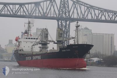
EKMEN TRANS
General Cargo

Current Trip
| Time Travelled | 2 days |
|---|---|
| Remaining Time | 1 day |
| Distance Travelled | 458.25 nm |
| Remaining Distance | 440.96 nm |
| AVG Speed | 9.9 Knots |
| MAX Speed | 10.6 Knots |
| AVG Wind | 7.7 knots |
| MAX Wind | 11.2 knots |
| MIN Temp | 26.8°C / 80.24°F |
| MAX Temp | 30°C / 86°F |
| Dybgang | 7 m |
| Position Modtaget | 2025-02-16 23:04 |
Current Position
| Longitude | --- |
|---|---|
| Latitude | --- |
| Status | Under way using engine |
| Fart | 11.2 Knots |
| Kurs | 203.4° |
| Område | North Atlantic Ocean |
| Station | T-AIS |
| Position Modtaget | 2025-02-16 23:04 |
Information
The current position of EKMEN TRANS is in North Atlantic Ocean with coordinates 27.75983° / -15.28469° as reported on 2025-02-16 23:04 by AIS to our vessel tracker app. The vessel's current speed is 11.2 Knots and is heading at the port of ABIDJAN. The estimated time of arrival as calculated by MyShipTracking vessel tracking app is 2025-03-31 13:16 LT
The vessel EKMEN TRANS (IMO: 9204348, MMSI: 314616000) is a General Cargo that was built in 1999 ( 26 år gamle ). It's sailing under the flag of [BB] Barbados.
In this page you can find informations about the vessels current position, last detected port calls, and current voyage information. If the vessels is not in coverage by AIS you will find the latest position.
The current position of EKMEN TRANS is detected by our AIS receivers and we are not responsible for the reliability of the data. The last position was recorded while the vessel was in Coverage by the Ais receivers of our vessel tracking app.
The current draught of EKMEN TRANS as reported by AIS is 7 meters
Weather
| Temperature | 28.5°C / 83.3°F |
|---|---|
| Wind Speed | 11 knots |
| Direction | 185° S |
| Pressure | 1009.1 hPa |
| Humidity | 78.7 % |
| Cloud Coverage | 92 % |


Featured Company
Last Port Calls
| Port | Arrival | Departure | Time In Port |
|---|---|---|---|
| 2025-03-26 15:46 | 2025-03-27 15:10 | 23 h | |
| 2025-03-05 20:35 | 2025-03-08 05:29 | 2 d | |
| 2025-02-26 16:23 | 2025-03-05 04:35 | 6 d | |
| 2025-02-16 07:11 | 2025-02-16 20:40 | 13 h | |
| 2025-02-09 22:24 | 2025-02-10 21:20 | 22 h | |
| 2025-01-31 12:09 | 2025-02-07 15:02 | 7 d | |
| 2025-01-21 22:59 | 2025-01-22 23:37 | 1 d | |
| 2025-01-16 09:52 | 2025-01-21 10:44 | 5 d |
Last Trips
| Origin | Departure | Destination | Arrival | Distance | |
|---|---|---|---|---|---|
| 2025-03-08 05:29 | 2025-03-26 15:46 | 1018.31 nm | |||
| 2025-03-05 04:35 | 2025-03-05 20:35 | 166.22 nm | |||
| 2025-02-16 20:40 | 2025-02-26 16:23 | 2049.05 nm | |||
| 2025-02-10 21:20 | 2025-02-16 07:11 | 1286.66 nm | |||
| 2025-02-07 15:02 | 2025-02-09 22:24 | 644.26 nm | |||
| 2025-01-22 23:37 | 2025-01-31 12:09 | 902.68 nm | |||
| 2025-01-21 10:44 | 2025-01-21 22:59 | 93.70 nm | |||
| 2024-12-22 21:03 | 2025-01-16 09:52 | 3100.75 nm |
Events
| Tid | Hændelsen | Detaljer | Position / Dest | Info |
|---|---|---|---|---|
| 2025-03-27 22:42 | START Sejllads | 4.66 nm, West of OWENDO |
.28696 / 9.42961
ABIDJAN
|
Fart: 4.6 kn Kurs: 335° |
| 2025-03-27 15:00 | STOP Sejllads | 4.44 nm, West of OWENDO |
.28487 / 9.43321
ABIDJAN
|
Fart: 0.1 kn Kurs: 330° |
| 2025-03-27 14:10 | Afsejlet fra sidste havn |
|
.27935 / 9.49977
ABIDJAN
|
Fart: 3.1 kn Kurs: 83° |
| 2025-03-27 13:59 | START Sejllads |
.28264 / 9.50280
[GA] OWENDO
|
Fart: 3.1 kn Kurs: 83° |
|
| 2025-03-26 14:46 | STOP Sejllads |
.28450 / 9.50830
[GA] OWENDO
|
Fart: Kurs: 74° |
|
| 2025-03-26 14:46 | Skibe i havn |
|
.28450 / 9.50830
[GA] OWENDO
|
Fart: 3.2 kn Kurs: 66° |
| 2025-03-26 12:38 | START Sejllads | 4.18 nm, South West of LIBREVILLE |
.33511 / 9.40437
ABIDJAN
|
Fart: 4.4 kn Kurs: 179° |
| 2025-03-20 00:58 | STOP Sejllads | 3.99 nm, South West of LIBREVILLE |
.33820 / 9.40518
ABIDJAN
|
Fart: 0.3 kn Kurs: 155° |