
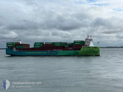
ECO MAESTRO
Cargo
Current Trip
| Time Travelled | 4 days |
|---|---|
| Remaining Time | 9 h, 20 mins |
| Distance Travelled | 994.07 nm |
| Remaining Distance | 118.29 nm |
| AVG Speed | 9.8 Knots |
| MAX Speed | 15 Knots |
| AVG Wind | 9.2 knots |
| MAX Wind | 21.8 knots |
| MIN Temp | 0.2°C / 32.36°F |
| MAX Temp | 8°C / 46.4°F |
| Draught | 8.1 m |
| Position Received | Now |
Current Position
| Longitude | --- |
|---|---|
| Latitude | --- |
| Status | Under way using engine |
| Speed | 13.2 Knots |
| Course | 250.5° |
| Area | North Sea |
| Station | T-AIS |
| Position Received | Now |
Information
The current position of ECO MAESTRO is in North Sea with coordinates 53.51534° / 4.83617° as reported on 2025-03-27 19:40 by AIS to our vessel tracker app. The vessel's current speed is 13.2 Knots and is heading at the port of ROTTERDAM. The estimated time of arrival as calculated by MyShipTracking vessel tracking app is 2025-03-28 05:01 LT
The vessel ECO MAESTRO (IMO: 9985942, MMSI: 256339000) is a Cargo It's sailing under the flag of [MT] Malta.
In this page you can find informations about the vessels current position, last detected port calls, and current voyage information. If the vessels is not in coverage by AIS you will find the latest position.
The current position of ECO MAESTRO is detected by our AIS receivers and we are not responsible for the reliability of the data. The last position was recorded while the vessel was in Coverage by the Ais receivers of our vessel tracking app.
The current draught of ECO MAESTRO as reported by AIS is 8.1 meters
Weather
| Temperature | 7.5°C / 45.5°F |
|---|---|
| Wind Speed | 14 knots |
| Direction | 211° SSW |
| Pressure | 1016.5 hPa |
| Humidity | 92.5 % |
| Cloud Coverage | 9 % |
Featured Company
Last Port Calls
| Port | Arrival | Departure | Time In Port |
|---|---|---|---|
| 2025-03-23 00:06 | 2025-03-23 17:08 | 17 h | |
| 2025-03-21 20:33 | 2025-03-22 16:33 | 20 h | |
| 2025-03-13 15:11 | 2025-03-17 08:27 | 3 d | |
| 2025-03-08 00:44 | 2025-03-08 13:41 | 12 h | |
| 2025-03-07 12:10 | 2025-03-07 20:10 | 7 h | |
| 2025-02-28 17:44 | 2025-03-01 01:47 | 8 h | |
| 2025-02-23 14:42 | 2025-02-28 06:17 | 4 d | |
| 2025-02-17 05:03 | 2025-02-18 12:15 | 1 d | |
| 2025-02-16 14:03 | 2025-02-17 00:20 | 10 h | |
| 2025-02-10 11:57 | 2025-02-10 21:34 | 9 h |
Most Visited Ports (Last year)
| Port | Arrivals | |
|---|---|---|
| 26 | ||
| 15 | ||
| 15 | ||
| 14 | ||
| 7 | ||
| 3 |
Last Trips
| Origin | Departure | Destination | Arrival | Distance | |
|---|---|---|---|---|---|
| 2025-03-22 18:33 | 2025-03-23 02:06 | 48.97 nm | |||
| 2025-03-17 09:27 | 2025-03-21 22:33 | 970.13 nm | |||
| 2025-03-08 15:41 | 2025-03-13 16:11 | 1420.36 nm | |||
| 2025-03-07 22:10 | 2025-03-08 02:44 | 46.56 nm | |||
| 2025-03-01 02:47 | 2025-03-07 14:10 | 1054.18 nm | |||
| 2025-02-28 07:17 | 2025-02-28 18:44 | 107.20 nm | |||
| 2025-02-18 14:15 | 2025-02-23 15:42 | 980.13 nm | |||
| 2025-02-17 02:20 | 2025-02-17 07:03 | 47.81 nm | |||
| 2025-02-10 22:34 | 2025-02-16 16:03 | 1095.23 nm | |||
| 2025-02-10 04:37 | 2025-02-10 12:57 | 98.59 nm |
Events
| Time | Event | Details | Position / Dest | Info |
|---|---|---|---|---|
| 2025-03-27 15:50 | Change Sea Area | Dutch part of the North Sea German part of the North Sea |
53.76751 / 6.07451
North Sea
NLRTM
|
Speed: 11.7 kn Course: 251.6° |
| 2025-03-27 15:50 | IN Coverage |
53.76751 / 6.07451
North Sea
NLRTM
|
Speed: 11.7 kn Course: 251.6° |
|
| 2025-03-27 14:02 | OUT of Coverage |
53.87310 / 6.70109
North Sea
NLRTM
|
Speed: 13.4 kn Course: 255.5° |
|
| 2025-03-27 12:28 | IN Coverage |
53.95853 / 7.25670
North Sea
NLRTM
|
Speed: 12.6 kn Course: 253.3° |
|
| 2025-03-27 10:19 | OUT of Coverage |
54.01311 / 8.03788
North Sea
NLRTM
|
Speed: 13.9 kn Course: 273.3° |
|
| 2025-03-27 06:42 | START Moving | 1.03 nm, South West of BRUNSBUETTEL |
53.89062 / 9.14001
NLRTM
|
Speed: 3.1 kn Course: 226° |
| 2025-03-27 05:35 | STOP Moving | 0.82 nm, South West of BRUNSBUETTEL |
53.89292 / 9.14426
NLRTM
|
Speed: 0.3 kn Course: 227° |
| 2025-03-27 05:32 | Change Sea Area | German part of the North Sea German part of the Baltic Sea |
53.89329 / 9.14495
North Sea
NLRTM
|
Speed: 1 kn Course: 223.7° |
| 2025-03-27 03:43 | START Moving | 1.13 nm, North of HOCHDONN |
54.03746 / 9.30265
NLRTM
|
Speed: 3.5 kn Course: 185° |
| 2025-03-27 03:19 | STOP Moving | 1.29 nm, North of HOCHDONN |
54.04007 / 9.30290
NLRTM
|
Speed: 0.3 kn Course: 195° |