

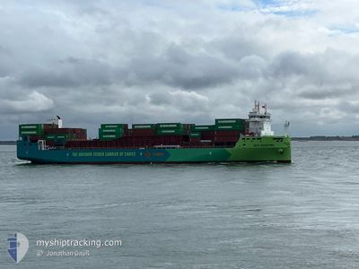
ECO MAESTRO
Cargo

Current Trip
| Time Travelled | 1 day |
|---|---|
| Remaining Time | --- |
| Distance Travelled | 264.08 nm |
| Remaining Distance | --- |
| AVG Speed | 11.6 Noeuds |
| MAX Speed | 17.6 Noeuds |
| AVG Wind | 10.8 knots |
| MAX Wind | 19.7 knots |
| MIN Temp | -0.5°C / 31.1°F |
| MAX Temp | 6.9°C / 44.42°F |
| Tirant d eau | 8.1 m |
| Position reçue | 24 m depuis |
Current Position
| Longitude | --- |
|---|---|
| Latitude | --- |
| Etat | At anchor |
| Vitesse | 0.3 Noeuds |
| Parcours | 132° |
| Zone | North Sea |
| Station | T-AIS |
| Position reçue | 24 m depuis |
Information
The current position of ECO MAESTRO is in North Sea with coordinates 52.12448° / 3.65157° as reported on 2025-02-04 14:15 by AIS to our vessel tracker app. The vessel's current speed is 0.3 Noeuds
The vessel ECO MAESTRO (IMO: 9985942, MMSI: 256339000) is a Cargo It's sailing under the flag of [MT] Malta.
In this page you can find informations about the vessels current position, last detected port calls, and current voyage information. If the vessels is not in coverage by AIS you will find the latest position.
The current position of ECO MAESTRO is detected by our AIS receivers and we are not responsible for the reliability of the data. The last position was recorded while the vessel was in Coverage by the Ais receivers of our vessel tracking app.
The current draught of ECO MAESTRO as reported by AIS is 8.1 meters
Weather
| Temperature | 6°C / 42.8°F |
|---|---|
| Wind Speed | 17 knots |
| Direction | 202° SSW |
| Pressure | 1024.3 hPa |
| Humidity | 77.3 % |
| Cloud Coverage | 4 % |


Featured Company
Last Port Calls
| Port | Arrival | Departure | Time In Port |
|---|---|---|---|
| 2025-02-02 18:33 | 2025-02-02 20:09 | 1 h | |
| 2025-01-29 21:57 | 2025-01-30 13:19 | 15 h | |
| 2025-01-29 01:52 | 2025-01-29 17:07 | 15 h | |
| 2025-01-23 19:33 | 2025-01-24 03:41 | 8 h | |
| 2025-01-21 16:40 | 2025-01-22 13:55 | 21 h | |
| 2025-01-21 06:45 | 2025-01-21 16:29 | 9 h | |
| 2025-01-16 22:53 | 2025-01-21 06:31 | 4 d | |
| 2025-01-14 15:35 | 2025-01-16 22:46 | 2 d | |
| 2024-12-31 18:25 | 2025-01-03 06:21 | 2 d | |
| 2024-12-31 00:43 | 2024-12-31 14:13 | 13 h |
Most Visited Ports (Last year)
| Port | Arrivals | |
|---|---|---|
| 22 | ||
| 12 | ||
| 12 | ||
| 12 | ||
| 7 | ||
| 3 |
Last Trips
| Origin | Departure | Destination | Arrival | Distance | |
|---|---|---|---|---|---|
| 2025-01-30 15:19 | 2025-02-02 19:33 | 684.05 nm | |||
| 2025-01-29 19:07 | 2025-01-29 23:57 | 46.52 nm | |||
| 2025-01-24 04:41 | 2025-01-29 03:52 | 1171.48 nm | |||
| 2025-01-22 14:55 | 2025-01-23 20:33 | 114.09 nm | |||
| 2025-01-21 17:29 | 2025-01-21 17:40 | 0.46 nm | |||
| 2025-01-21 07:31 | 2025-01-21 07:45 | 0.76 nm | |||
| 2025-01-16 23:46 | 2025-01-16 23:53 | 0.51 nm | |||
| 2025-01-03 08:21 | 2025-01-14 16:35 | 1111.36 nm | |||
| 2024-12-31 16:13 | 2024-12-31 20:25 | 45.79 nm | |||
| 2024-12-28 16:34 | 2024-12-31 02:43 | 624.73 nm |
Events
| Heure | Evenement | Détails | Position/ Destination | Info |
|---|---|---|---|---|
| 2025-02-04 10:51 | Dans la zone couverte |
52.12454 / 3.65109
North Sea
NLRTM
|
Vitesse: 0.2 kn Parcours: 63.7° |
|
| 2025-02-04 08:54 | Hors de la zone couverte |
52.12424 / 3.65210
North Sea
NLRTM
|
Vitesse: 0.2 kn Parcours: 268.3° |
|
| 2025-02-04 08:54 | Dans la zone couverte |
52.12424 / 3.65210
North Sea
NLRTM
|
Vitesse: 0.2 kn Parcours: 268.3° |
|
| 2025-02-04 07:51 | Hors de la zone couverte |
52.12414 / 3.65213
North Sea
NLRTM
|
Vitesse: 0.1 kn Parcours: 159.7° |
|
| 2025-02-04 07:51 | Dans la zone couverte |
52.12414 / 3.65213
North Sea
NLRTM
|
Vitesse: 0.1 kn Parcours: 159.7° |
|
| 2025-02-04 06:03 | Hors de la zone couverte |
52.12402 / 3.65231
North Sea
NLRTM
|
Vitesse: 0.2 kn Parcours: 135.2° |
|
| 2025-02-04 04:12 | Dans la zone couverte |
52.12418 / 3.65165
North Sea
NLRTM
|
Vitesse: 0.3 kn Parcours: 147° |
|
| 2025-02-04 02:39 | Hors de la zone couverte |
52.12419 / 3.65088
North Sea
NLRTM
|
Vitesse: 0.2 kn Parcours: 43.5° |
|
| 2025-02-04 00:27 | Etat Changé | At anchor Under way using engine |
52.12389 / 3.64906
NLRTM
|
Vitesse: 0.3 kn Parcours: 297° |
| 2025-02-04 00:03 | Arret | 18.28 nm, North West of MAASVLAKTE - ROTTERDAM |
52.12263 / 3.65036
NLRTM
|
Vitesse: 0.3 kn Parcours: 297° |