
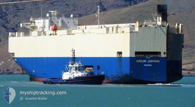
DREAM JASMINE
Vehicles Carrier
Current Trip
| Time Travelled | 5 days |
|---|---|
| Remaining Time | 11 h, 26 mins |
| Distance Travelled | 861.88 nm |
| Remaining Distance | 208.86 nm |
| AVG Speed | 12.7 Knots |
| MAX Speed | 18.5 Knots |
| AVG Wind | 14.1 knots |
| MAX Wind | 34.9 knots |
| MIN Temp | 13.6°C / 56.48°F |
| MAX Temp | 22.6°C / 72.68°F |
| Draught | 7.7 m |
| Position Received | 2 d ago |
Current Position
| Longitude | 130.85684° |
|---|---|
| Latitude | 34.02596° |
| Status | At anchor |
| Speed | |
| Course | 267° |
| Area | Japan Sea |
| Station | T-AIS |
| Position Received | 2 d ago |
Info
Information
The current position of DREAM JASMINE is in Japan Sea with coordinates 34.02596° / 130.85684° as reported on 2024-05-15 06:19 by AIS to our vessel tracker app. The vessel's current speed is 0 Knots and is heading at the port of MOJI. The estimated time of arrival as calculated by MyShipTracking vessel tracking app is 2024-05-18 17:47 LT
The vessel DREAM JASMINE (IMO: 9334246, MMSI: 370552000) is a Vehicles Carrier that was built in 2008 ( 16 years old ). It's sailing under the flag of [PA] Panama.
In this page you can find informations about the vessels current position, last detected port calls, and current voyage information. If the vessels is not in coverage by AIS you will find the latest position.
The current position of DREAM JASMINE is detected by our AIS receivers and we are not responsible for the reliability of the data. The last position was recorded while the vessel was in Coverage by the Ais receivers of our vessel tracking app.
The current draught of DREAM JASMINE as reported by AIS is 7.7 meters
Weather
| Temperature | 20.4°C / 68.72°F |
|---|---|
| Wind Speed | 8 knots |
| Direction | 36° NE |
| Pressure | 1019.3 hPa |
| Humidity | 69.9 % |
| Cloud Coverage | 98 % |
Featured Company
Last Port Calls
| Port | Arrival | Departure | Time In Port |
|---|---|---|---|
| 2024-05-12 02:51 | 2024-05-12 13:51 | 11 h | |
| 2024-05-06 12:24 | 2024-05-11 10:29 | 4 d | |
| 2024-04-15 19:24 | 2024-04-16 07:45 | 12 h | |
| 2024-04-12 12:40 | 2024-04-13 21:01 | 1 d | |
| 2024-03-30 08:44 | 2024-03-30 17:11 | 8 h | |
| 2024-03-27 11:07 | 2024-03-29 16:38 | 2 d | |
| 2024-03-25 10:37 | 2024-03-26 17:37 | 1 d | |
| 2024-03-03 23:21 | 2024-03-05 03:15 | 1 d |
Last Trips
| Origin | Departure | Destination | Arrival | Distance | |
|---|---|---|---|---|---|
| 2024-05-11 10:29 | 2024-05-12 02:51 | 152.83 nm | |||
| 2024-04-16 07:45 | 2024-05-06 12:24 | 6236.40 nm | |||
| 2024-04-13 21:01 | 2024-04-15 19:24 | 622.46 nm | |||
| 2024-03-30 17:11 | 2024-04-12 12:40 | 4882.43 nm | |||
| 2024-03-29 16:38 | 2024-03-30 08:44 | 210.83 nm | |||
| 2024-03-26 17:37 | 2024-03-27 11:07 | 251.02 nm | |||
| 2024-03-05 03:15 | 2024-03-25 10:37 | 4717.33 nm | |||
| 2024-02-29 16:28 | 2024-03-03 23:21 | 646.52 nm |
Events
| Time | Event | Details | Position / Dest | Info |
|---|---|---|---|---|
| 2024-05-17 07:00 | START Moving | 1.24 nm, West of MOJI |
33.96378 / 130.98540
JP MOJ
|
Speed: 3.1 kn Course: 54° |
| 2024-05-16 07:52 | STOP Moving | 1.51 nm, West of MOJI |
33.96012 / 130.98062
JP MOJ
|
Speed: Course: 83° |
| 2024-05-15 10:05 | START Moving | 5.32 nm, North East of KITAKYUSHU |
34.03031 / 130.85172
JP MOJ
|
Speed: 6.9 kn Course: 311° |
| 2024-05-15 06:25 | Status Changed | Default At anchor |
34.02594 / 130.85686
JP MOJ
|
Speed: Course: 267° |
| 2024-05-15 06:19 | Status Changed | At anchor Default |
34.02596 / 130.85684
JP MOJ
|
Speed: Course: 263° |
| 2024-05-15 06:19 | OUT of Coverage |
34.02596 / 130.85684
Japan Sea
JP MOJ
|
Speed: Course: 151.8° |
|
| 2024-05-15 06:07 | Status Changed | Default At anchor |
34.02602 / 130.85683
JP MOJ
|
Speed: 0.1 kn Course: 241° |
| 2024-05-15 05:58 | Status Changed | At anchor Default |
34.02620 / 130.85670
JP MOJ
|
Speed: Course: 231° |
| 2024-05-15 05:40 | IN Coverage |
34.02620 / 130.85670
Japan Sea
JP MOJ
|
Speed: Course: 151.8° |
|
| 2024-05-15 04:28 | OUT of Coverage |
34.02647 / 130.85633
Japan Sea
JP MOJ
|
Speed: Course: 151.8° |