
DONG-A METIS
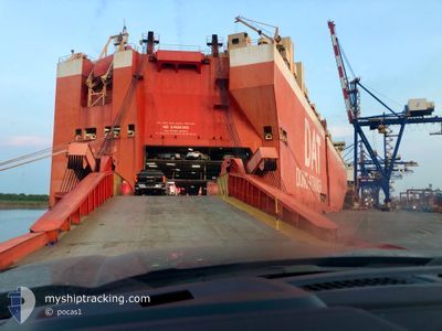
Vehicles Carrier
Current Trip
| Time Travelled | 11 h, 55 mins |
|---|---|
| Remaining Time | --- |
| Distance Travelled | 157.50 nm |
| Remaining Distance | --- |
| AVG Speed | 13.5 Knots |
| MAX Speed | 18.1 Knots |
| AVG Wind | 18.5 knots |
| MAX Wind | 26.7 knots |
| MIN Temp | 7.8°C / 46.04°F |
| MAX Temp | 10.4°C / 50.72°F |
| Draught | 9.1 m |
| Position Received | 1 m ago |
Current Position
| Longitude | --- |
|---|---|
| Latitude | --- |
| Status | Under way using engine |
| Speed | 12.4 Knots |
| Course | 213.1° |
| Area | North Pacific Ocean |
| Station | T-AIS |
| Position Received | 1 m ago |
Info
Information
The current position of DONG-A METIS is in North Pacific Ocean with coordinates 48.40530° / -125.13901° as reported on 2025-12-06 22:12 by AIS to our vessel tracker app. The vessel's current speed is 12.4 Knots and is heading at the port of PYEONGTAEK. The estimated time of arrival as calculated by MyShipTracking vessel tracking app is 2025-12-25 18:30 LT
The vessel DONG-A METIS (IMO: 9419747, MMSI: 372997000) is a Vehicles Carrier that was built in 2010 ( 15 years old ). It's sailing under the flag of [PA] Panama.
In this page you can find informations about the vessels current position, last detected port calls, and current voyage information. If the vessels is not in coverage by AIS you will find the latest position.
The current position of DONG-A METIS is detected by our AIS receivers and we are not responsible for the reliability of the data. The last position was recorded while the vessel was in Coverage by the Ais receivers of our vessel tracking app.
The current draught of DONG-A METIS as reported by AIS is 9.1 meters
Weather
| Temperature | 10.2°C / 50.36°F |
|---|---|
| Wind Speed | 17 knots |
| Direction | 269° W |
| Pressure | 1015.1 hPa |
| Humidity | 83.2 % |
| Cloud Coverage | 69 % |
Featured Company
Last Port Calls
| Port | Arrival | Departure | Time In Port |
|---|---|---|---|
| 2025-12-03 12:13 | 2025-12-06 02:19 | 2 d | |
| 2025-11-20 08:49 | 2025-11-20 16:55 | 8 h | |
| 2025-10-30 19:29 | 2025-10-31 20:18 | 1 d | |
| 2025-10-26 02:38 | 2025-10-28 22:05 | 2 d | |
| 2025-10-24 07:25 | 2025-10-25 21:58 | 1 d | |
| 2025-10-22 22:08 | 2025-10-23 13:46 | 15 h | |
| 2025-10-22 20:43 | 2025-10-22 21:57 | 1 h | |
| 2025-10-20 05:58 | 2025-10-20 17:10 | 11 h | |
| 2025-10-15 11:06 | 2025-10-16 11:16 | 1 d | |
| 2025-10-11 04:47 | 2025-10-11 14:57 | 10 h |
Last Trips
| Origin | Departure | Destination | Arrival | Distance | |
|---|---|---|---|---|---|
| 2025-11-20 16:55 | 2025-12-03 12:13 | 4224.78 nm | |||
| 2025-10-31 20:18 | 2025-11-20 08:49 | 6286.67 nm | |||
| 2025-10-28 22:05 | 2025-10-30 19:29 | 350.01 nm | |||
| 2025-10-25 21:58 | 2025-10-26 02:38 | 53.20 nm | |||
| 2025-10-23 13:46 | 2025-10-24 07:25 | 162.17 nm | |||
| 2025-10-22 21:57 | 2025-10-22 22:08 | 0.35 nm | |||
| 2025-10-20 17:10 | 2025-10-22 20:43 | 134.93 nm | |||
| 2025-10-16 11:16 | 2025-10-20 05:58 | 1294.09 nm | |||
| 2025-10-11 14:57 | 2025-10-15 11:06 | 862.17 nm | |||
| 2025-10-07 01:30 | 2025-10-11 04:47 | 1445.28 nm |
Events
| Time | Event | Details | Position / Dest | Info |
|---|---|---|---|---|
| 2025-12-06 21:53 | Change Sea Area | United States part of the North Pacific Ocean Canadian part of the North Pacific Ocean |
48.46614 / -125.09262
North Pacific Ocean
KRPTK
|
Speed: 12.5 kn Course: 202.2° |
| 2025-12-06 21:40 | ETA Changed | 2025/12/25 09:30 2025/12/24 17:00 |
48.49890 / -125.05737
KRPTK
|
Speed: 11 kn Course: 269.3° |
| 2025-12-06 21:28 | Status Changed | Under way using engine Default |
48.49905 / -125.00888
KRPTK
|
Speed: 10.4 kn Course: 242° |
| 2025-12-06 21:27 | Status Changed | Default Under way using engine |
48.50141 / -125.00359
KRPTK
|
Speed: 9.9 kn Course: 259.5° |
| 2025-12-06 21:17 | Status Changed | Under way using engine Default |
48.50735 / -124.96307
KRPTK
|
Speed: 10.6 kn Course: 263° |
| 2025-12-06 21:11 | Status Changed | Default Under way using engine |
48.50905 / -124.93974
KRPTK
|
Speed: 9.6 kn Course: 266.6° |
| 2025-12-06 21:04 | Status Changed | Under way using engine Default |
48.51020 / -124.90853
KRPTK
|
Speed: 9.4 kn Course: 263° |
| 2025-12-06 21:03 | Status Changed | Default Under way using engine |
48.51033 / -124.90582
KRPTK
|
Speed: 10.3 kn Course: 265.8° |
| 2025-12-06 20:54 | Status Changed | Under way using engine Default |
48.51175 / -124.86898
KRPTK
|
Speed: 10.7 kn Course: 268° |
| 2025-12-06 20:51 | Status Changed | Default Under way using engine |
48.51186 / -124.85319
KRPTK
|
Speed: 11.3 kn Course: 267.2° |