
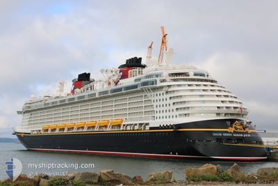
DISNEY FANTASY
Passengers Ship
Current Trip
| Time Travelled | 1 day |
|---|---|
| Remaining Time | --- |
| Distance Travelled | 790.78 nm |
| Remaining Distance | --- |
| AVG Speed | 17.9 Knots |
| MAX Speed | 21 Knots |
| AVG Wind | 8.3 knots |
| MAX Wind | 14 knots |
| MIN Temp | 24.7°C / 76.46°F |
| MAX Temp | 27.4°C / 81.32°F |
| Draught | 8.6 m |
| Position Received | 13 h, 45 m ago |
Current Position
| Longitude | -72.14682° |
|---|---|
| Latitude | 22.97885° |
| Status | Under way using engine |
| Speed | 18.6 Knots |
| Course | 130.3° |
| Area | North Atlantic Ocean |
| Station | T-AIS |
| Position Received | 13 h, 45 m ago |
Info
Information
The current position of DISNEY FANTASY is in North Atlantic Ocean with coordinates 22.97885° / -72.14682° as reported on 2024-05-13 04:28 by AIS to our vessel tracker app. The vessel's current speed is 18.6 Knots and is heading at the port of ROAD TOWN. The estimated time of arrival as calculated by MyShipTracking vessel tracking app is 2024-05-14 10:30 LT
The vessel DISNEY FANTASY (IMO: 9445590, MMSI: 311058700) is a Passengers Ship that was built in 2012 ( 12 years old ). It's sailing under the flag of [BS] Bahamas.
In this page you can find informations about the vessels current position, last detected port calls, and current voyage information. If the vessels is not in coverage by AIS you will find the latest position.
The current position of DISNEY FANTASY is detected by our AIS receivers and we are not responsible for the reliability of the data. The last position was recorded while the vessel was in Coverage by the Ais receivers of our vessel tracking app.
The current draught of DISNEY FANTASY as reported by AIS is 8.6 meters
Weather
| Temperature | 27.5°C / 81.5°F |
|---|---|
| Wind Speed | 6 knots |
| Direction | 106° ESE |
| Pressure | 1016.3 hPa |
| Humidity | 78 % |
| Cloud Coverage | 98 % |
Featured Company
Last Port Calls
| Port | Arrival | Departure | Time In Port |
|---|---|---|---|
| 2024-05-11 09:08 | 2024-05-11 20:57 | 11 h | |
| 2024-05-08 11:58 | 2024-05-08 21:59 | 10 h | |
| 2024-05-06 12:33 | 2024-05-06 22:00 | 9 h | |
| 2024-05-04 09:05 | 2024-05-04 20:52 | 11 h | |
| 2024-05-01 10:52 | 2024-05-01 20:06 | 9 h | |
| 2024-04-30 11:14 | 2024-04-30 22:15 | 11 h | |
| 2024-04-27 09:11 | 2024-04-27 21:03 | 11 h | |
| 2024-04-24 11:13 | 2024-04-24 22:35 | 11 h | |
| 2024-04-22 12:37 | 2024-04-22 21:56 | 9 h | |
| 2024-04-20 09:17 | 2024-04-20 21:17 | 12 h |
Last Trips
| Origin | Departure | Destination | Arrival | Distance | |
|---|---|---|---|---|---|
| 2024-05-08 16:59 | 2024-05-11 05:08 | 901.50 nm | |||
| 2024-05-06 17:00 | 2024-05-08 06:58 | 555.99 nm | |||
| 2024-05-04 16:52 | 2024-05-06 07:33 | 695.21 nm | |||
| 2024-05-01 16:06 | 2024-05-04 05:05 | 1074.93 nm | |||
| 2024-04-30 18:15 | 2024-05-01 06:52 | 125.53 nm | |||
| 2024-04-27 17:03 | 2024-04-30 07:14 | 1083.97 nm | |||
| 2024-04-24 17:35 | 2024-04-27 05:11 | 900.43 nm | |||
| 2024-04-22 16:56 | 2024-04-24 06:13 | 553.87 nm | |||
| 2024-04-20 17:17 | 2024-04-22 07:37 | 696.28 nm | |||
| 2024-04-17 16:27 | 2024-04-20 05:17 | 1074.12 nm |
Events
| Time | Event | Details | Position / Dest | Info |
|---|---|---|---|---|
| 2024-05-13 04:39 | Status Changed | Default Under way using engine |
22.94208 / -72.10022
VG RAD
|
Speed: 18.6 kn Course: 130.3° |
| 2024-05-13 04:28 | Detected in Sea | Bahamas part of the North Atlantic Ocean |
22.97885 / -72.14682
North Atlantic Ocean
VG RAD
|
Speed: 18.6 kn Course: 130.3° |
| 2024-05-13 04:28 | OUT of Coverage |
22.97885 / -72.14682
North Atlantic Ocean
VG RAD
|
Speed: 18.6 kn Course: 130.3° |
|
| 2024-05-13 04:27 | Status Changed | Under way using engine Default |
22.98253 / -72.15153
VG RAD
|
Speed: 18.5 kn Course: 130° |
| 2024-05-13 04:27 | IN Coverage |
22.97885 / -72.14682
North Atlantic Ocean
VG RAD
|
Speed: 18.6 kn Course: 130.3° |
|
| 2024-05-12 00:50 | Status Changed | Default Under way using engine |
27.95692 / -79.57832
VG RAD
|
Speed: 16.7 kn Course: 117° |
| 2024-05-12 00:36 | OUT of Coverage |
27.98623 / -79.64613
North Atlantic Ocean
VG RAD
|
Speed: 16.7 kn Course: 117° |
|
| 2024-05-11 23:27 | Status Changed | Under way using engine Default |
28.12422 / -79.96556
VG RAD
|
Speed: 16.3 kn Course: 117° |
| 2024-05-11 23:27 | IN Coverage |
28.12138 / -79.95866
North Atlantic Ocean
VG RAD
|
Speed: 16.3 kn Course: 115.1° |
|
| 2024-05-11 22:26 | OUT of Coverage |
28.24757 / -80.24950
North Atlantic Ocean
VG RAD
|
Speed: 16.1 kn Course: 116.2° |