
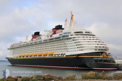
DISNEY FANTASY
Passengers Ship
Current Trip
BS GOC
| Time Travelled | 2 days |
|---|---|
| Remaining Time | --- |
| Distance Travelled | 803.84 nm |
| Remaining Distance | --- |
| AVG Speed | 20.2 Knots |
| MAX Speed | 21.5 Knots |
| AVG Wind | 9.9 knots |
| MAX Wind | 15.9 knots |
| MIN Temp | 26°C / 78.8°F |
| MAX Temp | 29.1°C / 84.38°F |
| Dybgang | 8.6 m |
| Position Modtaget | 1 d siden |
Current Position
| Longitude | -65.89785° |
|---|---|
| Latitude | 18.85698° |
| Status | Under way using engine |
| Fart | 20.9 Knots |
| Kurs | 304.3° |
| Område | North Atlantic Ocean |
| Station | T-AIS |
| Position Modtaget | 1 d siden |
Info
Information
The current position of DISNEY FANTASY is in North Atlantic Ocean with coordinates 18.85698° / -65.89785° as reported on 2024-06-05 22:54 by AIS to our vessel tracker app. The vessel's current speed is 20.9 Knots
The vessel DISNEY FANTASY (IMO: 9445590, MMSI: 311058700) is a Passengers Ship that was built in 2012 ( 12 år gamle ). It's sailing under the flag of [BS] Bahamas.
In this page you can find informations about the vessels current position, last detected port calls, and current voyage information. If the vessels is not in coverage by AIS you will find the latest position.
The current position of DISNEY FANTASY is detected by our AIS receivers and we are not responsible for the reliability of the data. The last position was recorded while the vessel was in Coverage by the Ais receivers of our vessel tracking app.
The current draught of DISNEY FANTASY as reported by AIS is 8.6 meters
Weather
| Temperature | 28.8°C / 83.84°F |
|---|---|
| Wind Speed | 5 knots |
| Direction | 273° W |
| Pressure | 1012.1 hPa |
| Humidity | 70.3 % |
| Cloud Coverage | --- |
Featured Company
Last Port Calls
| Port | Arrival | Departure | Time In Port |
|---|---|---|---|
| 2024-06-05 06:51 | 2024-06-05 15:35 | 8 h | |
| 2024-06-04 07:16 | 2024-06-04 18:06 | 10 h | |
| 2024-06-01 05:13 | 2024-06-01 17:51 | 12 h | |
| 2024-05-29 06:57 | 2024-05-29 16:05 | 9 h | |
| 2024-05-28 07:02 | 2024-05-28 18:11 | 11 h | |
| 2024-05-25 05:14 | 2024-05-25 17:18 | 12 h | |
| 2024-05-22 06:23 | 2024-05-22 17:09 | 10 h | |
| 2024-05-20 07:32 | 2024-05-20 17:00 | 9 h | |
| 2024-05-18 05:06 | 2024-05-18 17:19 | 12 h | |
| 2024-05-15 06:54 | 2024-05-15 16:11 | 9 h |
Last Trips
| Origin | Departure | Destination | Arrival | Distance | |
|---|---|---|---|---|---|
| 2024-06-04 18:06 | 2024-06-05 06:51 | 145.92 nm | |||
| 2024-06-01 17:51 | 2024-06-04 07:16 | 1083.23 nm | |||
| 2024-05-29 16:05 | 2024-06-01 05:13 | 1077.59 nm | |||
| 2024-05-28 18:11 | 2024-05-29 06:57 | 133.82 nm | |||
| 2024-05-25 17:18 | 2024-05-28 07:02 | 1083.94 nm | |||
| 2024-05-22 17:09 | 2024-05-25 05:14 | 900.55 nm | |||
| 2024-05-20 17:00 | 2024-05-22 06:23 | 560.41 nm | |||
| 2024-05-18 17:19 | 2024-05-20 07:32 | 694.55 nm | |||
| 2024-05-15 16:11 | 2024-05-18 05:06 | 1076.02 nm | |||
| 2024-05-14 18:07 | 2024-05-15 06:54 | 133.11 nm |
Events
| Tid | Hændelsen | Detaljer | Position / Dest | Info |
|---|---|---|---|---|
| 2024-06-07 13:49 | STOP Sejllads |
26.07853 / -77.53838
BS GOC
|
Fart: 0.1 kn Kurs: 211° |
|
| 2024-06-05 23:28 | Status er ændret | Default Under way using engine |
18.96917 / -66.07014
BS GOC
|
Fart: 20.9 kn Kurs: 304.3° |
| 2024-06-05 22:54 | Udenfor Dækning |
18.85698 / -65.89785
North Atlantic Ocean
BS GOC
|
Fart: 20.9 kn Kurs: 304.3° |
|
| 2024-06-05 22:02 | Ændre havområde | Puerto Rican part of the North Atlantic Ocean Puerto Rican part of the Caribbean Sea |
18.68532 / -65.63458
North Atlantic Ocean
BS GOC
|
Fart: 20.7 kn Kurs: 304.2° |
| 2024-06-05 19:46 | Destination er ændret | BS GOC VISTT |
18.29657 / -64.94838
BS GOC
|
Fart: 16.5 kn Kurs: 246.6° |
| 2024-06-05 19:46 | ETA er ændret | 2024/06/07 13:15 2024/06/05 10:45 |
18.29657 / -64.94838
BS GOC
|
Fart: 16.5 kn Kurs: 246.6° |
| 2024-06-05 19:35 | Afsejlet fra sidste havn |
|
18.31978 / -64.92627
VISTT
|
Fart: 7.8 kn Kurs: 168° |
| 2024-06-05 19:31 | START Sejllads |
18.32838 / -64.92813
[VI] ST THOMAS
|
Fart: 3.2 kn Kurs: 176° |
|
| 2024-06-05 19:22 | Status er ændret | Under way using engine Moored |
18.33105 / -64.92595
[VI] ST THOMAS
|
Fart: Kurs: 238° |
| 2024-06-05 16:11 | Status er ændret | Moored Default |
18.33097 / -64.92578
[VI] ST THOMAS
|
Fart: Kurs: 238° |