
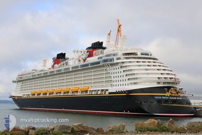
DISNEY FANTASY
Passengers Ship
Current Trip
KYGEC
| Time Travelled | 23 h, 24 mins |
|---|---|
| Remaining Time | --- |
| Distance Travelled | 421.62 nm |
| Remaining Distance | --- |
| AVG Speed | 18.7 Noeuds |
| MAX Speed | 20.4 Noeuds |
| AVG Wind | 12.6 knots |
| MAX Wind | 23 knots |
| MIN Temp | 25°C / 77°F |
| MAX Temp | 27.3°C / 81.14°F |
| Tirant d eau | 8.6 m |
| Position reçue | 1 d depuis |
Current Position
| Longitude | -81.11869° |
|---|---|
| Latitude | 19.17096° |
| Etat | Under way using engine |
| Vitesse | 18 Noeuds |
| Parcours | 99.9° |
| Zone | Caribbean Sea |
| Station | T-AIS |
| Position reçue | 1 d depuis |
Info
Information
The current position of DISNEY FANTASY is in Caribbean Sea with coordinates 19.17096° / -81.11869° as reported on 2024-05-21 23:56 by AIS to our vessel tracker app. The vessel's current speed is 18 Noeuds
The vessel DISNEY FANTASY (IMO: 9445590, MMSI: 311058700) is a Passengers Ship that was built in 2012 ( 12 Age ). It's sailing under the flag of [BS] Bahamas.
In this page you can find informations about the vessels current position, last detected port calls, and current voyage information. If the vessels is not in coverage by AIS you will find the latest position.
The current position of DISNEY FANTASY is detected by our AIS receivers and we are not responsible for the reliability of the data. The last position was recorded while the vessel was in Coverage by the Ais receivers of our vessel tracking app.
The current draught of DISNEY FANTASY as reported by AIS is 8.6 meters
Weather
| Temperature | 25.7°C / 78.26°F |
|---|---|
| Wind Speed | 13 knots |
| Direction | 57° ENE |
| Pressure | 1013.5 hPa |
| Humidity | 80.3 % |
| Cloud Coverage | 100 % |
Featured Company
Last Port Calls
| Port | Arrival | Departure | Time In Port |
|---|---|---|---|
| 2024-05-22 11:23 | 2024-05-22 22:09 | 10 h | |
| 2024-05-20 12:32 | 2024-05-20 22:00 | 9 h | |
| 2024-05-18 09:06 | 2024-05-18 21:19 | 12 h | |
| 2024-05-15 10:54 | 2024-05-15 20:11 | 9 h | |
| 2024-05-14 11:15 | 2024-05-14 22:07 | 10 h | |
| 2024-05-11 09:08 | 2024-05-11 20:57 | 11 h | |
| 2024-05-08 11:58 | 2024-05-08 21:59 | 10 h | |
| 2024-05-06 12:33 | 2024-05-06 22:00 | 9 h | |
| 2024-05-04 09:05 | 2024-05-04 20:52 | 11 h | |
| 2024-05-01 10:52 | 2024-05-01 20:06 | 9 h |
Last Trips
| Origin | Departure | Destination | Arrival | Distance | |
|---|---|---|---|---|---|
| 2024-05-20 17:00 | 2024-05-22 06:23 | 560.41 nm | |||
| 2024-05-18 17:19 | 2024-05-20 07:32 | 694.55 nm | |||
| 2024-05-15 16:11 | 2024-05-18 05:06 | 1076.02 nm | |||
| 2024-05-14 18:07 | 2024-05-15 06:54 | 133.11 nm | |||
| 2024-05-11 16:57 | 2024-05-14 07:15 | 1083.99 nm | |||
| 2024-05-08 16:59 | 2024-05-11 05:08 | 901.50 nm | |||
| 2024-05-06 17:00 | 2024-05-08 06:58 | 555.99 nm | |||
| 2024-05-04 16:52 | 2024-05-06 07:33 | 695.21 nm | |||
| 2024-05-01 16:06 | 2024-05-04 05:05 | 1074.93 nm | |||
| 2024-04-30 18:15 | 2024-05-01 06:52 | 125.53 nm |
Events
| Heure | Evenement | Détails | Position/ Destination | Info |
|---|---|---|---|---|
| 2024-05-22 22:09 | PORT DE DEPART |
|
18.53332 / -77.59455
KYGEC
|
Vitesse: Parcours: 59° |
| 2024-05-22 11:23 | Port d'arrivée |
|
18.49495 / -77.64803
[JM] FALMOUTH
|
Vitesse: 17.8 kn Parcours: 100° |
| 2024-05-21 23:56 | Hors de la zone couverte |
19.17096 / -81.11869
Caribbean Sea
|
Vitesse: 18 kn Parcours: 99.9° |
|
| 2024-05-21 22:44 | Démarrage |
19.29752 / -81.39268
KYGEC
|
Vitesse: 5 kn Parcours: 214.8° |
|
| 2024-05-21 22:25 | Etat Changé | Under way using engine At anchor |
19.30258 / -81.38872
KYGEC
|
Vitesse: 0.3 kn Parcours: 111° |
| 2024-05-21 21:40 | Etat Changé | At anchor Default |
19.30308 / -81.38913
KYGEC
|
Vitesse: 0.2 kn Parcours: 119° |
| 2024-05-21 21:37 | Etat Changé | Default At anchor |
19.30307 / -81.38900
KYGEC
|
Vitesse: 0.1 kn Parcours: 116° |
| 2024-05-21 20:12 | Etat Changé | At anchor Default |
19.30320 / -81.38880
KYGEC
|
Vitesse: 0.3 kn Parcours: 113° |
| 2024-05-21 20:00 | Etat Changé | Default At anchor |
19.30300 / -81.38915
KYGEC
|
Vitesse: 0.1 kn Parcours: 125° |
| 2024-05-21 19:04 | Etat Changé | At anchor Default |
19.30313 / -81.38896
KYGEC
|
Vitesse: 0.1 kn Parcours: 128° |