

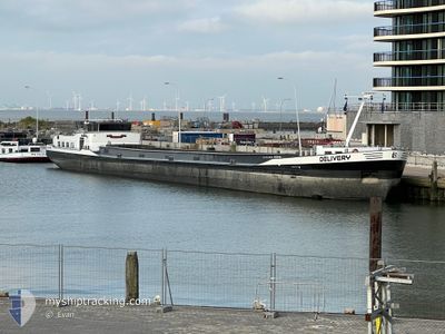
DELIVERY
Cargo

Current Trip
| Time Travelled | 22 h, 1 mins |
|---|---|
| Remaining Time | 2 h, 32 mins |
| Distance Travelled | 40.16 nm |
| Remaining Distance | 28.86 nm |
| AVG Speed | 10 Knots |
| MAX Speed | 11.7 Knots |
| AVG Wind | 8.6 knots |
| MAX Wind | 9.9 knots |
| MIN Temp | -0.3°C / 31.46°F |
| MAX Temp | 4.5°C / 40.1°F |
| Draught | 1 m |
| Position Received | Now |
Current Position
| Longitude | --- |
|---|---|
| Latitude | --- |
| Status | Under way using engine |
| Speed | 9.2 Knots |
| Course | 322.1° |
| Area | North Sea |
| Station | T-AIS |
| Position Received | Now |
Information
The current position of DELIVERY is in North Sea with coordinates 51.28914° / 4.31954° as reported on 2025-02-18 13:18 by AIS to our vessel tracker app. The vessel's current speed is 9.2 Knots and is heading at the port of TERNEUZEN. The estimated time of arrival as calculated by MyShipTracking vessel tracking app is 2025-02-18 15:51 LT
The vessel DELIVERY (MMSI: 244051287) is a Cargo It's sailing under the flag of [NL] Netherlands.
In this page you can find informations about the vessels current position, last detected port calls, and current voyage information. If the vessels is not in coverage by AIS you will find the latest position.
The current position of DELIVERY is detected by our AIS receivers and we are not responsible for the reliability of the data. The last position was recorded while the vessel was in Coverage by the Ais receivers of our vessel tracking app.
The current draught of DELIVERY as reported by AIS is 1 meters
Weather
| Temperature | 4.5°C / 40.1°F |
|---|---|
| Wind Speed | 10 knots |
| Direction | 98° E |
| Pressure | 1023.7 hPa |
| Humidity | 34 % |
| Cloud Coverage | 7 % |


Featured Company
Last Port Calls
| Port | Arrival | Departure | Time In Port |
|---|---|---|---|
| 2025-02-17 13:17 | 2025-02-17 15:18 | 2 h | |
| 2025-02-14 18:10 | 2025-02-17 04:49 | 2 d | |
| 2025-02-14 13:53 | 2025-02-14 17:09 | 3 h | |
| 2025-02-13 00:53 | 2025-02-13 01:05 | 12 m | |
| 2025-02-12 21:55 | 2025-02-13 00:43 | 2 h | |
| 2025-02-11 09:39 | 2025-02-11 11:41 | 2 h | |
| 2025-02-10 10:58 | 2025-02-10 13:35 | 2 h | |
| 2025-02-07 18:06 | 2025-02-09 17:32 | 1 d | |
| 2025-02-07 13:04 | 2025-02-07 14:07 | 1 h | |
| 2025-02-07 10:35 | 2025-02-07 12:10 | 1 h |
Last Trips
| Origin | Departure | Destination | Arrival | Distance | |
|---|---|---|---|---|---|
| 2025-02-17 05:49 | 2025-02-17 14:17 | 36.00 nm | |||
| 2025-02-14 18:09 | 2025-02-14 19:10 | 11.46 nm | |||
| 2025-02-13 02:05 | 2025-02-14 14:53 | 33.77 nm | |||
| 2025-02-13 01:43 | 2025-02-13 01:53 | 0.82 nm | |||
| 2025-02-11 12:41 | 2025-02-12 22:55 | 96.45 nm | |||
| 2025-02-10 14:35 | 2025-02-11 10:39 | 48.52 nm | |||
| 2025-02-09 18:32 | 2025-02-10 11:58 | 13.14 nm | |||
| 2025-02-07 15:07 | 2025-02-07 19:06 | 27.35 nm | |||
| 2025-02-07 13:10 | 2025-02-07 14:04 | 7.24 nm | |||
| 2025-02-07 10:35 | 2025-02-07 11:35 | 8.48 nm |
Events
| Time | Event | Details | Position / Dest | Info |
|---|---|---|---|---|
| 2025-02-18 11:41 | Destination Changed | EVERINGEN NETEKANAAL |
51.09464 / 4.34157
EVERINGEN
|
Speed: 10.9 kn Course: 295° |
| 2025-02-18 11:41 | ETA Changed | 2025/02/18 17:21 2025/02/17 23:39 |
51.09464 / 4.34157
EVERINGEN
|
Speed: 10.9 kn Course: 295° |
| 2025-02-18 11:23 | Destination Changed | NETEKANAAL RUPEL |
51.07889 / 4.40815
NETEKANAAL
|
Speed: 9.2 kn Course: 239.4° |
| 2025-02-18 11:23 | ETA Changed | 2025/02/17 23:39 2025/02/17 11:40 |
51.07889 / 4.40815
NETEKANAAL
|
Speed: 9.2 kn Course: 239.4° |
| 2025-02-18 11:13 | Status Changed | Under way using engine Default |
51.07814 / 4.43998
RUPEL
|
Speed: 7.5 kn Course: 220° |
| 2025-02-18 11:13 | IN Coverage |
51.07814 / 4.43998
North Sea
|
Speed: 8.1 kn Course: 294.9° |
|
| 2025-02-17 16:49 | Status Changed | Default Under way using engine |
51.07442 / 4.47635
RUPEL
|
Speed: 6.3 kn Course: 101.7° |
| 2025-02-17 16:32 | OUT of Coverage |
51.07854 / 4.43836
North Sea
|
Speed: 6.3 kn Course: 101.7° |
|
| 2025-02-17 15:18 | PORT DEPARTURE |
|
51.16070 / 4.32864
RUPEL
|
Speed: 9.6 kn Course: 175.6° |
| 2025-02-17 13:17 | PORT ARRIVAL |
|
51.36509 / 4.21961
[BE] ANTWERP
|
Speed: 9.6 kn Course: 159.3° |