

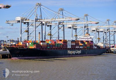
DELAWARE EXPRESS
Container Ship

Current Trip
| Time Travelled | 10 days |
|---|---|
| Remaining Time | 22 h, 25 mins |
| Distance Travelled | 4258.66 nm |
| Remaining Distance | 413.30 nm |
| AVG Speed | 17.4 Knots |
| MAX Speed | 20.4 Knots |
| AVG Wind | 16.9 knots |
| MAX Wind | 29.8 knots |
| MIN Temp | 4.8°C / 40.64°F |
| MAX Temp | 20.9°C / 69.62°F |
| Draught | 11.6 m |
| Position Received | Now |
Current Position
| Longitude | --- |
|---|---|
| Latitude | --- |
| Status | Under way using engine |
| Speed | 18 Knots |
| Course | 74.3° |
| Area | English Channel |
| Station | T-AIS |
| Position Received | Now |
Information
The current position of DELAWARE EXPRESS is in English Channel with coordinates 49.47928° / -4.84244° as reported on 2025-02-23 05:29 by AIS to our vessel tracker app. The vessel's current speed is 18 Knots and is heading at the port of ANTWERP. The estimated time of arrival as calculated by MyShipTracking vessel tracking app is 2025-02-24 03:55 LT
The vessel DELAWARE EXPRESS (IMO: 9349514, MMSI: 367422000) is a Container Ship that was built in 2008 ( 17 years old ). It's sailing under the flag of [US] USA.
In this page you can find informations about the vessels current position, last detected port calls, and current voyage information. If the vessels is not in coverage by AIS you will find the latest position.
The current position of DELAWARE EXPRESS is detected by our AIS receivers and we are not responsible for the reliability of the data. The last position was recorded while the vessel was in Coverage by the Ais receivers of our vessel tracking app.
The current draught of DELAWARE EXPRESS as reported by AIS is 11.6 meters
Weather
| Temperature | 10.9°C / 51.62°F |
|---|---|
| Wind Speed | 26 knots |
| Direction | 190° S |
| Pressure | 1019.9 hPa |
| Humidity | 86.4 % |
| Cloud Coverage | 100 % |


Featured Company
Last Port Calls
| Port | Arrival | Departure | Time In Port |
|---|---|---|---|
| 2025-02-11 12:19 | 2025-02-13 01:08 | 1 d | |
| 2025-02-08 17:17 | 2025-02-10 08:44 | 1 d | |
| 2025-01-23 23:19 | 2025-01-25 04:35 | 1 d | |
| 2025-01-20 15:57 | 2025-01-22 07:09 | 1 d | |
| 2025-01-17 17:20 | 2025-01-19 09:45 | 1 d | |
| 2025-01-03 08:12 | 2025-01-04 19:47 | 1 d | |
| 2024-12-30 21:05 | 2024-12-31 22:21 | 1 d | |
| 2024-12-27 06:32 | 2024-12-28 18:10 | 1 d | |
| 2024-12-12 05:16 | 2024-12-14 19:31 | 2 d | |
| 2024-12-09 19:25 | 2024-12-10 21:12 | 1 d |
Last Trips
| Origin | Departure | Destination | Arrival | Distance | |
|---|---|---|---|---|---|
| 2025-02-10 03:44 | 2025-02-11 07:19 | 465.19 nm | |||
| 2025-01-25 04:35 | 2025-02-08 12:17 | 4185.68 nm | |||
| 2025-01-22 08:09 | 2025-01-23 23:19 | 600.19 nm | |||
| 2025-01-19 10:45 | 2025-01-20 16:57 | 421.45 nm | |||
| 2025-01-04 14:47 | 2025-01-17 18:20 | 4632.95 nm | |||
| 2024-12-31 17:21 | 2025-01-03 03:12 | 552.74 nm | |||
| 2024-12-28 13:10 | 2024-12-30 16:05 | 126.84 nm | |||
| 2024-12-14 20:31 | 2024-12-27 01:32 | 4387.64 nm | |||
| 2024-12-10 22:12 | 2024-12-12 06:16 | 422.54 nm | |||
| 2024-11-30 16:36 | 2024-12-09 20:25 | 3639.41 nm |
Events
| Time | Event | Details | Position / Dest | Info |
|---|---|---|---|---|
| 2025-02-23 04:44 | Change Sea Area | United Kingdom part of the English Channel United Kingdom part of the Celtic Sea |
49.42880 / -5.17957
English Channel
BEANR
|
Speed: 18 kn Course: 81.8° |
| 2025-02-23 03:43 | IN Coverage |
49.37430 / -5.63873
Celtic Sea
BEANR
|
Speed: 18.1 kn Course: 77.5° |
|
| 2025-02-23 02:34 | OUT of Coverage |
49.32010 / -6.17023
Celtic Sea
BEANR
|
Speed: 18.1 kn Course: 78.4° |
|
| 2025-02-23 02:19 | IN Coverage |
49.32010 / -6.17023
Celtic Sea
BEANR
|
Speed: 18.1 kn Course: 78.4° |
|
| 2025-02-23 02:11 | ETA Changed | 2025/02/24 09:00 2025/02/23 23:00 |
49.29919 / -6.34693
BEANR
|
Speed: 17.9 kn Course: 78.8° |
| 2025-02-23 01:55 | Status Changed | Under way using engine Default |
49.27929 / -6.45920
BEANR
|
Speed: 18.1 kn Course: 42° |
| 2025-02-23 01:52 | Status Changed | Default Under way using engine |
49.26427 / -6.47872
BEANR
|
Speed: 18.2 kn Course: 40.4° |
| 2025-02-23 01:44 | Status Changed | Under way using engine Default |
49.23407 / -6.51063
BEANR
|
Speed: 18.3 kn Course: 28° |
| 2025-02-23 01:40 | Status Changed | Default Under way using engine |
49.21330 / -6.52823
BEANR
|
Speed: 18.2 kn Course: 24.7° |
| 2025-02-23 01:08 | OUT of Coverage |
49.07092 / -6.63131
Celtic Sea
BEANR
|
Speed: 18.1 kn Course: 24° |