
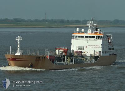
DARMIK
Oil/Chemical Tanker
Current Trip
| Trip Time | 7 days |
|---|---|
| Trip Distance | 860.32 nm |
| AVG Speed | 11.5 Knots |
| MAX Speed | 11.5 Knots |
| Draught | 5.3 m |
| AVG Wind | 13.7 knots |
| MAX Wind | 22.9 knots |
| MIN Temp | 16°C / 60.8°F |
| MAX Temp | 30.1°C / 86.18°F |
| Position Received | 58 m ago |
Current Position
| Longitude | 34.64884° |
|---|---|
| Latitude | 36.80069° |
| Status | Under way using engine |
| Speed | 13.6 Knots |
| Course | 43.9° |
| Area | Mediterranean Sea - Eastern Basin |
| Station | T-AIS |
| Position Received | 58 m ago |
Info
Information
The current position of DARMIK is in Mediterranean Sea - Eastern Basin with coordinates 36.80069° / 34.64884° as reported on 2024-06-26 14:55 by AIS to our vessel tracker app. The vessel's current speed is 13.6 Knots and is currently inside the port of MERSIN.
The vessel DARMIK (IMO: 9201774, MMSI: 271047982) is a Oil/Chemical Tanker that was built in 2000 ( 24 years old ). It's sailing under the flag of [TR] Turkey.
In this page you can find informations about the vessels current position, last detected port calls, and current voyage information. If the vessels is not in coverage by AIS you will find the latest position.
The current position of DARMIK is detected by our AIS receivers and we are not responsible for the reliability of the data. The last position was recorded while the vessel was in Coverage by the Ais receivers of our vessel tracking app.
The current draught of DARMIK as reported by AIS is 5.3 meters
Weather
| Temperature | 28.6°C / 83.48°F |
|---|---|
| Wind Speed | 11 knots |
| Direction | 210° SSW |
| Pressure | 1002.6 hPa |
| Humidity | 73.4 % |
| Cloud Coverage | --- |
Featured Company
Last Port Calls
| Port | Arrival | Departure | Time In Port |
|---|---|---|---|
| 2024-06-26 14:31 | |||
| 2024-06-15 06:07 | 2024-06-18 14:57 | 3 d | |
| 2024-06-04 17:45 | |||
| 2024-05-27 12:21 | 2024-05-29 21:03 | 2 d | |
| 2024-05-24 18:56 | 2024-05-24 23:58 | 5 h | |
| 2024-05-23 08:35 | 2024-05-23 20:57 | 12 h | |
| 2024-05-18 12:51 | 2024-05-19 23:11 | 1 d | |
| 2024-05-15 18:32 | 2024-05-17 19:56 | 2 d | |
| 2024-05-11 21:38 | 2024-05-12 19:03 | 21 h | |
| 2024-05-07 16:18 | 2024-05-09 02:16 | 1 d |
Last Trips
| Origin | Departure | Destination | Arrival | Distance | |
|---|---|---|---|---|---|
| 2024-06-18 17:57 | 2024-06-26 17:31 | 860.32 nm | |||
| 2024-05-29 22:03 | 2024-06-04 18:45 | 210.35 nm | |||
| 2024-05-23 22:57 | 2024-05-24 20:56 | 246.45 nm | |||
| 2024-05-20 01:11 | 2024-05-23 10:35 | 310.75 nm | |||
| 2024-05-17 21:56 | 2024-05-18 14:51 | 175.83 nm | |||
| 2024-05-12 20:03 | 2024-05-15 20:32 | 787.99 nm | |||
| 2024-05-09 03:16 | 2024-05-11 22:38 | 166.50 nm | |||
| 2024-05-03 04:14 | 2024-05-07 17:18 | 451.78 nm | |||
| 2024-04-27 20:57 | 2024-05-02 06:21 | 258.89 nm | |||
| 2024-04-24 14:36 | 2024-04-27 13:42 | 568.83 nm |
Events
| Time | Event | Details | Position / Dest | Info |
|---|---|---|---|---|
| 2024-06-26 14:57 | Status Changed | Default Under way using engine |
36.80030 / 34.64892
[TR] MERSIN
|
Speed: 13.6 kn Course: 43.9° |
| 2024-06-26 14:57 | STOP Moving |
36.80030 / 34.64892
[TR] MERSIN
|
Speed: 0.1 kn Course: -1° |
|
| 2024-06-26 14:31 | PORT ARRIVAL |
|
36.78314 / 34.64777
[TR] MERSIN
|
Speed: 7.3 kn Course: 317.4° |
| 2024-06-26 14:08 | Status Changed | Under way using engine Default |
36.74271 / 34.68633
TR MER
|
Speed: 8.3 kn Course: 18° |
| 2024-06-26 13:37 | Status Changed | Default Under way using engine |
36.72357 / 34.67062
TR MER
|
Speed: 1.9 kn Course: 511° |
| 2024-06-26 13:09 | Status Changed | Under way using engine Default |
36.72674 / 34.68627
TR MER
|
Speed: 1.8 kn Course: -1° |
| 2024-06-26 12:56 | IN Coverage |
36.72659 / 34.68483
Mediterranean Sea - Eastern Basin
|
Speed: 2 kn Course: 255.9° |
|
| 2024-06-26 12:33 | START Moving | 5.71 nm, South East of MERSIN |
36.71982 / 34.71563
TR MER
|
Speed: 7.5 kn Course: 284° |
| 2024-06-26 12:08 | Status Changed | Default At anchor |
36.71830 / 34.73150
TR MER
|
Speed: 0.1 kn Course: 511° |
| 2024-06-26 11:52 | OUT of Coverage |
36.71825 / 34.73247
Mediterranean Sea - Eastern Basin
|
Speed: 0.1 kn Course: 192.1° |