
DARMIK
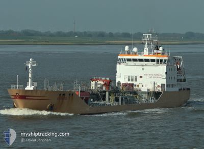
Oil/Chemical Tanker
Current Trip
| Time Travelled | 4 days |
|---|---|
| Remaining Time | --- |
| Distance Travelled | 450.45 nm |
| Remaining Distance | --- |
| AVG Speed | 11.5 Knop |
| MAX Speed | 13.2 Knop |
| AVG Wind | 12.5 knots |
| MAX Wind | 34 knots |
| MIN Temp | 16.1°C / 60.98°F |
| MAX Temp | 20.5°C / 68.9°F |
| Djupgående | 7.2 m |
| Position mottagen | 2 d sen |
Current Position
| Longitud | -10.06419° |
|---|---|
| Latitude | 31.41174° |
| Status | Under way using engine |
| Fart | 12 Knop |
| Kurs | 188.9° |
| Område | North Atlantic Ocean |
| Station | T-AIS |
| Position mottagen | 2 d sen |
Info
Information
The current position of DARMIK is in North Atlantic Ocean with coordinates 31.41174° / -10.06419° as reported on 2024-05-26 13:37 by AIS to our vessel tracker app. The vessel's current speed is 12 Knop
The vessel DARMIK (IMO: 9201774, MMSI: 271047982) is a Oil/Chemical Tanker that was built in 2000 ( 24 År gammal ). It's sailing under the flag of [TR] Turkey.
In this page you can find informations about the vessels current position, last detected port calls, and current voyage information. If the vessels is not in coverage by AIS you will find the latest position.
The current position of DARMIK is detected by our AIS receivers and we are not responsible for the reliability of the data. The last position was recorded while the vessel was in Coverage by the Ais receivers of our vessel tracking app.
The current draught of DARMIK as reported by AIS is 7.2 meters
Weather
| Temperature | 19.1°C / 66.38°F |
|---|---|
| Wind Speed | 5 knots |
| Direction | 204° SSW |
| Pressure | 1014.7 hPa |
| Humidity | 82.4 % |
| Cloud Coverage | 3 % |
Featured Company
Last Port Calls
| Port | Arrival | Departure | Time In Port |
|---|---|---|---|
| 2024-05-27 13:21 | |||
| 2024-05-24 20:56 | 2024-05-25 01:58 | 5 h | |
| 2024-05-23 10:35 | 2024-05-23 22:57 | 12 h | |
| 2024-05-18 14:51 | 2024-05-20 01:11 | 1 d | |
| 2024-05-15 20:32 | 2024-05-17 21:56 | 2 d | |
| 2024-05-11 22:38 | 2024-05-12 20:03 | 21 h | |
| 2024-05-07 17:18 | 2024-05-09 03:16 | 1 d | |
| 2024-05-02 06:21 | 2024-05-03 04:14 | 21 h | |
| 2024-04-27 13:42 | 2024-04-27 20:57 | 7 h | |
| 2024-04-23 15:29 | 2024-04-24 14:36 | 23 h |
Last Trips
| Origin | Departure | Destination | Arrival | Distance | |
|---|---|---|---|---|---|
| 2024-05-23 22:57 | 2024-05-24 20:56 | 246.45 nm | |||
| 2024-05-20 01:11 | 2024-05-23 10:35 | 310.75 nm | |||
| 2024-05-17 21:56 | 2024-05-18 14:51 | 175.83 nm | |||
| 2024-05-12 20:03 | 2024-05-15 20:32 | 787.99 nm | |||
| 2024-05-09 03:16 | 2024-05-11 22:38 | 166.50 nm | |||
| 2024-05-03 04:14 | 2024-05-07 17:18 | 451.78 nm | |||
| 2024-04-27 20:57 | 2024-05-02 06:21 | 258.89 nm | |||
| 2024-04-24 14:36 | 2024-04-27 13:42 | 568.83 nm | |||
| 2024-04-22 01:26 | 2024-04-23 15:29 | 416.89 nm | |||
| 2024-04-19 22:27 | 2024-04-21 09:52 | 356.48 nm |
Events
| Tid | Event | Detaljer | Position / Dest | Information |
|---|---|---|---|---|
| 2024-05-27 12:21 | ANLÄNDER HAMN |
|
30.42665 / -9.64769
[MA] AGADIR
|
Fart: 1.3 kn Kurs: -1° |
| 2024-05-26 13:48 | Status ändrad | Default Under way using engine |
31.37384 / -10.06535
MAAGA
|
Fart: 12 kn Kurs: 188.9° |
| 2024-05-26 13:37 | UTANFÖR täckningsområde |
31.41174 / -10.06419
North Atlantic Ocean
MAAGA
|
Fart: 12 kn Kurs: 188.9° |
|
| 2024-05-26 11:54 | Status ändrad | Under way using engine Default |
31.75328 / -9.95768
MAAGA
|
Fart: 12.8 kn Kurs: 195° |
| 2024-05-26 11:28 | Status ändrad | Default Under way using engine |
31.84109 / -9.92857
MAAGA
|
Fart: 13.2 kn Kurs: 193.5° |
| 2024-05-26 11:11 | Status ändrad | Under way using engine Default |
31.90090 / -9.90905
MAAGA
|
Fart: 12.4 kn Kurs: 192° |
| 2024-05-26 11:11 | I täckningsområde |
31.90090 / -9.90905
North Atlantic Ocean
MAAGA
|
Fart: 13.2 kn Kurs: 193.5° |
|
| 2024-05-26 09:53 | Status ändrad | Default Under way using engine |
32.15046 / -9.80912
MAAGA
|
Fart: 11.9 kn Kurs: 215.4° |
| 2024-05-26 09:48 | UTANFÖR täckningsområde |
32.16366 / -9.79952
North Atlantic Ocean
MAAGA
|
Fart: 11.9 kn Kurs: 215.4° |
|
| 2024-05-26 09:38 | Status ändrad | Under way using engine Default |
32.19220 / -9.77924
MAAGA
|
Fart: 11.8 kn Kurs: 211° |