
CZECH
Cargo D
Current Trip
| Time Travelled | 7 days |
|---|---|
| Remaining Time | 1 day |
| Distance Travelled | 3427.02 nm |
| Remaining Distance | 674.90 nm |
| AVG Speed | 18.4 Knots |
| MAX Speed | 19.8 Knots |
| AVG Wind | 12.4 knots |
| MAX Wind | 21 knots |
| MIN Temp | 11.3°C / 52.34°F |
| MAX Temp | 26.8°C / 80.24°F |
| Draught | 13.1 m |
| Position Received | 7 d ago |
Current Position
| Longitude | -67.30093° |
|---|---|
| Latitude | 19.37104° |
| Status | Under way using engine |
| Speed | 18.6 Knots |
| Course | 44.1° |
| Area | North Atlantic Ocean |
| Station | T-AIS |
| Position Received | 7 d ago |
Info
Information
The current position of CZECH is in North Atlantic Ocean with coordinates 19.37104° / -67.30093° as reported on 2024-04-21 14:09 by AIS to our vessel tracker app. The vessel's current speed is 18.6 Knots and is heading at the port of ROTTERDAM. The estimated time of arrival as calculated by MyShipTracking vessel tracking app is 2024-04-30 06:03 LT
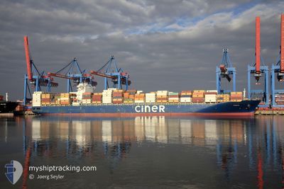
The vessel CZECH (IMO: 9723241, MMSI: 256771000) is a Cargo D It's sailing under the flag of [MT] Malta.
In this page you can find informations about the vessels current position, last detected port calls, and current voyage information. If the vessels is not in coverage by AIS you will find the latest position.
The current position of CZECH is detected by our AIS receivers and we are not responsible for the reliability of the data. The last position was recorded while the vessel was in Coverage by the Ais receivers of our vessel tracking app.
The current draught of CZECH as reported by AIS is 13.1 meters
Weather
| Temperature | 11.3°C / 52.34°F |
|---|---|
| Wind Speed | 14 knots |
| Direction | 256° WSW |
| Pressure | 1012.3 hPa |
| Humidity | 82.9 % |
| Cloud Coverage | 100 % |
Featured Company
Last Port Calls
| Port | Arrival | Departure | Time In Port |
|---|---|---|---|
| 2024-04-19 19:24 | 2024-04-21 04:09 | 1 d | |
| 2024-04-17 09:34 | 2024-04-18 08:39 | 23 h | |
| 2024-04-16 01:04 | 2024-04-16 14:45 | 13 h | |
| 2024-04-10 04:06 | 2024-04-10 20:50 | 16 h | |
| 2024-04-02 19:21 | 2024-04-07 00:29 | 4 d | |
| 2024-03-28 19:32 | 2024-03-30 00:49 | 1 d | |
| 2024-03-26 02:54 | 2024-03-26 11:20 | 8 h | |
| 2024-03-21 06:00 | 2024-03-22 08:52 | 1 d | |
| 2024-03-17 22:35 | 2024-03-19 03:07 | 1 d | |
| 2024-03-05 07:57 | 2024-03-06 07:11 | 23 h |
Last Trips
| Origin | Departure | Destination | Arrival | Distance | |
|---|---|---|---|---|---|
| 2024-04-18 03:39 | 2024-04-19 15:24 | 641.55 nm | |||
| 2024-04-16 09:45 | 2024-04-17 04:34 | 287.07 nm | |||
| 2024-04-10 15:50 | 2024-04-15 20:04 | 1499.87 nm | |||
| 2024-04-06 21:29 | 2024-04-09 23:06 | 1351.60 nm | |||
| 2024-03-29 19:49 | 2024-04-02 16:21 | 1343.98 nm | |||
| 2024-03-26 06:20 | 2024-03-28 14:32 | 682.32 nm | |||
| 2024-03-22 03:52 | 2024-03-25 21:54 | 1103.50 nm | |||
| 2024-03-18 23:07 | 2024-03-21 01:00 | 654.34 nm | |||
| 2024-03-06 08:11 | 2024-03-17 18:35 | 4432.27 nm | |||
| 2024-03-04 07:55 | 2024-03-05 08:57 | 406.83 nm |
Events
| Time | Event | Details | Position / Dest | Info |
|---|---|---|---|---|
| 2024-04-21 14:12 | Status Changed | Default Under way using engine |
19.38500 / -67.28500
NLRTM
|
Speed: 18.6 kn Course: 44.1° |
| 2024-04-21 14:09 | Status Changed | Under way using engine Default |
19.37104 / -67.30093
NLRTM
|
Speed: 18 kn Course: 43° |
| 2024-04-21 14:09 | OUT of Coverage |
19.37104 / -67.30093
North Atlantic Ocean
NLRTM
|
Speed: 18.6 kn Course: 44.1° |
|
| 2024-04-21 13:45 | Status Changed | Default Under way using engine |
19.28333 / -67.38834
NLRTM
|
Speed: 19 kn Course: 43.7° |
| 2024-04-21 12:25 | Change Sea Area | Puerto Rican part of the North Atlantic Ocean Domican Republic part of the Caribbean Sea |
18.93966 / -67.65174
North Atlantic Ocean
NLRTM
|
Speed: 18.8 kn Course: 35° |
| 2024-04-21 12:25 | Status Changed | Under way using engine Default |
18.93966 / -67.65174
NLRTM
|
Speed: 18 kn Course: 34° |
| 2024-04-21 12:25 | IN Coverage |
18.93966 / -67.65174
North Atlantic Ocean
NLRTM
|
Speed: 18.8 kn Course: 35° |
|
| 2024-04-21 04:09 | Status Changed | Default Under way using engine |
18.40333 / -69.58500
NLRTM
|
Speed: 7.7 kn Course: 112° |
| 2024-04-21 04:09 | PORT DEPARTURE |
|
18.40333 / -69.58500
NLRTM
|
Speed: 7.7 kn Course: 112° |
| 2024-04-21 03:58 | OUT of Coverage |
18.42948 / -69.61742
Caribbean Sea
NLRTM
|
Speed: 7.7 kn Course: 106.3° |