
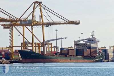
CONTSHIP RAY
General Cargo
Current Trip
| Trip Time | 8 days |
|---|---|
| Trip Distance | 1419.64 nm |
| AVG Speed | 10.4 Knots |
| MAX Speed | 12.7 Knots |
| Draught | 8.6 m |
| AVG Wind | 10.3 knots |
| MAX Wind | 24.5 knots |
| MIN Temp | 10.2°C / 50.36°F |
| MAX Temp | 18.5°C / 65.3°F |
| Position Received | 5 d ago |
Current Position
| Longitude | --- |
|---|---|
| Latitude | --- |
| Status | Under way using engine |
| Speed | 11.3 Knots |
| Course | 292.2° |
| Area | Mediterranean Sea - Eastern Basin |
| Station | T-AIS |
| Position Received | 5 d ago |
Info
Information
The current position of CONTSHIP RAY is in Mediterranean Sea - Eastern Basin with coordinates 36.30922° / 13.87286° as reported on 2025-12-28 19:29 by AIS to our vessel tracker app. The vessel's current speed is 11.3 Knots and is currently inside the port of ALGER.
The vessel CONTSHIP RAY (IMO: 9388338, MMSI: 636017852) is a General Cargo that was built in 2008 ( 18 years old ). It's sailing under the flag of [LR] Liberia.
In this page you can find informations about the vessels current position, last detected port calls, and current voyage information. If the vessels is not in coverage by AIS you will find the latest position.
The current position of CONTSHIP RAY is detected by our AIS receivers and we are not responsible for the reliability of the data. The last position was recorded while the vessel was in Coverage by the Ais receivers of our vessel tracking app.
The current draught of CONTSHIP RAY as reported by AIS is 8.6 meters
Weather
| Temperature | 15.1°C / 59.18°F |
|---|---|
| Wind Speed | 7 knots |
| Direction | 177° S |
| Pressure | 1007.5 hPa |
| Humidity | 49.9 % |
| Cloud Coverage | 41 % |
Featured Company
Last Port Calls
| Port | Arrival | Departure | Time In Port |
|---|---|---|---|
| 2026-01-01 14:36 | |||
| 2025-12-23 10:50 | 2025-12-24 04:28 | 17 h | |
| 2025-12-17 18:30 | 2025-12-18 21:22 | 1 d | |
| 2025-12-06 15:58 | 2025-12-12 03:42 | 5 d | |
| 2025-11-20 10:49 | 2025-11-22 16:17 | 2 d | |
| 2025-11-09 08:30 | 2025-11-16 14:56 | 7 d | |
| 2025-11-07 02:30 | 2025-11-08 11:42 | 1 d | |
| 2025-11-01 18:01 |
Last Trips
| Origin | Departure | Destination | Arrival | Distance | |
|---|---|---|---|---|---|
| 2025-12-24 04:28 | 2026-01-01 14:36 | 1419.64 nm | |||
| 2025-12-18 21:22 | 2025-12-23 10:50 | 436.94 nm | |||
| 2025-12-12 03:42 | 2025-12-17 18:30 | 1374.06 nm | |||
| 2025-11-22 16:17 | 2025-12-06 15:58 | 749.24 nm | |||
| 2025-11-16 14:56 | 2025-11-20 10:49 | 229.15 nm | |||
| 2025-11-08 11:42 | 2025-11-09 08:30 | 197.39 nm | |||
| 2025-11-01 18:01 | 2025-11-07 02:30 | 896.31 nm |
Events
| Time | Event | Details | Position / Dest | Info |
|---|---|---|---|---|
| 2026-01-01 14:05 | STOP Moving |
36.76757 / 3.06364
[DZ] ALGER
|
Speed: Course: 287° |
|
| 2026-01-01 13:36 | PORT ARRIVAL |
|
36.76149 / 3.08062
[DZ] ALGER
|
Speed: 4 kn Course: 276° |
| 2026-01-01 13:29 | START Moving | 1.06 nm, South East of ALGER |
36.76312 / 3.09136
DZALG
|
Speed: 4.3 kn Course: 237° |
| 2025-12-30 19:10 | STOP Moving | 1.84 nm, East of ALGER |
36.76985 / 3.10953
DZALG
|
Speed: 0.2 kn Course: 235° |
| 2025-12-28 19:36 | Status Changed | Default Under way using engine |
36.31708 / 13.84883
DZALG
|
Speed: 11.3 kn Course: 292.2° |
| 2025-12-28 19:29 | OUT of Coverage |
36.30922 / 13.87286
Mediterranean Sea - Eastern Basin
DZALG
|
Speed: 11.3 kn Course: 292.2° |
|
| 2025-12-28 15:37 | Destination Changed | DZALG MALTA |
35.93350 / 14.65910
DZALG
|
Speed: 11.9 kn Course: 303.8° |
| 2025-12-28 15:37 | ETA Changed | 2025/12/30 20:00 2025/12/27 08:00 |
35.93350 / 14.65910
DZALG
|
Speed: 11.9 kn Course: 303.8° |
| 2025-12-28 15:05 | START Moving | 11.28 nm, East of MARSAXLOKK |
35.88082 / 14.76733
MALTA
|
Speed: 6.4 kn Course: 297.2° |
| 2025-12-28 15:02 | Status Changed | Under way using engine Default |
35.87969 / 14.77023
MALTA
|
Speed: 0.5 kn Course: 3° |