
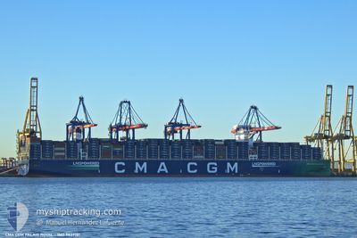
CMA CGM PALAIS ROYAL
Cargo
Current Trip
| Time Travelled | 11 days |
|---|---|
| Remaining Time | 11 days |
| Distance Travelled | 5023.46 nm |
| Remaining Distance | 5781.71 nm |
| AVG Speed | 19 Knots |
| MAX Speed | 22 Knots |
| AVG Wind | 11.8 knots |
| MAX Wind | 22.8 knots |
| MIN Temp | 17.3°C / 63.14°F |
| MAX Temp | 29.2°C / 84.56°F |
| Draught | 14.6 m |
| Position Received | 6 d ago |
Current Position
| Longitude | -16.47144° |
|---|---|
| Latitude | 9.83445° |
| Status | Under way using engine |
| Speed | 20.4 Knots |
| Course | 146° |
| Area | North Atlantic Ocean |
| Station | T-AIS |
| Position Received | 6 d ago |
Info
Information
The current position of CMA CGM PALAIS ROYAL is in North Atlantic Ocean with coordinates 9.83445° / -16.47144° as reported on 2024-04-21 16:10 by AIS to our vessel tracker app. The vessel's current speed is 20.4 Knots and is heading at the port of SINGAPORE. The estimated time of arrival as calculated by MyShipTracking vessel tracking app is 2024-05-10 11:04 LT
The vessel CMA CGM PALAIS ROYAL (IMO: 9839181, MMSI: 228394600) is a Cargo It's sailing under the flag of [FR] France.
In this page you can find informations about the vessels current position, last detected port calls, and current voyage information. If the vessels is not in coverage by AIS you will find the latest position.
The current position of CMA CGM PALAIS ROYAL is detected by our AIS receivers and we are not responsible for the reliability of the data. The last position was recorded while the vessel was in Coverage by the Ais receivers of our vessel tracking app.
The current draught of CMA CGM PALAIS ROYAL as reported by AIS is 14.6 meters
Weather
| Temperature | 17.8°C / 64.04°F |
|---|---|
| Wind Speed | 14 knots |
| Direction | 317° NW |
| Pressure | 1012.5 hPa |
| Humidity | 93.5 % |
| Cloud Coverage | --- |
Featured Company
Last Port Calls
| Port | Arrival | Departure | Time In Port |
|---|---|---|---|
| 2024-04-15 14:11 | 2024-04-16 22:29 | 1 d | |
| 2024-04-10 11:44 | 2024-04-12 13:57 | 2 d | |
| 2024-04-07 21:42 | 2024-04-09 15:31 | 1 d | |
| 2024-04-03 17:53 | 2024-04-07 02:13 | 3 d | |
| 2024-03-31 11:43 | 2024-04-02 20:18 | 2 d | |
| 2024-03-24 14:57 | 2024-03-25 16:07 | 1 d | |
| 2024-02-21 13:55 | 2024-02-23 01:34 | 1 d | |
| 2024-02-15 20:03 | 2024-02-16 09:22 | 13 h | |
| 2024-02-09 17:39 | 2024-02-11 05:59 | 1 d | |
| 2024-02-04 21:02 | 2024-02-07 11:42 | 2 d |
Most Visited Ports (Last year)
| Port | Arrivals | |
|---|---|---|
| 6 | ||
| 4 | ||
| 4 | ||
| 3 | ||
| 3 | ||
| 3 |
Last Trips
| Origin | Departure | Destination | Arrival | Distance | |
|---|---|---|---|---|---|
| 2024-04-12 15:57 | 2024-04-15 16:11 | 1290.49 nm | |||
| 2024-04-09 17:31 | 2024-04-10 13:44 | 266.48 nm | |||
| 2024-04-07 03:13 | 2024-04-07 23:42 | 273.71 nm | |||
| 2024-04-02 22:18 | 2024-04-03 18:53 | 260.24 nm | |||
| 2024-03-25 16:07 | 2024-03-31 13:43 | 1601.27 nm | |||
| 2024-02-23 09:34 | 2024-03-24 14:57 | 10901.67 nm | |||
| 2024-02-16 17:22 | 2024-02-21 21:55 | 1481.90 nm | |||
| 2024-02-11 13:59 | 2024-02-16 04:03 | 930.25 nm | |||
| 2024-02-07 19:42 | 2024-02-10 01:39 | 501.83 nm | |||
| 2024-01-30 20:00 | 2024-02-05 05:02 | 1237.94 nm |
Events
| Time | Event | Details | Position / Dest | Info |
|---|---|---|---|---|
| 2024-04-21 16:14 | Status Changed | Default Under way using engine |
9.81333 / -16.45667
ESALG>>SGSIN PWBGA
|
Speed: 20.4 kn Course: 146° |
| 2024-04-21 16:10 | Status Changed | Under way using engine Default |
9.83445 / -16.47144
ESALG>>SGSIN PWBGA
|
Speed: 20 kn Course: 146° |
| 2024-04-21 16:10 | OUT of Coverage |
9.83445 / -16.47144
North Atlantic Ocean
ESALG>>SGSIN PWBGA
|
Speed: 20.4 kn Course: 146° |
|
| 2024-04-21 16:05 | Status Changed | Default Under way using engine |
9.85667 / -16.48667
ESALG>>SGSIN PWBGA
|
Speed: 20.5 kn Course: 146.1° |
| 2024-04-21 15:59 | Change Sea Area | Guinean part of the North Atlantic Ocean Guinea Bissau part of the North Atlantic Ocean |
9.88209 / -16.50362
North Atlantic Ocean
ESALG>>SGSIN PWBGA
|
Speed: 20.5 kn Course: 146.1° |
| 2024-04-21 15:59 | Status Changed | Under way using engine Default |
9.88209 / -16.50362
ESALG>>SGSIN PWBGA
|
Speed: 20.6 kn Course: 147° |
| 2024-04-21 15:53 | IN Coverage |
9.88209 / -16.50362
North Atlantic Ocean
ESALG>>SGSIN PWBGA
|
Speed: 20.5 kn Course: 146.1° |
|
| 2024-04-21 14:09 | Status Changed | Default Under way using engine |
10.43671 / -16.83215
ESALG>>SGSIN PWBGA
|
Speed: 20.6 kn Course: 151.3° |
| 2024-04-21 14:04 | OUT of Coverage |
10.46457 / -16.84752
North Atlantic Ocean
ESALG>>SGSIN PWBGA
|
Speed: 20.6 kn Course: 151.3° |
|
| 2024-04-21 14:03 | Status Changed | Under way using engine Default |
10.47002 / -16.85054
ESALG>>SGSIN PWBGA
|
Speed: 20.3 kn Course: 148° |