
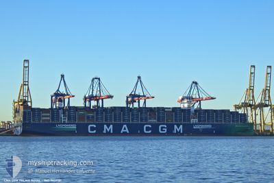
CMA CGM PALAIS ROYAL
Cargo
Current Trip
| Time Travelled | 22 h, 20 mins |
|---|---|
| Remaining Time | 6 h, 15 mins |
| Distance Travelled | 211.03 nm |
| Remaining Distance | 69.73 nm |
| AVG Speed | 11.2 Noeuds |
| MAX Speed | 16 Noeuds |
| AVG Wind | 6.4 knots |
| MAX Wind | 12 knots |
| MIN Temp | 3.1°C / 37.58°F |
| MAX Temp | 7.6°C / 45.68°F |
| Tirant d eau | 12.1 m |
| Position reçue | 1 m depuis |
Current Position
| Longitude | --- |
|---|---|
| Latitude | --- |
| Etat | Under way using engine |
| Vitesse | 10.3 Noeuds |
| Parcours | 72.6° |
| Zone | North Sea |
| Station | T-AIS |
| Position reçue | 1 m depuis |
Info
Information
The current position of CMA CGM PALAIS ROYAL is in North Sea with coordinates 51.39018° / 2.71645° as reported on 2025-01-21 20:24 by AIS to our vessel tracker app. The vessel's current speed is 10.3 Noeuds and is heading at the port of ANTWERP. The estimated time of arrival as calculated by MyShipTracking vessel tracking app is 2025-01-22 03:40 LT
The vessel CMA CGM PALAIS ROYAL (IMO: 9839181, MMSI: 228394600) is a Cargo It's sailing under the flag of [FR] France.
In this page you can find informations about the vessels current position, last detected port calls, and current voyage information. If the vessels is not in coverage by AIS you will find the latest position.
The current position of CMA CGM PALAIS ROYAL is detected by our AIS receivers and we are not responsible for the reliability of the data. The last position was recorded while the vessel was in Coverage by the Ais receivers of our vessel tracking app.
The current draught of CMA CGM PALAIS ROYAL as reported by AIS is 12.1 meters
Weather
| Temperature | 5.2°C / 41.36°F |
|---|---|
| Wind Speed | 11 knots |
| Direction | 156° SSE |
| Pressure | 1012.3 hPa |
| Humidity | 82.5 % |
| Cloud Coverage | 100 % |
Featured Company
Last Port Calls
| Port | Arrival | Departure | Time In Port |
|---|---|---|---|
| 2025-01-18 10:58 | 2025-01-20 22:05 | 2 d | |
| 2025-01-13 00:06 | 2025-01-17 15:22 | 4 d | |
| 2025-01-08 03:49 | 2025-01-11 03:00 | 2 d | |
| 2024-12-12 09:58 | 2024-12-13 12:37 | 1 d | |
| 2024-12-07 06:21 | 2024-12-09 02:29 | 1 d | |
| 2024-12-01 01:12 | 2024-12-03 02:07 | 2 d | |
| 2024-11-20 23:12 | 2024-11-24 09:08 | 3 d |
Most Visited Ports (Last year)
| Port | Arrivals | |
|---|---|---|
| 5 | ||
| 5 | ||
| 4 | ||
| 4 | ||
| 4 | ||
| 4 |
Last Trips
| Origin | Departure | Destination | Arrival | Distance | |
|---|---|---|---|---|---|
| 2025-01-17 15:22 | 2025-01-18 10:58 | 264.23 nm | |||
| 2025-01-11 03:00 | 2025-01-13 00:06 | 136.22 nm | |||
| 2024-12-13 12:37 | 2025-01-08 03:49 | 11759.60 nm | |||
| 2024-12-09 02:29 | 2024-12-12 09:58 | 1481.55 nm | |||
| 2024-12-03 02:07 | 2024-12-07 06:21 | 881.59 nm | |||
| 2024-11-24 09:08 | 2024-12-01 01:12 | 2426.73 nm | |||
| 2024-10-25 05:15 | 2024-11-20 23:12 | 11484.93 nm |
Events
| Heure | Evenement | Détails | Position/ Destination | Info |
|---|---|---|---|---|
| 2025-01-21 18:50 | Démarrage | 18.28 nm, North West of OOSTENDE |
51.46777 / 2.64792
BEANR
|
Vitesse: 3.1 kn Parcours: 247° |
| 2025-01-21 18:43 | Etat Changé | Under way using engine At anchor |
51.46674 / 2.65110
BEANR
|
Vitesse: 0.2 kn Parcours: 186° |
| 2025-01-21 16:35 | Changement d'ETA | 2025/01/21 20:15 2025/01/21 18:45 |
51.46645 / 2.65143
BEANR
|
Vitesse: Parcours: 193° |
| 2025-01-21 15:10 | Changement d'ETA | 2025/01/21 18:45 2025/01/21 18:15 |
51.46633 / 2.64951
BEANR
|
Vitesse: Parcours: 137° |
| 2025-01-21 13:02 | Etat Changé | At anchor Under way using engine |
51.46458 / 2.64894
BEANR
|
Vitesse: 0.1 kn Parcours: 80° |
| 2025-01-21 12:45 | Arret | 18.13 nm, North West of OOSTENDE |
51.46525 / 2.64940
BEANR
|
Vitesse: 0.3 kn Parcours: 27° |
| 2025-01-21 11:08 | Changement de zone | Belgian part of the North Sea French part of the North Sea |
51.33791 / 2.36710
North Sea
BEANR
|
Vitesse: 12.4 kn Parcours: 54.8° |
| 2025-01-21 10:52 | Changement d'ETA | 2025/01/21 18:15 2025/01/21 12:00 |
51.31230 / 2.29878
BEANR
|
Vitesse: 9.8 kn Parcours: 68.5° |
| 2025-01-21 08:20 | Changement de zone | French part of the North Sea French part of the English Channel |
51.00270 / 1.60992
North Sea
BEANR
|
Vitesse: 13.9 kn Parcours: 37.2° |
| 2025-01-21 05:49 | Changement de zone | French part of the English Channel United Kingdom part of the English Channel |
50.51722 / 1.02769
English Channel
BEANR
|
Vitesse: 14.3 kn Parcours: 62.5° |