

CL CONTIGO
Cargo

Current Trip
| Trip Time | 32 days |
|---|---|
| Trip Distance | 5665.43 nm |
| AVG Speed | 10 Knots |
| MAX Speed | 13.1 Knots |
| Draught | 6.6 m |
| AVG Wind | 7.4 knots |
| MAX Wind | 27.2 knots |
| MIN Temp | 23.1°C / 73.58°F |
| MAX Temp | 29.5°C / 85.1°F |
| Position Received | 11 h, 5 m ago |
Current Position
| Longitude | --- |
|---|---|
| Latitude | --- |
| Status | Under way using engine |
| Speed | 6.7 Knots |
| Course | 68.8° |
| Area | South China Sea |
| Station | T-AIS |
| Position Received | 11 h, 5 m ago |
Information
The current position of CL CONTIGO is in South China Sea with coordinates 22.53803° / 120.25748° as reported on 2025-03-25 04:13 by AIS to our vessel tracker app. The vessel's current speed is 6.7 Knots and is currently inside the port of KAOHSIUNG.
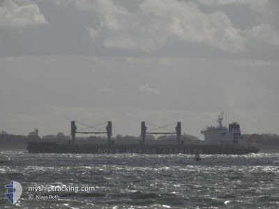
The vessel CL CONTIGO (IMO: 9703411, MMSI: 205125000) is a Cargo It's sailing under the flag of [BE] Belgium.
In this page you can find informations about the vessels current position, last detected port calls, and current voyage information. If the vessels is not in coverage by AIS you will find the latest position.
The current position of CL CONTIGO is detected by our AIS receivers and we are not responsible for the reliability of the data. The last position was recorded while the vessel was in Coverage by the Ais receivers of our vessel tracking app.
The current draught of CL CONTIGO as reported by AIS is 6.6 meters
Weather
| Temperature | 24.3°C / 75.74°F |
|---|---|
| Wind Speed | 2 knots |
| Direction | 248° WSW |
| Pressure | 1009.5 hPa |
| Humidity | 66.2 % |
| Cloud Coverage | 3 % |


Featured Company
Last Port Calls
| Port | Arrival | Departure | Time In Port |
|---|---|---|---|
| 2025-03-25 12:52 | |||
| 2025-02-19 11:32 | 2025-02-21 04:22 | 1 d | |
| 2025-02-11 10:23 | 2025-02-15 05:03 | 3 d | |
| 2025-01-29 20:08 | 2025-01-30 10:44 | 14 h | |
| 2025-01-06 01:33 |
Last Trips
| Origin | Departure | Destination | Arrival | Distance | |
|---|---|---|---|---|---|
| 2025-02-21 04:22 | 2025-03-25 12:52 | 5665.43 nm | |||
| 2025-02-15 05:03 | 2025-02-19 11:32 | 402.13 nm | |||
| 2025-01-30 10:44 | 2025-02-11 10:23 | 2880.12 nm | |||
| 2025-01-06 01:33 | 2025-01-29 20:08 | 5640.95 nm |
Events
| Time | Event | Details | Position / Dest | Info |
|---|---|---|---|---|
| 2025-03-25 04:52 | STOP Moving |
22.53936 / 120.29854
[TW] KAOHSIUNG
|
Speed: 0.1 kn Course: 325° |
|
| 2025-03-25 04:52 | PORT ARRIVAL |
|
22.53936 / 120.29854
[TW] KAOHSIUNG
|
Speed: 2.3 kn Course: 277° |
| 2025-03-25 04:18 | Status Changed | Default Under way using engine |
22.54201 / 120.26743
IDBUT
|
Speed: 6.7 kn Course: 68.8° |
| 2025-03-25 04:13 | OUT of Coverage |
22.53803 / 120.25748
South China Sea
[TW] KAOHSIUNG
|
Speed: 6.7 kn Course: 68.8° |
|
| 2025-03-25 04:05 | Change Sea Area | Taiwanese part of the South China Sea Philippines part of the Sulu Sea |
22.53263 / 120.24326
South China Sea
|
Speed: 8.3 kn Course: 65.2° |
| 2025-03-25 04:05 | Status Changed | Under way using engine Default |
22.53263 / 120.24326
IDBUT
|
Speed: 9.9 kn Course: 48° |
| 2025-03-25 04:05 | IN Coverage |
22.53263 / 120.24326
South China Sea
|
Speed: 8.3 kn Course: 65.2° |
|
| 2025-03-25 03:18 | START Moving | 9.64 nm, South West of KAOHSIUNG |
22.42418 / 120.20747
IDBUT
|
Speed: 4 kn Course: 356° |
| 2025-03-24 20:02 | STOP Moving | 9.64 nm, South West of KAOHSIUNG |
22.45376 / 120.16753
IDBUT
|
Speed: 0.3 kn Course: 306° |
| 2025-03-21 23:31 | OUT of Coverage |
11.43419 / 120.57934
Sulu Sea
|
Speed: 8 kn Course: 344° |