
CL CONTIGO
Cargo
Current Trip
| Time Travelled | 20 h, 10 mins |
|---|---|
| Remaining Time | --- |
| Distance Travelled | 32.39 nm |
| Remaining Distance | --- |
| AVG Speed | 6.6 Knots |
| MAX Speed | 10.4 Knots |
| AVG Wind | 21 knots |
| MAX Wind | 25.2 knots |
| MIN Temp | -1.2°C / 29.84°F |
| MAX Temp | 5.2°C / 41.36°F |
| Dybgang | 6.4 m |
| Position Modtaget | 17 h, 15 m siden |
Current Position
| Longitude | --- |
|---|---|
| Latitude | --- |
| Status | Under way using engine |
| Fart | 6.7 Knots |
| Kurs | 55.9° |
| Område | North Sea |
| Station | T-AIS |
| Position Modtaget | 17 h, 15 m siden |
Info
Information
The current position of CL CONTIGO is in North Sea with coordinates 55.10177° / -0.90995° as reported on 2026-01-05 07:14 by AIS to our vessel tracker app. The vessel's current speed is 6.7 Knots and is heading at the port of BREVIK. The estimated time of arrival as calculated by MyShipTracking vessel tracking app is 2026-01-07 07:00 LT
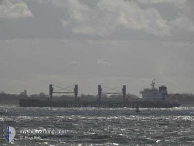
The vessel CL CONTIGO (IMO: 9703411, MMSI: 205125000) is a Cargo It's sailing under the flag of [BE] Belgium.
In this page you can find informations about the vessels current position, last detected port calls, and current voyage information. If the vessels is not in coverage by AIS you will find the latest position.
The current position of CL CONTIGO is detected by our AIS receivers and we are not responsible for the reliability of the data. The last position was recorded while the vessel was in Coverage by the Ais receivers of our vessel tracking app.
The current draught of CL CONTIGO as reported by AIS is 6.4 meters
Weather
| Temperature | 4.2°C / 39.56°F |
|---|---|
| Wind Speed | 10 knots |
| Direction | 286° WNW |
| Pressure | 1011.6 hPa |
| Humidity | 60.2 % |
| Cloud Coverage | 65 % |
Featured Company
Last Port Calls
| Port | Arrival | Departure | Time In Port |
|---|---|---|---|
| 2025-12-31 13:30 | 2026-01-05 04:19 | 4 d | |
| 2025-11-18 20:33 | 2025-11-24 21:52 | 6 d | |
| 2025-11-12 13:49 | 2025-11-14 01:38 | 1 d | |
| 2025-11-01 10:43 | 2025-11-05 01:12 | 3 d |
Most Visited Ports (Last year)
| Port | Arrivals | |
|---|---|---|
| 1 | ||
| 1 | ||
| 1 | ||
| 1 | ||
| 1 | ||
| 1 |
Last Trips
| Origin | Departure | Destination | Arrival | Distance | |
|---|---|---|---|---|---|
| 2025-11-24 21:52 | 2025-12-31 13:30 | 6125.46 nm | |||
| 2025-11-14 01:38 | 2025-11-18 20:33 | 505.81 nm | |||
| 2025-11-05 01:12 | 2025-11-12 13:49 | 1578.11 nm | |||
| 2025-10-25 21:13 | 2025-11-01 10:43 | 770.20 nm |
Events
| Tid | Hændelsen | Detaljer | Position / Dest | Info |
|---|---|---|---|---|
| 2026-01-05 07:14 | Status er ændret | Default Under way using engine |
55.10285 / -.90725
NO BVK
|
Fart: 6.7 kn Kurs: 55.9° |
| 2026-01-05 07:14 | Status er ændret | Under way using engine Default |
55.10177 / -.90995
NO BVK
|
Fart: 6.8 kn Kurs: 46° |
| 2026-01-05 07:14 | Udenfor Dækning |
55.10177 / -.90995
North Sea
NO BVK
|
Fart: 6.7 kn Kurs: 55.9° |
|
| 2026-01-05 06:34 | Status er ændret | Default Under way using engine |
55.07010 / -1.01773
NO BVK
|
Fart: 5.8 kn Kurs: 59.8° |
| 2026-01-05 06:28 | Status er ændret | Under way using engine Default |
55.06515 / -1.03699
NO BVK
|
Fart: 6.2 kn Kurs: 58° |
| 2026-01-05 06:27 | Status er ændret | Default Under way using engine |
55.06451 / -1.03924
NO BVK
|
Fart: 6.7 kn Kurs: 70.5° |
| 2026-01-05 04:19 | Afsejlet fra sidste havn |
|
55.01295 / -1.39881
NO BVK
|
Fart: 7.3 kn Kurs: 69° |
| 2026-01-05 03:46 | START Sejllads |
54.98653 / -1.45746
[GB] TYNE
|
Fart: 4 kn Kurs: 263° |
|
| 2026-01-05 03:40 | Status er ændret | Under way using engine Moored |
54.98627 / -1.45362
[GB] TYNE
|
Fart: Kurs: 253° |
| 2026-01-04 22:21 | Status er ændret | Moored Default |
54.98627 / -1.45363
[GB] TYNE
|
Fart: Kurs: 254° |