
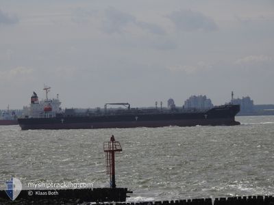
CHEMROAD SIRIUS
Tanker B
Current Trip
| Trip Time | 1 day |
|---|---|
| Trip Distance | 16.13 nm |
| AVG Speed | 5.5 Knots |
| MAX Speed | 10.8 Knots |
| Draught | 7 m |
| AVG Wind | 11.3 knots |
| MAX Wind | 21.4 knots |
| MIN Temp | 23.5°C / 74.3°F |
| MAX Temp | 26.6°C / 79.88°F |
| Position Received | 5 d ago |
Current Position
| Longitude | 52.16279° |
|---|---|
| Latitude | 27.15650° |
| Status | Under way using engine |
| Speed | 12.5 Knots |
| Course | 298.4° |
| Area | Persian Gulf |
| Station | T-AIS |
| Position Received | 5 d ago |
Info
Information
The current position of CHEMROAD SIRIUS is in Persian Gulf with coordinates 27.15650° / 52.16279° as reported on 2024-04-26 10:39 by AIS to our vessel tracker app. The vessel's current speed is 12.5 Knots and is currently inside the port of AL JUBAIL.
The vessel CHEMROAD SIRIUS (IMO: 9757979, MMSI: 357571000) is a Tanker B It's sailing under the flag of [PA] Panama.
In this page you can find informations about the vessels current position, last detected port calls, and current voyage information. If the vessels is not in coverage by AIS you will find the latest position.
The current position of CHEMROAD SIRIUS is detected by our AIS receivers and we are not responsible for the reliability of the data. The last position was recorded while the vessel was in Coverage by the Ais receivers of our vessel tracking app.
The current draught of CHEMROAD SIRIUS as reported by AIS is 7 meters
Weather
| Temperature | 24.7°C / 76.46°F |
|---|---|
| Wind Speed | 9 knots |
| Direction | 183° S |
| Pressure | 1005.9 hPa |
| Humidity | 71 % |
| Cloud Coverage | 100 % |
Featured Company
Last Port Calls
| Port | Arrival | Departure | Time In Port |
|---|---|---|---|
| 2024-04-30 23:10 | |||
| 2024-04-28 17:31 | 2024-04-29 10:49 | 17 h | |
| 2024-04-27 12:20 | 2024-04-28 15:23 | 1 d | |
| 2024-04-15 15:45 | 2024-04-23 15:09 | 7 d | |
| 2024-03-13 22:38 | 2024-03-14 18:55 | 20 h | |
| 2024-03-08 00:18 | 2024-03-08 23:39 | 23 h |
Last Trips
| Origin | Departure | Destination | Arrival | Distance | |
|---|---|---|---|---|---|
| 2024-04-29 13:49 | 2024-05-01 02:10 | 16.13 nm | |||
| 2024-04-28 18:23 | 2024-04-28 20:31 | 12.44 nm | |||
| 2024-04-23 18:09 | 2024-04-27 15:20 | 1148.66 nm | |||
| 2024-03-15 02:55 | 2024-04-15 18:45 | 8580.50 nm | |||
| 2024-03-09 07:39 | 2024-03-14 06:38 | 63.98 nm | |||
| 2024-02-26 03:15 | 2024-03-08 08:18 | 3329.13 nm |
Events
| Time | Event | Details | Position / Dest | Info |
|---|---|---|---|---|
| 2024-04-30 23:10 | STOP Moving |
27.07791 / 49.68120
[SA] AL JUBAIL
|
Speed: 0.3 kn Course: 6° |
|
| 2024-04-30 23:10 | PORT ARRIVAL |
|
27.07791 / 49.68120
[SA] AL JUBAIL
|
Speed: 0.6 kn Course: 4° |
| 2024-04-30 20:58 | START Moving | 6.44 nm, East of AL JUBAIL |
27.14712 / 49.80539
SA RAZ>SA JUB
|
Speed: 5.5 kn Course: 209° |
| 2024-04-29 11:55 | STOP Moving | 6.42 nm, East of AL JUBAIL |
27.15021 / 49.80359
SA RAZ>SA JUB
|
Speed: 0.2 kn Course: 39° |
| 2024-04-29 10:49 | PORT DEPARTURE |
|
27.09037 / 49.76517
SA RAZ>SA JUB
|
Speed: 11 kn Course: 46° |
| 2024-04-29 10:20 | START Moving |
27.07237 / 49.69228
[SA] AL JUBAIL
|
Speed: 4.6 kn Course: 105° |
|
| 2024-04-28 18:12 | STOP Moving |
27.07485 / 49.68712
[SA] AL JUBAIL
|
Speed: 0.1 kn Course: 1° |
|
| 2024-04-28 17:31 | PORT ARRIVAL |
|
27.06103 / 49.73222
[SA] AL JUBAIL
|
Speed: 6.5 kn Course: 227° |
| 2024-04-28 15:23 | PORT DEPARTURE |
|
27.06669 / 49.75081
SA RAZ>SA JUB
|
Speed: 10.5 kn Course: 40° |
| 2024-04-28 14:47 | START Moving |
27.02557 / 49.69101
[SA] AL JUBAIL
|
Speed: 5.5 kn Course: 46° |