
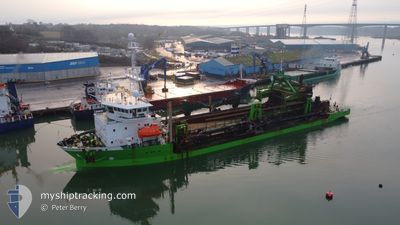
CHARLEMAGNE
Trailing Suction Hopper Dredger
Current Trip
| Time Travelled | 1 day |
|---|---|
| Remaining Time | 4 h, 3 mins |
| Distance Travelled | 274.14 nm |
| Remaining Distance | 39.41 nm |
| AVG Speed | 10.7 Knots |
| MAX Speed | 15.5 Knots |
| AVG Wind | 15.3 knots |
| MAX Wind | 20 knots |
| MIN Temp | 5.1°C / 41.18°F |
| MAX Temp | 7.1°C / 44.78°F |
| Draught | 8.5 m |
| Position Received | Now |
Current Position
| Longitude | --- |
|---|---|
| Latitude | --- |
| Status | Under way using engine |
| Speed | 9.7 Knots |
| Course | 127.8° |
| Area | North Sea |
| Station | T-AIS |
| Position Received | Now |
Info
Information
The current position of CHARLEMAGNE is in North Sea with coordinates 51.54006° / 2.73999° as reported on 2025-03-18 02:49 by AIS to our vessel tracker app. The vessel's current speed is 9.7 Knots and is heading at the port of VLISSINGEN. The estimated time of arrival as calculated by MyShipTracking vessel tracking app is 2025-03-18 07:53 LT
The vessel CHARLEMAGNE (IMO: 9243289, MMSI: 205796000) is a Trailing Suction Hopper Dredger that was built in 2002 ( 23 years old ). It's sailing under the flag of [BE] Belgium.
In this page you can find informations about the vessels current position, last detected port calls, and current voyage information. If the vessels is not in coverage by AIS you will find the latest position.
The current position of CHARLEMAGNE is detected by our AIS receivers and we are not responsible for the reliability of the data. The last position was recorded while the vessel was in Coverage by the Ais receivers of our vessel tracking app.
The current draught of CHARLEMAGNE as reported by AIS is 8.5 meters
Weather
| Temperature | 5.8°C / 42.44°F |
|---|---|
| Wind Speed | 17 knots |
| Direction | 111° ESE |
| Pressure | 1027.5 hPa |
| Humidity | 60.8 % |
| Cloud Coverage | --- |
Featured Company
Last Port Calls
| Port | Arrival | Departure | Time In Port |
|---|---|---|---|
| 2025-03-16 11:33 | 2025-03-16 18:13 | 6 h | |
| 2025-03-15 05:10 | 2025-03-15 06:01 | 51 m | |
| 2025-03-14 21:36 | 2025-03-15 04:11 | 6 h | |
| 2025-03-14 19:44 | 2025-03-14 20:47 | 1 h | |
| 2025-03-13 01:30 | 2025-03-13 11:03 | 9 h | |
| 2025-03-11 10:45 | 2025-03-11 11:37 | 51 m | |
| 2025-03-10 15:38 | 2025-03-11 09:52 | 18 h | |
| 2025-03-10 14:14 | 2025-03-10 14:51 | 37 m | |
| 2025-03-08 11:48 | 2025-03-08 22:09 | 10 h | |
| 2025-03-07 00:55 | 2025-03-07 10:37 | 9 h |
Most Visited Ports (Last year)
| Port | Arrivals | |
|---|---|---|
| 95 | ||
| 54 | ||
| 47 | ||
| 39 | ||
| 31 | ||
| 28 |
Last Trips
| Origin | Departure | Destination | Arrival | Distance | |
|---|---|---|---|---|---|
| 2025-03-15 06:01 | 2025-03-16 11:33 | 242.68 nm | |||
| 2025-03-15 04:11 | 2025-03-15 05:10 | 4.45 nm | |||
| 2025-03-14 20:47 | 2025-03-14 21:36 | 5.53 nm | |||
| 2025-03-13 11:03 | 2025-03-14 19:44 | 229.36 nm | |||
| 2025-03-11 11:37 | 2025-03-13 01:30 | 239.36 nm | |||
| 2025-03-11 09:52 | 2025-03-11 10:45 | 4.52 nm | |||
| 2025-03-10 14:51 | 2025-03-10 15:38 | 5.61 nm | |||
| 2025-03-08 22:09 | 2025-03-10 14:14 | 330.47 nm | |||
| 2025-03-07 10:37 | 2025-03-08 11:48 | 286.10 nm | |||
| 2025-03-06 09:17 | 2025-03-07 00:55 | 103.41 nm |
Events
| Time | Event | Details | Position / Dest | Info |
|---|---|---|---|---|
| 2025-03-18 01:05 | Change Sea Area | Belgian part of the North Sea Dutch part of the North Sea |
51.80425 / 2.64785
North Sea
VLISSINGEN
|
Speed: 13 kn Course: 172.9° |
| 2025-03-18 00:13 | Change Sea Area | Dutch part of the North Sea United Kingdom part of the North Sea |
51.96682 / 2.62009
North Sea
VLISSINGEN
|
Speed: 9.6 kn Course: 175.6° |
| 2025-03-18 00:12 | Draught Changed | 8.5 4.2 |
51.97173 / 2.61974
VLISSINGEN
|
Speed: 9.5 kn Course: 176.6° |
| 2025-03-18 00:12 | Destination Changed | VLISSINGEN DREDGE AREA 506 |
51.97173 / 2.61974
VLISSINGEN
|
Speed: 9.5 kn Course: 176.6° |
| 2025-03-18 00:12 | ETA Changed | 2025/03/18 07:30 2025/03/17 04:30 |
51.97173 / 2.61974
VLISSINGEN
|
Speed: 9.5 kn Course: 176.6° |
| 2025-03-17 23:59 | Status Changed | Under way using engine Default |
52.00349 / 2.61606
DREDGE AREA 506
|
Speed: 9.7 kn Course: 178° |
| 2025-03-17 23:48 | IN Coverage |
52.00001 / 2.61636
North Sea
|
Speed: 9.5 kn Course: 176.3° |
|
| 2025-03-17 21:09 | Status Changed | Default Under way using engine |
52.46303 / 2.61198
DREDGE AREA 506
|
Speed: 9.8 kn Course: 176.9° |
| 2025-03-17 21:04 | Status Changed | Under way using engine Default |
52.47773 / 2.61084
DREDGE AREA 506
|
Speed: 9.7 kn Course: 172° |
| 2025-03-17 21:04 | OUT of Coverage |
52.47773 / 2.61084
North Sea
|
Speed: 9.8 kn Course: 176.9° |