

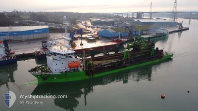
CHARLEMAGNE
Trailing Suction Hopper Dredger

Current Trip
DA 483
| Time Travelled | 1 day |
|---|---|
| Remaining Time | --- |
| Distance Travelled | 274.23 nm |
| Remaining Distance | --- |
| AVG Speed | 13.1 Knopen |
| MAX Speed | 17.6 Knopen |
| AVG Wind | 9.8 knots |
| MAX Wind | 12 knots |
| MIN Temp | 6.4°C / 43.52°F |
| MAX Temp | 10°C / 50°F |
| Diepgang | 4.5 M |
| Positie ontvangen | 4 h, 57 m geleden |
Current Position
| Lengtegraad | --- |
|---|---|
| Breedtegraat | --- |
| Status | Restricted manoeuverability |
| Snelheid | 1.6 Knopen |
| Koers | 347° |
| Gebied | North Sea |
| Station | T-AIS |
| Positie ontvangen | 4 h, 57 m geleden |
Information
The current position of CHARLEMAGNE is in North Sea with coordinates 53.67289° / 2.37134° as reported on 2025-03-10 01:13 by AIS to our vessel tracker app. The vessel's current speed is 1.6 Knopen
The vessel CHARLEMAGNE (IMO: 9243289, MMSI: 205796000) is a Trailing Suction Hopper Dredger that was built in 2002 ( 23 Jaar oud ). It's sailing under the flag of [BE] Belgium.
In this page you can find informations about the vessels current position, last detected port calls, and current voyage information. If the vessels is not in coverage by AIS you will find the latest position.
The current position of CHARLEMAGNE is detected by our AIS receivers and we are not responsible for the reliability of the data. The last position was recorded while the vessel was in Coverage by the Ais receivers of our vessel tracking app.
The current draught of CHARLEMAGNE as reported by AIS is 4.5 meters
Weather
| Temperature | 7.4°C / 45.32°F |
|---|---|
| Wind Speed | 11 knots |
| Direction | 49° NE |
| Pressure | 1002.3 hPa |
| Humidity | 87.4 % |
| Cloud Coverage | 56 % |


Featured Company
Last Port Calls
| Port | Arrival | Departure | Time In Port |
|---|---|---|---|
| 2025-03-08 11:48 | 2025-03-08 22:09 | 10 h | |
| 2025-03-07 00:55 | 2025-03-07 10:37 | 9 h | |
| 2025-03-06 03:35 | 2025-03-06 09:17 | 5 h | |
| 2025-03-04 06:23 | 2025-03-04 11:59 | 5 h | |
| 2025-03-02 15:38 | 2025-03-02 21:05 | 5 h | |
| 2025-03-01 09:22 | 2025-03-01 10:28 | 1 h | |
| 2025-03-01 02:32 | 2025-03-01 09:17 | 6 h | |
| 2025-03-01 00:56 | 2025-03-01 02:24 | 1 h | |
| 2025-02-27 21:18 | 2025-02-28 03:11 | 5 h | |
| 2025-02-27 09:23 | 2025-02-27 15:44 | 6 h |
Most Visited Ports (Last year)
| Port | Arrivals | |
|---|---|---|
| 95 | ||
| 55 | ||
| 47 | ||
| 40 | ||
| 27 | ||
| 24 |
Last Trips
| Origin | Departure | Destination | Arrival | Distance | |
|---|---|---|---|---|---|
| 2025-03-07 10:37 | 2025-03-08 11:48 | 286.10 nm | |||
| 2025-03-06 09:17 | 2025-03-07 00:55 | 103.41 nm | |||
| 2025-03-04 12:59 | 2025-03-06 03:35 | 332.46 nm | |||
| 2025-03-02 22:05 | 2025-03-04 07:23 | 340.40 nm | |||
| 2025-03-01 11:28 | 2025-03-02 16:38 | 233.24 nm | |||
| 2025-03-01 10:17 | 2025-03-01 10:22 | 0.87 nm | |||
| 2025-03-01 03:24 | 2025-03-01 03:32 | 2.18 nm | |||
| 2025-02-28 04:11 | 2025-03-01 01:56 | 117.47 nm | |||
| 2025-02-27 16:44 | 2025-02-27 22:18 | 10.41 nm | |||
| 2025-02-26 14:50 | 2025-02-27 10:23 | 205.49 nm |
Events
| Tijd | Evenement | Details | Positie / Bestemming | Info |
|---|---|---|---|---|
| 2025-03-10 01:13 | Status Changed | Default Restricted manoeuverability |
53.67297 / 2.37131
DA 483
|
Snelheid: 1.6 kn Koers: 347° |
| 2025-03-10 01:13 | Status Changed | Restricted manoeuverability Default |
53.67289 / 2.37134
DA 483
|
Snelheid: 2.2 kn Koers: 349° |
| 2025-03-10 01:13 | Buitenbereik |
53.67289 / 2.37134
North Sea
|
Snelheid: 1.6 kn Koers: 345.8° |
|
| 2025-03-10 00:29 | Status Changed | Default Restricted manoeuverability |
53.67543 / 2.36908
DA 483
|
Snelheid: 1.9 kn Koers: 357° |
| 2025-03-10 00:02 | Status Changed | Restricted manoeuverability Default |
53.66629 / 2.37148
DA 483
|
Snelheid: 2.2 kn Koers: 163° |
| 2025-03-09 23:49 | Binnenbereik |
53.66493 / 2.37113
North Sea
|
Snelheid: 1.6 kn Koers: 180.3° |
|
| 2025-03-09 22:57 | Status Changed | Default Restricted manoeuverability |
53.67279 / 2.36915
DA 483
|
Snelheid: 1.5 kn Koers: 147° |
| 2025-03-09 22:55 | Status Changed | Restricted manoeuverability Default |
53.67340 / 2.36836
DA 483
|
Snelheid: 1.4 kn Koers: 161° |
| 2025-03-09 22:55 | Buitenbereik |
53.67340 / 2.36836
North Sea
|
Snelheid: 1.5 kn Koers: 140.7° |
|
| 2025-03-09 22:42 | Binnenbereik |
53.67340 / 2.36836
North Sea
|
Snelheid: 1.5 kn Koers: 140.7° |