
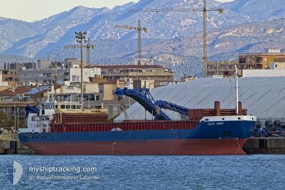
CELTIC SPIRIT
General Cargo
Current Trip
| Time Travelled | 22 h, 25 mins |
|---|---|
| Remaining Time | --- |
| Distance Travelled | 217.98 nm |
| Remaining Distance | --- |
| AVG Speed | 9.8 Knots |
| MAX Speed | 10.5 Knots |
| AVG Wind | 9.3 knots |
| MAX Wind | 14.7 knots |
| MIN Temp | 11.1°C / 51.98°F |
| MAX Temp | 16.7°C / 62.06°F |
| Draught | 5.5 m |
| Position Received | 2 m ago |
Current Position
| Longitude | --- |
|---|---|
| Latitude | --- |
| Status | Under way using engine |
| Speed | 9.9 Knots |
| Course | 198.8° |
| Area | North Atlantic Ocean |
| Station | T-AIS |
| Position Received | 2 m ago |
Info
Information
The current position of CELTIC SPIRIT is in North Atlantic Ocean with coordinates 39.04333° / -10.00955° as reported on 2024-12-04 21:28 by AIS to our vessel tracker app. The vessel's current speed is 9.9 Knots and is heading at the port of CHALKIS. The estimated time of arrival as calculated by MyShipTracking vessel tracking app is 2024-12-13 11:00 LT
The vessel CELTIC SPIRIT (IMO: 9365491, MMSI: 304242000) is a General Cargo that was built in 2007 ( 17 years old ). It's sailing under the flag of [AG] Antigua Barbuda.
In this page you can find informations about the vessels current position, last detected port calls, and current voyage information. If the vessels is not in coverage by AIS you will find the latest position.
The current position of CELTIC SPIRIT is detected by our AIS receivers and we are not responsible for the reliability of the data. The last position was recorded while the vessel was in Coverage by the Ais receivers of our vessel tracking app.
The current draught of CELTIC SPIRIT as reported by AIS is 5.5 meters
Weather
| Temperature | 16.7°C / 62.06°F |
|---|---|
| Wind Speed | 8 knots |
| Direction | 14° NNE |
| Pressure | 1030.4 hPa |
| Humidity | 81.5 % |
| Cloud Coverage | 78 % |
Featured Company
Last Port Calls
| Port | Arrival | Departure | Time In Port |
|---|---|---|---|
| 2024-12-02 22:02 | 2024-12-03 23:06 | 1 d | |
| 2024-11-27 09:07 | 2024-11-28 17:26 | 1 d | |
| 2024-11-22 05:35 | 2024-11-22 21:45 | 16 h | |
| 2024-11-17 19:28 | 2024-11-20 20:34 | 3 d | |
| 2024-11-07 18:09 | 2024-11-09 11:00 | 1 d | |
| 2024-11-02 16:21 | 2024-11-05 00:16 | 2 d | |
| 2024-10-28 15:47 | 2024-10-30 13:09 | 1 d | |
| 2024-10-24 03:30 | 2024-10-25 22:44 | 1 d | |
| 2024-10-17 15:08 | 2024-10-20 10:47 | 2 d | |
| 2024-10-16 13:01 | 2024-10-17 10:26 | 21 h |
Last Trips
| Origin | Departure | Destination | Arrival | Distance | |
|---|---|---|---|---|---|
| 2024-11-28 17:26 | 2024-12-02 23:02 | 103.35 nm | |||
| 2024-11-22 21:45 | 2024-11-27 09:07 | 746.77 nm | |||
| 2024-11-20 20:34 | 2024-11-22 05:35 | 354.99 nm | |||
| 2024-11-09 12:00 | 2024-11-17 19:28 | 1543.49 nm | |||
| 2024-11-05 00:16 | 2024-11-07 19:09 | 486.31 nm | |||
| 2024-10-30 13:09 | 2024-11-02 16:21 | 740.16 nm | |||
| 2024-10-25 23:44 | 2024-10-28 15:47 | 507.93 nm | |||
| 2024-10-20 11:47 | 2024-10-24 04:30 | 890.04 nm | |||
| 2024-10-17 11:26 | 2024-10-17 16:08 | 43.41 nm | |||
| 2024-10-08 18:38 | 2024-10-16 14:01 | 1708.97 nm |
Events
| Time | Event | Details | Position / Dest | Info |
|---|---|---|---|---|
| 2024-12-04 13:33 | Status Changed | Under way using engine Default |
40.19700 / -9.28656
GRQKG
|
Speed: 9.7 kn Course: 180° |
| 2024-12-04 13:27 | Status Changed | Default Under way using engine |
40.21386 / -9.28670
GRQKG
|
Speed: 9.9 kn Course: 178.9° |
| 2024-12-04 12:16 | Status Changed | Under way using engine Default |
40.40612 / -9.28665
GRQKG
|
Speed: 9.9 kn Course: 182° |
| 2024-12-04 12:15 | Status Changed | Default Under way using engine |
40.41063 / -9.28658
GRQKG
|
Speed: 9.9 kn Course: 180.4° |
| 2024-12-04 11:50 | Status Changed | Under way using engine Default |
40.48106 / -9.28595
GRQKG
|
Speed: 10.1 kn Course: 179° |
| 2024-12-04 11:10 | Status Changed | Default Under way using engine |
40.59155 / -9.28803
GRQKG
|
Speed: 9.8 kn Course: 178.4° |
| 2024-12-04 11:00 | Status Changed | Under way using engine Default |
40.61923 / -9.28916
GRQKG
|
Speed: 9.7 kn Course: 179° |
| 2024-12-04 10:23 | Status Changed | Default Under way using engine |
40.72072 / -9.29258
GRQKG
|
Speed: 9.3 kn Course: 181.8° |
| 2024-12-04 10:15 | Status Changed | Under way using engine Default |
40.73916 / -9.29233
GRQKG
|
Speed: 9.4 kn Course: 180° |
| 2024-12-04 10:13 | Status Changed | Default Under way using engine |
40.74691 / -9.29219
GRQKG
|
Speed: 9.4 kn Course: 181.1° |