

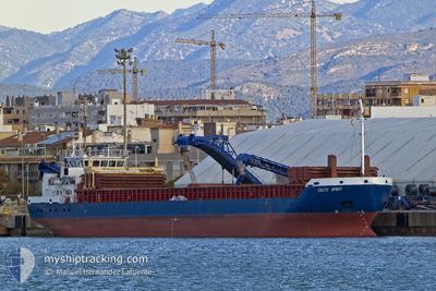
CELTIC SPIRIT
General Cargo

Current Trip
| Trip Time | 1 day |
|---|---|
| Trip Distance | 279.07 nm |
| AVG Speed | 10.9 Knots |
| MAX Speed | 12.2 Knots |
| Dybgang | 3.5 m |
| AVG Wind | 9.1 knots |
| MAX Wind | 21 knots |
| MIN Temp | 12.4°C / 54.32°F |
| MAX Temp | 16.7°C / 62.06°F |
| Position Modtaget | 20 m siden |
Current Position
| Longitude | --- |
|---|---|
| Latitude | --- |
| Status | Moored |
| Fart | |
| Kurs | 74° |
| Område | Alboran Sea |
| Station | T-AIS |
| Position Modtaget | 20 m siden |
Information
The current position of CELTIC SPIRIT is in Alboran Sea with coordinates 36.71191° / -4.42040° as reported on 2025-02-18 19:01 by AIS to our vessel tracker app. The vessel's current speed is 0 Knots and is currently inside the port of MALAGA.
The vessel CELTIC SPIRIT (IMO: 9365491, MMSI: 304242000) is a General Cargo that was built in 2007 ( 18 år gamle ). It's sailing under the flag of [AG] Antigua Barbuda.
In this page you can find informations about the vessels current position, last detected port calls, and current voyage information. If the vessels is not in coverage by AIS you will find the latest position.
The current position of CELTIC SPIRIT is detected by our AIS receivers and we are not responsible for the reliability of the data. The last position was recorded while the vessel was in Coverage by the Ais receivers of our vessel tracking app.
The current draught of CELTIC SPIRIT as reported by AIS is 3.5 meters
Weather
| Temperature | 14°C / 57.2°F |
|---|---|
| Wind Speed | 1 knots |
| Direction | 138° SE |
| Pressure | 1013.7 hPa |
| Humidity | 75.6 % |
| Cloud Coverage | 100 % |


Featured Company
Last Port Calls
| Port | Arrival | Departure | Time In Port |
|---|---|---|---|
| 2025-02-18 18:28 | |||
| 2025-02-15 07:59 | 2025-02-17 18:00 | 2 d | |
| 2025-02-05 10:32 | 2025-02-05 17:26 | 6 h | |
| 2025-01-31 20:03 | 2025-02-02 09:01 | 1 d | |
| 2025-01-28 05:43 | 2025-01-30 02:57 | 1 d | |
| 2025-01-26 06:26 | 2025-01-28 00:54 | 1 d | |
| 2025-01-22 13:14 | 2025-01-25 06:42 | 2 d | |
| 2025-01-18 19:19 | 2025-01-20 20:23 | 2 d | |
| 2025-01-12 16:05 | 2025-01-14 07:18 | 1 d | |
| 2024-12-19 08:45 | 2024-12-23 13:13 | 4 d |
Last Trips
| Origin | Departure | Destination | Arrival | Distance | |
|---|---|---|---|---|---|
| 2025-02-17 19:00 | 2025-02-18 19:28 | 279.07 nm | |||
| 2025-02-05 17:26 | 2025-02-15 08:59 | 1444.15 nm | |||
| 2025-02-02 09:01 | 2025-02-05 10:32 | 97.97 nm | |||
| 2025-01-30 03:57 | 2025-01-31 20:03 | 304.90 nm | |||
| 2025-01-28 01:54 | 2025-01-28 06:43 | 28.34 nm | |||
| 2025-01-25 06:42 | 2025-01-26 07:26 | 220.44 nm | |||
| 2025-01-20 20:23 | 2025-01-22 13:14 | 365.03 nm | |||
| 2025-01-14 08:18 | 2025-01-18 19:19 | 993.04 nm | |||
| 2024-12-23 16:13 | 2025-01-12 17:05 | 3844.39 nm | |||
| 2024-12-13 17:20 | 2024-12-19 11:45 | 566.38 nm |
Events
| Tid | Hændelsen | Detaljer | Position / Dest | Info |
|---|---|---|---|---|
| 2025-02-18 19:06 | Status er ændret | Default Moored |
36.71188 / -4.42038
[ES] MALAGA
|
Fart: Kurs: 74° |
| 2025-02-18 18:52 | Status er ændret | Moored Under way using engine |
36.71192 / -4.42042
[ES] MALAGA
|
Fart: 0.1 kn Kurs: 74° |
| 2025-02-18 18:48 | STOP Sejllads |
36.71207 / -4.42044
[ES] MALAGA
|
Fart: 0.3 kn Kurs: 72° |
|
| 2025-02-18 18:28 | Skibe i havn |
|
36.69947 / -4.41668
[ES] MALAGA
|
Fart: 7.8 kn Kurs: 3.2° |
| 2025-02-18 18:01 | Status er ændret | Under way using engine Default |
36.67360 / -4.33625
ES AGP
|
Fart: 11.5 kn Kurs: 284° |
| 2025-02-18 17:59 | Status er ændret | Default Under way using engine |
36.67233 / -4.32984
ES AGP
|
Fart: 11.6 kn Kurs: 284° |
| 2025-02-18 13:54 | Status er ændret | Under way using engine Default |
36.56002 / -3.36705
ES AGP
|
Fart: 12.3 kn Kurs: 278° |
| 2025-02-18 13:38 | Status er ændret | Default Under way using engine |
36.55279 / -3.30055
ES AGP
|
Fart: 12 kn Kurs: 278.7° |
| 2025-02-18 13:31 | Status er ændret | Under way using engine Default |
36.54929 / -3.27157
ES AGP
|
Fart: 12.4 kn Kurs: 278° |
| 2025-02-18 13:23 | Status er ændret | Default Under way using engine |
36.54536 / -3.24038
ES AGP
|
Fart: 12.1 kn Kurs: 277.6° |