
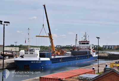
CELTIC EXPLORER
General Cargo
Current Trip
| Time Travelled | 1 day |
|---|---|
| Remaining Time | 12 h, 19 mins |
| Distance Travelled | 270.12 nm |
| Remaining Distance | 107.23 nm |
| AVG Speed | 8.2 Knots |
| MAX Speed | 10.8 Knots |
| AVG Wind | 18.8 knots |
| MAX Wind | 27 knots |
| MIN Temp | 8.9°C / 48.02°F |
| MAX Temp | 10.9°C / 51.62°F |
| Draught | 5.6 m |
| Position Received | 1 m ago |
Current Position
| Longitude | --- |
|---|---|
| Latitude | --- |
| Status | Under way using engine |
| Speed | 8.6 Knots |
| Course | 180.9° |
| Area | Celtic Sea |
| Station | T-AIS |
| Position Received | 1 m ago |
Info
Information
The current position of CELTIC EXPLORER is in Celtic Sea with coordinates 50.47291° / -5.99784° as reported on 2025-03-07 19:20 by AIS to our vessel tracker app. The vessel's current speed is 8.6 Knots and is heading at the port of PLYMOUTH. The estimated time of arrival as calculated by MyShipTracking vessel tracking app is 2025-03-08 07:41 LT
The vessel CELTIC EXPLORER (IMO: 9380726, MMSI: 304905000) is a General Cargo that was built in 2007 ( 18 years old ). It's sailing under the flag of [AG] Antigua Barbuda.
In this page you can find informations about the vessels current position, last detected port calls, and current voyage information. If the vessels is not in coverage by AIS you will find the latest position.
The current position of CELTIC EXPLORER is detected by our AIS receivers and we are not responsible for the reliability of the data. The last position was recorded while the vessel was in Coverage by the Ais receivers of our vessel tracking app.
The current draught of CELTIC EXPLORER as reported by AIS is 5.6 meters
Weather
| Temperature | 10.9°C / 51.62°F |
|---|---|
| Wind Speed | 14 knots |
| Direction | 136° SE |
| Pressure | 1004.6 hPa |
| Humidity | 86 % |
| Cloud Coverage | 100 % |
Featured Company
Last Port Calls
| Port | Arrival | Departure | Time In Port |
|---|---|---|---|
| 2025-03-05 11:00 | 2025-03-06 11:57 | 1 d | |
| 2025-03-03 17:07 | 2025-03-04 19:27 | 1 d | |
| 2025-02-24 09:44 | 2025-02-25 16:45 | 1 d | |
| 2025-02-19 19:16 | 2025-02-21 16:16 | 1 d | |
| 2025-02-11 20:46 | 2025-02-13 17:20 | 1 d | |
| 2025-02-10 02:00 | 2025-02-10 21:18 | 19 h | |
| 2025-02-05 11:12 | 2025-02-06 14:11 | 1 d | |
| 2025-02-04 03:23 | 2025-02-05 04:53 | 1 d | |
| 2025-01-31 14:18 | 2025-01-31 23:38 | 9 h | |
| 2025-01-28 23:09 | 2025-01-30 23:49 | 2 d |
Last Trips
| Origin | Departure | Destination | Arrival | Distance | |
|---|---|---|---|---|---|
| 2025-03-04 19:27 | 2025-03-05 11:00 | 104.98 nm | |||
| 2025-02-25 17:45 | 2025-03-03 17:07 | 1412.84 nm | |||
| 2025-02-21 16:16 | 2025-02-24 10:44 | 642.04 nm | |||
| 2025-02-13 17:20 | 2025-02-19 19:16 | 1283.68 nm | |||
| 2025-02-10 21:18 | 2025-02-11 20:46 | 223.70 nm | |||
| 2025-02-06 14:11 | 2025-02-10 02:00 | 744.10 nm | |||
| 2025-02-05 04:53 | 2025-02-05 11:12 | 63.11 nm | |||
| 2025-01-31 23:38 | 2025-02-04 03:23 | 545.00 nm | |||
| 2025-01-30 23:49 | 2025-01-31 14:18 | 147.30 nm | |||
| 2025-01-21 14:24 | 2025-01-28 23:09 | 1370.83 nm |
Events
| Time | Event | Details | Position / Dest | Info |
|---|---|---|---|---|
| 2025-03-07 19:00 | ETA Changed | 2025/03/08 07:00 2025/03/08 05:00 |
50.52109 / -5.99837
GB PLY
|
Speed: 8.9 kn Course: 179.1° |
| 2025-03-07 14:04 | Status Changed | Under way using engine Default |
51.24576 / -5.99296
GB PLY
|
Speed: 8.2 kn Course: 180° |
| 2025-03-07 14:04 | Status Changed | Default Under way using engine |
51.24703 / -5.99291
GB PLY
|
Speed: 8.2 kn Course: 179.5° |
| 2025-03-07 13:39 | Status Changed | Under way using engine Default |
51.30489 / -5.99361
GB PLY
|
Speed: 8.2 kn Course: 180° |
| 2025-03-07 13:39 | IN Coverage |
51.30324 / -5.99357
Celtic Sea
GB PLY
|
Speed: 8.4 kn Course: 177.8° |
|
| 2025-03-07 09:04 | Status Changed | Default Under way using engine |
51.95345 / -5.86442
GB PLY
|
Speed: 10 kn Course: 186.6° |
| 2025-03-07 08:55 | OUT of Coverage |
51.97813 / -5.85974
Celtic Sea
GB PLY
|
Speed: 10 kn Course: 186.6° |
|
| 2025-03-07 08:43 | Detected in Sea | United Kingdom part of the Celtic Sea |
52.01130 / -5.85339
Celtic Sea
GB PLY
|
Speed: 10.2 kn Course: 187° |
| 2025-03-07 08:42 | Status Changed | Under way using engine Default |
52.01447 / -5.85278
GB PLY
|
Speed: 10 kn Course: 185° |
| 2025-03-07 08:32 | Status Changed | Default Under way using engine |
52.04411 / -5.84723
GB PLY
|
Speed: 10.1 kn Course: 187.4° |