
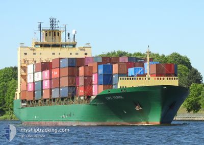
CAPE FERROL
Container Ship
Current Trip
| Time Travelled | 1 day |
|---|---|
| Remaining Time | 1 day |
| Distance Travelled | 341.84 nm |
| Remaining Distance | 339.05 nm |
| AVG Speed | 9.6 Knots |
| MAX Speed | 11.3 Knots |
| AVG Wind | 7.7 knots |
| MAX Wind | 13.8 knots |
| MIN Temp | 3°C / 37.4°F |
| MAX Temp | 11.2°C / 52.16°F |
| Draught | 9.4 m |
| Position Received | 1 m ago |
Current Position
| Longitude | --- |
|---|---|
| Latitude | --- |
| Status | Under way using engine |
| Speed | 9.6 Knots |
| Course | 212.9° |
| Area | North Sea |
| Station | T-AIS |
| Position Received | 1 m ago |
Information
The current position of CAPE FERROL is in North Sea with coordinates 55.76451° / 6.71901° as reported on 2025-03-10 23:33 by AIS to our vessel tracker app. The vessel's current speed is 9.6 Knots and is heading at the port of ANTWERP. The estimated time of arrival as calculated by MyShipTracking vessel tracking app is 2025-03-12 09:50 LT
The vessel CAPE FERROL (IMO: 9359325, MMSI: 538003221) is a Container Ship that was built in 2008 ( 17 years old ). It's sailing under the flag of [MH] Marshall Is.
In this page you can find informations about the vessels current position, last detected port calls, and current voyage information. If the vessels is not in coverage by AIS you will find the latest position.
The current position of CAPE FERROL is detected by our AIS receivers and we are not responsible for the reliability of the data. The last position was recorded while the vessel was in Coverage by the Ais receivers of our vessel tracking app.
The current draught of CAPE FERROL as reported by AIS is 9.4 meters
Weather
| Temperature | 5.7°C / 42.26°F |
|---|---|
| Wind Speed | 11 knots |
| Direction | 341° NNW |
| Pressure | 1003.9 hPa |
| Humidity | 89.5 % |
| Cloud Coverage | 100 % |
Featured Company
Last Port Calls
| Port | Arrival | Departure | Time In Port |
|---|---|---|---|
| 2025-03-09 04:54 | 2025-03-09 12:17 | 7 h | |
| 2025-03-07 19:16 | 2025-03-08 14:15 | 18 h | |
| 2025-03-06 05:43 | 2025-03-07 06:33 | 1 d | |
| 2025-03-04 12:45 | 2025-03-05 06:33 | 17 h | |
| 2025-03-01 02:19 | 2025-03-02 03:34 | 1 d | |
| 2025-02-26 02:48 | 2025-02-26 19:29 | 16 h | |
| 2025-02-23 04:26 | 2025-02-23 14:17 | 9 h | |
| 2025-02-22 07:15 | 2025-02-22 16:52 | 9 h | |
| 2025-02-20 05:48 | 2025-02-20 18:43 | 12 h | |
| 2025-02-18 12:59 | 2025-02-19 16:28 | 1 d |
Most Visited Ports (Last year)
| Port | Arrivals | |
|---|---|---|
| 31 | ||
| 15 | ||
| 14 | ||
| 13 | ||
| 12 | ||
| 12 |
Last Trips
| Origin | Departure | Destination | Arrival | Distance | |
|---|---|---|---|---|---|
| 2025-03-08 15:15 | 2025-03-09 05:54 | 109.70 nm | |||
| 2025-03-07 07:33 | 2025-03-07 20:16 | 104.16 nm | |||
| 2025-03-05 07:33 | 2025-03-06 06:43 | 124.91 nm | |||
| 2025-03-02 04:34 | 2025-03-04 13:45 | 490.27 nm | |||
| 2025-02-26 20:29 | 2025-03-01 03:19 | 103.70 nm | |||
| 2025-02-23 15:17 | 2025-02-26 03:48 | 707.57 nm | |||
| 2025-02-22 17:52 | 2025-02-23 05:26 | 108.68 nm | |||
| 2025-02-20 19:43 | 2025-02-22 08:15 | 107.45 nm | |||
| 2025-02-19 17:28 | 2025-02-20 06:48 | 114.24 nm | |||
| 2025-02-17 01:06 | 2025-02-18 13:59 | 488.13 nm |
Events
| Time | Event | Details | Position / Dest | Info |
|---|---|---|---|---|
| 2025-03-10 23:22 | Status Changed | Under way using engine Default |
55.78945 / 6.74684
ANTWERP
|
Speed: 9.5 kn Course: 211° |
| 2025-03-10 23:12 | Status Changed | Default Under way using engine |
55.81158 / 6.77098
ANTWERP
|
Speed: 9.5 kn Course: 212.1° |
| 2025-03-10 12:46 | Change Sea Area | Danish part of the North Sea Danish part of the Skaggerak |
57.19683 / 8.46093
North Sea
ANTWERP
|
Speed: 9.6 kn Course: 221.7° |
| 2025-03-10 03:01 | Change Sea Area | Danish part of the Skaggerak Danish part of the Kattegat |
57.80336 / 10.92664
Skaggerak
ANTWERP
|
Speed: 9.7 kn Course: 317.3° |
| 2025-03-10 01:29 | Change Sea Area | Danish part of the Kattegat Swedish part of the Kattegat |
57.62361 / 11.23293
Kattegat
ANTWERP
|
Speed: 9.7 kn Course: 319.4° |
| 2025-03-09 15:05 | Change Sea Area | Swedish part of the Kattegat Danish part of the Kattegat |
56.12751 / 12.52933
Kattegat
ANTWERP
|
Speed: 11.1 kn Course: 317.4° |
| 2025-03-09 14:56 | Change Sea Area | Danish part of the Kattegat Swedish part of the Kattegat |
56.10729 / 12.56359
Kattegat
ANTWERP
|
Speed: 11 kn Course: 312.8° |
| 2025-03-09 13:34 | ETA Changed | 2025/03/12 06:00 2025/03/12 00:00 |
55.89812 / 12.74570
ANTWERP
|
Speed: 10.4 kn Course: 13.5° |
| 2025-03-09 13:05 | Change Sea Area | Swedish part of the Kattegat Danish part of the Kattegat |
55.82190 / 12.72694
Kattegat
ANTWERP
|
Speed: 9.2 kn Course: 25.7° |
| 2025-03-09 12:17 | PORT DEPARTURE |
|
55.71472 / 12.62827
ANTWERP
|
Speed: 8.2 kn Course: 53° |