
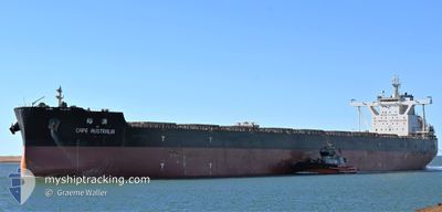
CAPE AUSTRALIA
Cargo
Current Trip
CN QDG
| Time Travelled | 16 days |
|---|---|
| Remaining Time | --- |
| Distance Travelled | 1078.78 nm |
| Remaining Distance | --- |
| AVG Speed | 10.8 Knots |
| MAX Speed | 14.8 Knots |
| AVG Wind | 10 knots |
| MAX Wind | 32.5 knots |
| MIN Temp | 13.3°C / 55.94°F |
| MAX Temp | 25.9°C / 78.62°F |
| Draught | 18.1 m |
| Position Received | 9 h, 52 m ago |
Current Position
| Longitude | 119.79358° |
|---|---|
| Latitude | 22.69879° |
| Status | Under way using engine |
| Speed | 10.7 Knots |
| Course | 182.5° |
| Area | South China Sea |
| Station | T-AIS |
| Position Received | 9 h, 52 m ago |
Info
Information
The current position of CAPE AUSTRALIA is in South China Sea with coordinates 22.69879° / 119.79358° as reported on 2024-04-26 21:06 by AIS to our vessel tracker app. The vessel's current speed is 10.7 Knots
The vessel CAPE AUSTRALIA (IMO: 9654763, MMSI: 564196000) is a Cargo It's sailing under the flag of [SG] Singapore.
In this page you can find informations about the vessels current position, last detected port calls, and current voyage information. If the vessels is not in coverage by AIS you will find the latest position.
The current position of CAPE AUSTRALIA is detected by our AIS receivers and we are not responsible for the reliability of the data. The last position was recorded while the vessel was in Coverage by the Ais receivers of our vessel tracking app.
The current draught of CAPE AUSTRALIA as reported by AIS is 18.1 meters
Weather
| Temperature | 26.1°C / 78.98°F |
|---|---|
| Wind Speed | 14 knots |
| Direction | 58° ENE |
| Pressure | 1010.2 hPa |
| Humidity | 87.9 % |
| Cloud Coverage | 96 % |
Featured Company
Last Port Calls
| Port | Arrival | Departure | Time In Port |
|---|---|---|---|
| 2024-04-09 03:45 | 2024-04-11 03:25 | 1 d | |
| 2024-03-21 03:10 | 2024-03-22 13:02 | 1 d | |
| 2024-02-27 16:15 | 2024-02-28 03:10 | 10 h | |
| 2024-02-26 10:55 | 2024-02-27 15:47 | 1 d | |
| 2024-02-08 02:02 | 2024-02-10 13:46 | 2 d |
Most Visited Ports (Last year)
| Port | Arrivals | |
|---|---|---|
| 3 | ||
| 2 | ||
| 2 | ||
| 2 | ||
| 1 | ||
| 1 |
Last Trips
| Origin | Departure | Destination | Arrival | Distance | |
|---|---|---|---|---|---|
| 2024-03-22 21:02 | 2024-04-09 11:45 | 3222.62 nm | |||
| 2024-02-28 11:10 | 2024-03-21 11:10 | 3920.96 nm | |||
| 2024-02-27 23:47 | 2024-02-28 00:15 | 1.40 nm | |||
| 2024-02-10 21:46 | 2024-02-26 18:55 | 3562.36 nm | |||
| 2024-01-26 15:49 | 2024-02-08 10:02 | 3414.87 nm |
Events
| Time | Event | Details | Position / Dest | Info |
|---|---|---|---|---|
| 2024-04-26 21:07 | Status Changed | Default Under way using engine |
22.69576 / 119.79344
CN QDG
|
Speed: 10.7 kn Course: 182.5° |
| 2024-04-26 21:06 | Status Changed | Under way using engine Default |
22.69879 / 119.79358
CN QDG
|
Speed: 10.8 kn Course: 183° |
| 2024-04-26 21:06 | OUT of Coverage |
22.69879 / 119.79358
South China Sea
|
Speed: 10.7 kn Course: 182.5° |
|
| 2024-04-26 20:33 | Status Changed | Default Under way using engine |
22.79976 / 119.79981
CN QDG
|
Speed: 11.2 kn Course: 185° |
| 2024-04-26 20:21 | Status Changed | Under way using engine Default |
22.83419 / 119.80260
CN QDG
|
Speed: 11.1 kn Course: 185° |
| 2024-04-26 19:28 | Status Changed | Default Under way using engine |
22.99862 / 119.81802
CN QDG
|
Speed: 11.2 kn Course: 184° |
| 2024-04-26 19:18 | Status Changed | Under way using engine Default |
23.02946 / 119.82069
CN QDG
|
Speed: 10.9 kn Course: 184° |
| 2024-04-26 18:51 | Status Changed | Default Under way using engine |
23.10959 / 119.82629
CN QDG
|
Speed: 9.9 kn Course: 175.7° |
| 2024-04-26 18:45 | Change Sea Area | Taiwanese part of the South China Sea Taiwanese part of the Eastern China Sea |
23.12523 / 119.82545
South China Sea
|
Speed: 9.9 kn Course: 175.7° |
| 2024-04-26 18:45 | Status Changed | Under way using engine Default |
23.12523 / 119.82545
CN QDG
|
Speed: 9.9 kn Course: 176° |